Download
1 / 26
260 likes | 493 Vues
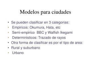
Modelos para ciudades. Se pueden clasificar en 3 categorias : Empiricos: Okumura , Hata , etc Semi-empiric o BBC y Walfish Ikegami Deterministic os: Trazado de rayos Otra forma de clasificar es por el tipo de area: Rural y suburban o Urban o. Modelos Empiricos. Lee Young Okumura

E N D
Modelos para ciudades • Se pueden clasificar en 3 categorias: • Empiricos: Okumura, Hata, etc • Semi-empirico BBC y Walfish Ikegami • Deterministicos: Trazado de rayos • Otra forma de clasificar es por el tipo de area: • Rural y suburbano • Urbano
Modelos Empiricos • Lee • Young • Okumura • Hata • Longley - Rice
Lee • Ajuste de predicciones por ajuste de rectas por regresión lineal • Medidas en una ciudad determinda • No toma en cuenta condiciones del entorno • Distancias mayores a 1 km • C- depende de la f y hTy hR
Lee cont. • d – distancia • n – parámetro función de la hT y del tipo de medio • Sirve para entorno urbano • C se estima con recorridos de prueba • N se ajusta con las medidas
Young • Se basó en medidas en N.Y. • Presenta curvas de b en función del porcentaje de sitios del área comprendidos • hT- altrura transmisor, hR- altura receptor, r- distancia • b- clutter factor
Okumura • Basado en medidas en Tokio • Presenta la atenuacion adicional a espacio libre, para terreno suave y entorno urbano • No se basa en ningún modelo físico • Curvas para frecuencias de 150 a 1500 MHz • Curvas para terreno rugoso y suave • Altura de antena de RB aprox. 200 m.
Hata • Automatizacion del modelo de Okumura • Dedujo las ecuaciones a partir de las curvas de Okumura por regresión simple • f - frecuencia, hT- altura de tx (30 a 200m) • hm- altura del receptor (1 a 10 m) • d - distancia (1 a 20 km)
Hata cont. • Ciudad media- pequeña • Ciudad grande • Zona suburbana • Zona rural
Modelos semi-empíricos • Cost 231 – Hata • Cost 231-Walfish - Ikegami
Cost 231 – ETSI GSM 03.30 • Cost231- Hata • Ploss = 46.3 + 33.9log(f) -13.82log (hT) • +[44.9 - 6.55log (hT)]log(d) -a(hR) +Cm • donde a(hR) = (1.1log(f) - 0.7)hR - 1.56log(f) -0.8 • Cm = 0dB para ciudades medias y suburbana • Cm = 3dB para zonas densamente urbanas • Aplicable con • 1500MHz = f = 2000MHz • 30m = hT= 200m • 1m = hR= 10m • 1km = d = 20km
Direction of travel (plan view) Mobile Incident wave Base station antenna d Buildings h1 hr w b h2 Street level (profile view) Mobile station antenna Walfish-Ikegami • The Walfish-Ikegami model (WIM) has been shown to be a good fit to measured propagation data for frequencies in the range of 800 to 2,000 MHz and path distances, alternatively called cell radius, in the range of 0.02 to 5 km. Figure 1 shows the meaning of the symbols used in the formulae.
WI. cont • Frecuencia f: 800 – 2000 MHz • Altura de RB h1: 4 – 50 m • Altura del móvil h2:1 – 3 m • Distancia d: 0.02 – 5 km • Altura de techos de edificios hr: m • Ancho de calle w: m • Separación de edificios b: m • Orientación de la calle respectoa al rayo directo : º
WI cont. donde dkmis the link distance or cell radius in kilometers, • fMHz is the centre frequency in megahertz, roof-top-to-street diffraction and scatter loss, • w is the width of the road in metres • hr is the height of building roofs in metres • h2 is the height of the mobile station above ground level in metres
WI cont. • Lori = orientation loss due to the road orientation with respect to the direct radio path. • is the road orientation with respect to the direct radio path in degrees. • Lmsd = multiscreen diffraction loss,
WI cont • Lbsh = shadowing gain (negative loss) that occurs when the base station antenna height is higher than the rooftops • h1is the height of the base station above ground level in metres, • hris the height of building roofs in metres • ka is a quantity that determines the dependence of the multiscreen loss , on the cell radius or distance dkm,
WI cont • kd is a quantity that determines the dependence of the multiscreen loss , on the height above or below the building roof top that the base station antenna is located, • kfis a quantity that determines the dependence of the multiscreen loss , on the frequency fMHz,
WIM LOS • In a line of sight situation where the base station antenna is below roof top level, there is no obstruction in the direct path between the base station and the mobile station. The Walfische-Ikegami models this propagation loss in dB by the equation, • The WIM assumes the base station antenna height is greater or equal to 30 m to ensure that the path has a high degree of Fresnel zone clearance.
Longley-Rice • Comenzó en 1968 como un programa para enlaces punto a punto. • Inputs: Altura de antenas, radio efectivo de la tierra, contantes del terreno, clima • Inputs para describir el perfil – ver figura. • Unica forma de calcular las pérdidas por difracción. • http://www.softwright.com/faq/engineering/prop_longley_rice.html
L-R • Se puede usar en: frecuencias de 40MHz a 40 GHz, 1km<d <2000km • Considera la refracción atmosférica y al terreno • Usa como modelo primario doble reflexión en el suelo y la difracción en obstaculos • Usa la teoría forward scatter para considerar la dispersión troposférica (troposcatter) • Para estimar las perdidas por difracción en campo lejano usa el metodo de Van Der Pol-Bremmer • Factores que le afectan: clutter cerca del receptor y la contribución del multicamino
Trazado de rayos • Generalmente tienen un motor de lanzamiento de rayos • Usan UTD • D: es el coef. De difraccion, k el numero de onda
Saunders - Bonar • Minimiza el tiempo de computacion, sustituyendo varias aristas por una mas alta • Se precisa altura y espaciado medio entre obstaculos • Se calculan los parametros de Vogler y se desprecian las aristas con bm<-2,5 (-0,9) • Hasta reducir a 5 aristas • Se calculan determinadas atenuaciones y se llega a una atenuacion total, realizando menos calculos.
T. Rayos cont. • Base de datos de terreno • Contorno de edif. y alturas • Precision +- 2 m.