Download
1 / 24
250 likes | 396 Vues
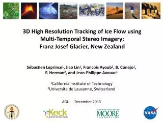
3D High Resolution Tracking of Ice Flow using Multi-Temporal S tereo Imagery: Franz Josef Glacier, New Zealand. Sébastien Leprince 1 , Jiao Lin 1 , Francois Ayoub 1 , B. Conejo 1 , F. Herman 2 , and Jean-Philippe Avouac 1 1 California Institute of Technology

E N D
3D High Resolution Tracking of Ice Flow using Multi-Temporal Stereo Imagery:Franz Josef Glacier, New Zealand SébastienLeprince1, Jiao Lin1, Francois Ayoub1, B. Conejo1, F. Herman2, and Jean-Philippe Avouac1 1California Institute of Technology 2Universite de Lausanne, Switzerland AGU - December 2013
COSI-Corr: Co-registration of Optically Sensed Images and Correlation Satellite imagery acquired at different times, any resolution, possibly by different sensors Measuring surface processes from optical imagery COSI-Corr Ground deformation Automatic registration with accuracy of 1/10 of the pixel size (sub-pixel) Automatic comparison of images to measure motion Correlation Vector field Time Leprince et al., IEEE TGRS, 2007 http://www.tectonics.caltech.edu/slip_history/spot_coseis/
Extension: processing multi-angle pushbroom images to measure 3D ground deformation • In this presentation: • (More) Detailed processing chain and possible extensions, • Application to ice flow monitoring using Worldview images above Franz Josef Glacier, New Zealand.
3D and 4D Processing Flow • Optimize Viewing Parameters
Optimize Viewing Parameters • Jointly optimize external parameters: • roll, pitch, yaw angles: r(t), p(t), y(t) • Spacecraft position in time x(t), y(t), z(t) • 2nd order polynomials approximation • If no GCP, regularized solution to stay within instrument uncertainties.
3D and 4D Processing Flow • Optimize Viewing Parameters • Pairwise image matching between all images, • Only keep tie-points on stable surfaces (e.g., bedrock), • Optimize external viewing parameters of all images jointly using regularized bundle adjustment. • Produce Disparity Maps
Produce Disparity Maps Given a stereo-pair of images (IS ,IT) how to retrieve the disparity map d? Image Matching Framework with Regularization Similarity criteria (ZNCC) d constant on patch Piecewise constant prior Weighs the prior Neighbors of pixel x
Produce Disparity Maps Use of multi-scale pyramidal approach to lower the complexity Regularization: Semi-Global Matching (SGM) – current implementation Non convex problem => variational approaches won’t work => Restrict d(x) to a finite set of value and rewrite as first order Markov Random Field Only regularize along 1D directions and aggregate costs. Reduces complexity. Hirschmuller, CVPR, 2005
Produce Disparity Maps Regularization: Global Matching (GM) – under implementation => Restrict d(x) to a finite set of value and rewrite as first order Markov Random Field Complex problem (NP-Hard) but several effective techniques exist, e.g. Fast Primal-Dual from Komodakis, Tziritas and Paragios See B. Conejo poster G33A-0971 on Wed afternoon.
3D and 4D Processing Flow • Optimize Viewing Parameters • Pairwise image matching between all images, • Only keep tie-points on stable surfaces (e.g., bedrock), • Optimize external viewing parameters of all images jointly using regularized bundle adjustment. • Produce Disparity Maps • Project all images on reference surface (e.g. low res DTM, GTOPO or smoothed GDEM), • Cross-correlate image pairs using multi-scale, regularized image correlation. • Produce Point and Vector clouds (3D, 4D)
Produce Point and Vector clouds (3D, 4D) Triangulate multiple disparity maps to retrieve 3D topography and displacement fields
3D and 4D Processing Flow • Optimize Viewing Parameters • Pairwise image matching between all images, • Only keep tie-points on stable surfaces (e.g., bedrock), • Optimize external viewing parameters of all images jointly using regularized bundle adjustment. • Produce Disparity Maps • Project all images on reference surface (e.g. low res DTM, GTOPO or smoothed GDEM), • Cross-correlate image pairs using multi-scale, regularized image correlation. • Produce Point and Vector clouds (3D, 4D) • Triangulate disparity maps, • (x1, y1, z1) • (x2, y2, z2) • (x1, y1, z1, Dx, Dy, Dz) • Output surface models at all times.
3D and 4D Processing Flow • Optimize Viewing Parameters • Pairwise image matching between all images, • Only keep tie-points on stable surfaces (e.g., bedrock), • Optimize external viewing parameters of all images jointly using regularized bundle adjustment. • Produce Disparity Maps • Project all images on reference surface (e.g. low res DTM, GTOPO or smoothed GDEM), • Cross-correlate image pairs using multi-scale, regularized image correlation. • Produce Point and Vector clouds (3D, 4D) • Triangulate disparity maps, • (x1, y1, z1) • (x2, y2, z2) • (x1, y1, z1, Dx, Dy, Dz) • Output surface models at all times. • Grid Point Clouds and Vector Clouds • Use standard gridding libraries on each components (only external processing).
Application: Monitoring Glacier Flow in New Zealand • Multi-temporal Stereo Acquisitions using Worldview GSD 50 cm: • January 30, 2013 (x2) • February 9, 2013 (x2) • February 28, 2013 (x2) • Bundle adjustment between all images, • Multi-scale image matching due to large disparities (up to 1000 pixels), • Regularized matching because of occlusions Franz Josef Glacier Fox Glacier Tasman Glacier 2 km
Application: Monitoring Glacier Flow in New Zealand 3D motion between January 30 and February 9, 2013 2 km East-West North-South Vertical -0.8 m/day 2 -1.5 m/day 1.5 -1.5 m/day 1 Measurements with intersection errors larger than 2m (20cm/day) have been removed (white areas).
Application: Monitoring Glacier Flow in New Zealand 3D motion between January 30 and February 9, 2013 2 km East-West North-South Vertical -0.8 m/day 2 -1.5 m/day 1.5 -1.5 m/day 1 Measurements with intersection errors larger than 2m (20cm/day) have been removed (white areas).
Application: Monitoring Glacier Flow in New Zealand 1m GSD Shaded Elevation Model generated from stereo pair: January 30, 2013 2 km
Application: Monitoring Glacier Flow in New Zealand 1m GSD Shaded Elevation Model generated from stereo pair: February 9, 2013 2 km
Application: Monitoring Glacier Flow in New Zealand 1m GSD Shaded Elevation Model generated from stereo pair: February 28, 2013 2 km
Application: Monitoring Glacier Flow in New Zealand Jan 30 – Feb 9, 2013 Velocity changes 0 m/day >2 2 km
Application: Monitoring Glacier Flow in New Zealand Feb 9 – Feb 28, 2013 Velocity changes 0 m/day >2 2 km
Application: Monitoring Glacier Flow in New Zealand (1) (2) Velocity changes Velocity (GPS), Precipitations, Temperatures B. Anderson (pers. Com.) Univ. Wellington, NZ Glacial dynamics strongly affected by hydrology
Application: Monitoring Glacier Flow in New Zealand 0 m/day >2 Average daily velocity of up to 4 m/day at the Fox Glacier
Conclusions • Rigorous method to measure 3D ground deformation using multi-temporal optical stereo acquisitions, • All software and algorithms developed in house, except for the gridding that uses standard libraries (but can be improved), • Generic methods to monitor a variety of surface processes (fault rupture, landslides, sand dune migration, glaciers, etc.), • Implementation on cluster computing environment for fast processing, • Next generation of matching algorithm using Global regularization is coming soon (see B. Conejo poster on Wed), • Successfully demonstrated on earthquake last year, and now on glaciers. Working on making the workflow more robust and more automatic. Would like to propose a cloud application.