Activities on GNSS Implementation in Korea
170 likes | 339 Vues
The 15th Meeting of the APEC GNSS Implementation Team (GIT/15), held in Brisbane, Australia, from June 13-17, 2011, focused on the implementation of GNSS technologies in Korea, particularly regarding the GBAS (Ground-Based Augmentation System) and high precision DGPS (Differential Global Positioning System). This meeting covered critical topics such as the safety issues inherent in GBAS, historical activities, objectives, milestones, and the importance of international collaboration. Key advancements including regulatory processes and technological developments were highlighted to ensure reliable positioning services for air traffic management and disaster prevention.

Activities on GNSS Implementation in Korea
E N D
Presentation Transcript
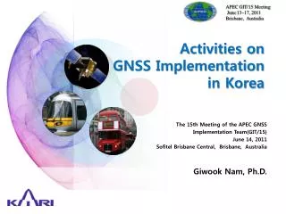
APEC GIT/15 Meeting June 13~17, 2011 Brisbane, Australia Activities onGNSS Implementationin Korea The 15th Meeting of the APEC GNSS Implementation Team(GIT/15) June 14, 2011 Sofitel Brisbane Central, Brisbane, Australia Giwook Nam, Ph.D.
Table of Contents • GBAS Implementation • High Precision DGPS • GNSS Application
Background for GBAS Program • Safety Issue • No ILS due to the terrain • CFIT Accidents (ASIANA Airline in 1992, Air China in 1996) • Capacity & Other Issues • Air Traffic increases 5% per year • More fuel consumption and CO2 emission
3 1 4 2 History of GBAS Activity • R&D for Academic Purpose • Develop GBAS prototype and T&E • Building experience and knowledge, gathering data for implementation of GBAS commercial service GBAS Test-Bed I (1998~2000) • GBAS Test-Bed II in Jeju Airport (2008~) GBAS Test-Bed II (2003~2007) DGPS Receiver (2001~2004) ’98 ’99 ’00 ’02 ’04 ’05 ’06 ’07 ’08 ’09 ’ 10
GBAS Implementation Program • Objectives • GBAS CAT-I Implementation for Commercial Service • Establish regulatory process for GBAS implementation • Period : Oct. 2010 ~ Sep. 2014 (4 Years) • International Collaboration : AsA, Honeywell • Candidate Airport : Kimpo (Traffic), Kimhae (Safety)
Milestoneof GBAS Implementation Program Operational Approval • 2012 GLS Procedure • 2013 ATC/Pilot Training • 2014 Flight Trial • 2011 Site Assessment • 2012 Installation • 2013 Flight Inspection • 2014 T&E Facility Approval with Certified GBAS Independent Monitor Unit
Objective • Provide the precise and reliable positioning service • Capable of recognizing lane on the road Urban Canyon Intermittent Signal Blockage Low Signal Strength Open Filed Phase1 Very Weak Signal Phase2 Development of HADGPS technologies to recognize lane inGood GNSS Signal Environment Development of receivertechnologies to recognize lane in Bad GNSS Signal Environment
The System Concept ① ∼ ⑥ common ① Satellite Orbit Error ② Satellite Clock Error ③ Satellite Data Error Digital Map ④ Ionosphere Error ⑤ Atmosphere Error ⑥ Signal Deformation Display) Signal Block ⑦ Multipath ⑧ Receiver Error Master Station Signal Acquisition Signal Acquisition Networked Carrier Phase DGPS Application Users Master Station ① ∼ ⑥ Error Correction ⑦ ∼ ⑧ Error Correction Reference 0.33 0.45 U-Transportation Smart Highway
2011 year 2010 year Research Status • Develop Simulation Environment • Modeling GNSS Signal Error Condition • Generating the GNSS Signal with Error • Evaluating Algorithms through Simulation • Field Test under Real Road Environment • - Development of Test Equipments • - Real Data Acquisition on the Road • Data Processing for Precise Positioning GNSS Signal Generation Reference & Master Station Test User Receiver Reference Station Correction Message HDGPS Master Station User Digital Map On Going
KARI-JAXA Collaboration KARI Use QZSS as test platform to broadcast correction message To improve the position Accuracy in Urban Canyon Environment JAXA Test QZSS performance in Korea
Solving national issues with GNSS technology Development of GNSS application technology toimprove public safety Road Detect and Prevent React to Disaster Aviation GPS Jamming Marine Tsunami Collision Vehicle Accident
Example of Road Disaster : Accident of Large Vehicles Carrying Dangerous Goods Veer off Roll Over Jack Knifing Detect Symptoms of Accident Report Accident to Agency Mitigate effect of accident Give warning to drivers
Concept of Detecting Symptoms of Car Accident RearGPS/INS Sensor FrontGPS/INS Sensor Accuracy: <many cm Accuracy: <30~40cm GPS/INS based precision relative position information Roll over Detection GPS/INS based precise location information Jack Knifing Detection Veer off Detection Real-time simulator