Download

1 / 56
560 likes | 592 Vues
Explore the impact of international migration on countries, challenges in gathering accurate population data, and the formation of river meanders. Learn about economic implications, welfare issues, data collection methods, and river channel features. Enhance exam-style question responses.

E N D
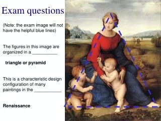
H Geography Exam-style questions
Exam Questions Success criteria .. • I can answer exam style questions • I can work with a partner to create answers • I can gain more confidence in my exam technique Learning intentions .. - To answer exam style questions
Population Lesson starter;
With reference to an international migration you have studied explain the impact on both the donor and receiving country. 4 marks
Study Figure 1. Discuss the possible consequences of the 2050 population structure for the future economy of Malawi and the welfare of its citizens. 6 marks 2010 2050
Consequences include: • Increased pressure on working population to provide for more than half of the population • Need to spend a lot of money on hospitals, doctors and nurses to provide the medical care needed by children • Expense of providing schools and teachers • Pressure on farmers to grow enough food • Land farmed intensively making soil poorer • More and more trees are being cut down to create farmland – desertification • People become poor and hungry due to stretched resources, and many move to cities in search of work • Not enough housing for everyone so people build their own makeshift shacks with lack of basic amenities, e.g. toilets and water supply • Insufficient jobs for everyone so unemployment is high and crime rates rise. Rise in informal sector employment • Traffic congestion worsens as city populations increase • Schools and hospitals are overcrowded and not everyone has access to them
In November 2013, the chairperson of Nigeria’s National Population Commission resigned after questioning the accuracy of the data gathered about the country’s population. (a) Discuss how countries gather accurate population data. (3) (b) Explain why it is difficult to gather accurate population data in developing world countries. (6)
Population data can be gathered by: • Census is a survey carried out every ten years to gather population data (1 mark). • Census: Each householder is asked to complete a detailed questionnaire about the number of people living in their home, their age, gender, employment, home and languages spoken (1 mark). • Civil registrations of births, marriages and deaths keep an up to date count of the population (1 mark). • Sampling – Population surveys are conducted to gather social and economic data, and can be conducted at regional, national or international levels (1 mark). • In China National Population Sample Surveys have been conducted annually, with 1% of the population being asked to complete the form (1 mark). • Government records: information on migration may be gathered from visa applications or Borders Agency (1 mark). • Data from electoral roll and NHS records allows population data to be updated in between census collection (1 mark).
Problems of gathering population data • Language barriers – countries with many official languages have to translate their census forms and employ enumerators who can speak multiple languages (1 mark) (some candidates may write the answer in this style - Nigeria has six major languages and hundreds of unofficial languages requiring more enumerators (1 mark)). • Literacy levels – many people can’t read and write, and therefore are unable to complete the forms, or might make mistakes unintentionally (1 mark). • Size of the population: the sheer size of some populations make it very difficult to conduct a census, eg in China and India (1 mark). • Inaccessibility: The poor infrastructure and difficult terrain, for example in the Amazon Rainforest, may make it difficult for enumerators to distribute census forms (1 mark). • Wars/civil wars: Conflict can make it too dangerous for enumerators to enter, or for data to quickly become dated (1 mark).
Cost: Undertaking the census is a very expensive process, even for developed world countries. In developing countries, there may be higher priorities for spending, including housing, education and health care (1 mark). • Migration: Rapid rural to urban migration, can make it difficult to gather accurate population data as data will become outdated very quickly (1 mark) • Many people in developing countries may be living in shanty towns, eg Dhararvi, or are homeless, so have no official address making it difficult to count them. (1 mark).
Hydrosphere Lesson starter;
Meanders are features commonly found in the middle and lower course of rivers. Explain the formation of a meander. You may wish to use an annotated diagram or diagrams. 8
hydraulic action (1 mark) which is when air is compressed into the river bank causing materials to be dislodged (1 mark) • abrasion (1 mark) when the force of the water throws bedload against the banks causing erosion (1 mark) • riffles and pools lead to changes in speed and depths in the river channel (1 mark) • pools are areas of deeper water whereas riffles are shallower with greater turbulence (2 marks) • river flows fastest on the outside bend increasing the erosive power (1 mark) • river flows slowest on the inside bend leading to deposition (1 mark) • helicoidal flow moves materials across the river channel. (1 mark) this leads to river cliffs and beaches developing (1 mark) • meanders migrate downstream as erosion continues. (1 mark)
With the aid of a diagram, explain the formation of a waterfall 8
Waterfalls are found where hard rock such as limestone overlies softer rock such as mudstone. The water is powerful and erodes the softer rock by hydraulic action(the sheer force of the water hitting off the rock). A plunge pool forms. The softer rock is worn away and the hard rock is undercut. And an overhang of hard rock is left suspended above the plunge pool. This collapses as there is nothing to support it and the rock falls into the plunge pool. Rock fragments swirling around deepen the plunge pool. This process is repeated over a long period of time and the waterfall retreats upstream leaving a steep-sided gorge. A good example of this can be found at High Force on the River Tees.
For the River Valency at Boscastle on 16 August 2004: (a) describe the changes in discharge level and (b) suggest reasons why these changes may have occurred. 10
Descriptions may include: • there is a lag time of five hours (1 mark) • there is a slow rise in discharge until 09:00 (1 mark) • there is a steep rising limb (1 mark) leading to a peak discharge of 100 cumecsat 18:00 (1 mark) • the rising limb becomes less steep briefly between 13:00 and 15:00 (1 mark) • there is a steep recession limb from 18:00 until 22:00. (1 mark)
Explanations may include: • this is caused by the initial rainfall which began at 07:00 (1 mark) • this rain may have been intercepted by vegetation (1 mark) • the water may also have infiltrated and be stored in the soil (1 mark) • the river rises because soil storage has been exceeded (1 mark) • the river may rise because of impermeable surfaces leading to rapid surface run-off (2 marks) • there may be a high number of tributaries transporting water to the channel • quickly (1 mark) • it may be a small catchment area meaning less travel time to the main channel • (1 mark) • the catchment area may be steep leading to rapid overland flow to the channel (1 mark) • the steep recession limb is due to there being no further rain after 15:00. (1 mark)
Rural Lesson starter;
Referring to named locations in either a semi-arid area or a rainforest area in a developing country discuss the consequences of rural land degradation on the people and their environment. 5 marks
Consequences to people and the environment: • Under-nourished and deaths from starvation due to crop failure • Increase in illness and diseases such as kwashiorkor – people are unable to work so have no money for food • People become weaker and poverty increases • People move to the cities in search of jobs – end up living in shanty towns • The traditional life of nomads is under threat – food and water for animals is scarce • Over-cultivation – as people are forced to settle in villages or at oases • Forced migration - people leaving homes to seek food and shelter in neighbouring countries (can lead to conflict with resident populations) • International aid is often necessary to ensure survival – this can lead to over-dependence on aid.
Referring to named locations in either a semi-arid or a rainforest area in a developing country: • Explain soil conservation strategies that have reduced land degradation. 5 marks • Comment on the effectiveness of these strategies 5 marks
Soil conservation strategies: • Movable fencing – allows farmers to restrict grazing animals to specific areas. • Contour ploughing – used to prevent soil being washed downhill • Terrace – levelled section of a hill designed to slow or prevent the rapid surface run-off of irrigation water • Magic stones – lines of stones laid along the contours of gently sloping farmland to catch rain water and reduce soil erosion • Shelter belts – trees planted to stop the wind drying out the ground and blowing the soil away • Strip cultivation – small crops grown between tall crops to provide shelter • Irrigation – used to artificially water crops • Zai – planting pits where water is trapped in the hole • Stone bunds – form a barrier which slows down run-off
Effectiveness of these strategies: • Movable fencing –effective if fencing is available and affordable, however herders need to meet an agreement which is not always possible. • Contour ploughing – can reduce soil erosion by as much as 50%, other measures need to be added to this to make it effective – if lines are not correctly established, there can be more risk to erosion • Terrace – successful in keeping the soil moist as they slow the flow of water • Magic stones – little cost involved, farmers can help each other • Shelter belts – successful as trees planted to stop the wind drying out the ground and blowing the soil away • Strip cultivation – successful as they provide shelter • Irrigation – successful if water is available to be stored • Zai – planting pits where water is trapped in the hole • Stone bunds – retain water and silt, building up new soil
Urban Lesson starter;
For a developed world city you have studied: a) Explain the techniques used to combat traffic congestion; and consider b) To what extent these techniques have been effective? 9 marks
For full marks you must comment on the effectiveness of the techniques. Answers must refer to named examples from a developed world city. Candidates who do not will not score full marks. For Glasgow: • The recently opened extension to the M74 has removed a large volume of traffic, easing congestion on the Kingston Bridge (1) • Measures such as higher on-street parking charges in the CBD discourage people form bringing their cars into the centre of the city, limiting on-street parking/lane blockage (1) • This is targeted at normal office hours when congestion is worst and reverts to free parking from 6pm to 8 am when congestion is lower (1) • Shops receive most of their deliveries early in the morning – when lorries and trucks are allowed on pedestrianised streets, e.g. Buchanan Street – removing commercial vehicles from the centre of the city (1)
Public transport has been improved to encourage people in Glasgow to leave cars at home. For example, bus frequency on major routes has been improved to every 10 minutes at peak times (1) • More carriages have been added to trains and wi-fi added to make the option of public transport more appealing to commuters and reduce the number of cars travelling into the CBD (1) • Bus land (e.g. on Maryhill Road) reduce journey times by public transport and make it more attractive than travelling by car (1) • This has been partially successful but can lead to heavier congestion on major roads at rush hour as there is less road space for cars, which remain the most common vehicle (1) • Season tickets and zone cards offer discounts for those using public transport to commute regularly, but campaigners argue that these remain too expensive to be truly effective in attracting people to leave their cars at home (1)
Park and ride schemes, e.g. at Shields Road, allow people to travel part of the way by car but to leave their car outside the CBD and complete their journey using the underground / overground train network (1) • The media is used to alert the public of potential problems to prevent congestion from building at hotspots, e.g. accidents or road works. For example, travel news on radio stations, using electronic noticeboards on main roads / motorways and using social media such as Transport Scotland updates on Twitter (1) • However, these methods can lead to the build-up of traffic in other areas as large numbers of commuters seek to avoid the original incident (1)
Cities in the developed world face many challenges at the start of the 21st century. Many of these problems are a result of changes that have occurred in the preceding 60 years. Inner city housing has changed dramatically in developed world cities. With reference to a named city in the developed world, explain the strategies used to solve the inner city housing problem. 5 marks
In Glasgow many of the worst tenement houses were demolished and replaced with high-rise flats, which allowed high population densities to be rehomed in areas such as the Gorbals (1) • High-ris flats were equipped with indoor bathrooms and heating, leading to health benefits for residents of these areas (1) • Many residents of overcrowded inner city areas were accommodated in nearby towns such as Barrhead and Paisley. This was a quicker solution than rebuilding due to the existing infrastructure in these areas (1) • More recently, high-rise flats have been demolished in areas including Govan. These flats have had significant problems linked to the loss of community spirit, damp and the breakdown of lifts, inconveniencing residents (1)
Modern tenement-style apartments have been built within the inner city, e.g. the Crown Street Regeneration Project. Services such as libraries and leisure centres are included in new developments to encourage longer-term success (1) • Loans and part ownership schemes have been launched to help existing residents afford houses in redeveloped inner city areas. This in response to criticism that many existing residents are often priced out of new developments (1)
Explain the strategies used to manage problems created by shanty towns; and • To what extent have solutions been effective in you chosen city? 10 marks
Self-improvement schemes involving residents forming self-help groups who persuade the authorities to give them ownership of their land (1) Then they design their own improvements. These include: building many more properly maintained toilets, improving the water supply, building another floor onto the houses, making stronger walls (1). • The people of Dharavi have a huge range of skills and can form self-help groups to carry out many of these improvements (1). • small loans from banks are provided to allow development (1). • authorities provide them with some basic services, such as electricity and piped water.(1)
Only some of the families will be rehoused in Dharavi. Many families are currently living above their workshops which would be impossible in the new apartments. This will separate communities and make people work away from where they live. • People are unhappy that they will be given such small apartments. Although the new apartments have more floor space, in the shanty town residents have made an extra storey in many of their houses, which will not be possible in a block of flats. • People are concerned that many of the workshops which give off pollution, such as the metalworking, will be banned with the new laws. • There is not enough space being given to industries such as pottery and recycling- these employ many people and bring in a lot of money, but they need large areas of land. If there is no recycling, there will be a lot of waste and litter all over the city. • These areas have strong safe neighbourhoods that have low crime and communal areas. Also at risk are the local shops and markets and the community spirit which has taken generations to develop. • Current redevelopment projects are densely populated and house lots of people. They are not good for community cohesion. Evaluation
The Society for the Promotion of Area Resource Centres, better known as SPARC, is an NGO (Non-governmental organisation) that supports the efforts of local people to get better housing for their many members (1). • Ideas generated from local people supported by this charity include adding an extra floor to buildings so that all family members can be accommodated in the same building (1). • These flats also had 14-foot high ceilings and a single tall window so are well ventilated, bright, and less dependent on electric fans for cooling (1). • Their loft spaces add extra room without seeming crowded, and include small spaces for bathing. But toilets are placed at the end of each of the building’s four floors, and kept clean by the two or three families who use each one. (1)
As the National Slum Dwellers Federation has repeatedly proven, housing the poor works best, costs less and is better for the environment, when the poor themselves have a say in what is being built (1). • Diseases such as cholera have been reduced due to the planning and management of upgraded mains sewers. Within 12 years 15% of Dharavi has been redeveloped (1). • Overcrowding is reduced as the self-help schemes support the efforts of local people to improve their housing for example by adding an additional floor to buildings (1). Toilets have been added and are shared by two or three families who help keep them clean, which has reduced the incidence of water related disease. However this idea only work when water is running in Dharavi (1). Evaluation
Explain the conditions and processes involved in the formation of a headland and bay. You may wish to use an annotated diagram or diagrams. 5 marks
Headlands and bays are found in areas where bands of hard and soft rock lie perpendicular (discordant) to the coastline(1) • As the result of the process of differential erosion, the softer rock is eroded more easily and at a faster rate than the hard rock (1) • Hydraulic action may occur when the crashing water of the waves forces air into small cracks in the rock causing mini-explosions. The repeat action of these explosions causes rock to fracture and break away (1) • Abrasion, when the load carried by the waves is thrown against the coastline, wears away at the coastline, breaking off material (1) • At the location of the soft rock, material is removed in transportation by the waves, leaving an area of the coastline set back from the surrounding harder/more resistant rock. This forms a bay (1) • Bands of hard rock are more resistant and remain as headlands at one or both ends of a bay (1)
Explain, with the aid of annotated diagrams, the various stages and processes involved in • the formation of: • a stack; and • (b) a sand spit. (10)
Headland with weaknesses such as joints, faults or cracks is eroded by the sea to form firstly caves (1 mark). Erosion takes place due to hydraulic action - pounding waves compress trapped air in the rocks, creating an explosive blast which weakens and loosens rock fragments (1mark), abrasion/corrasion – rock fragments thrown against the headland create a sandblasting (abrasive) action, wearing away the rock (1 mark), solution/corrosion – carbonic acid in sea water weathering limestone and chalk (1 mark), attrition – rock fragments slowly being ground down by friction from wave action into smaller and rounder pieces (1 mark). In some cases, a blowhole can form in the roof of the cave as compressed air is pushed upwards by the power of the waves, causing vertical erosion (1 mark). Over time, erosion on both sides of the headland cuts through the backwall and enlarges the cave to create an arch (1 mark). Continued erosion at the foot of the headland and the effects of vibrations on the roof of the arch weakens it, eventually resulting in the collapse of the arch roof, leaving a stack isolated from the headland (1 mark).
These low ridges of sand or shingle slowly extend from the shore across a bay or a river estuary and are caused by longshore drift (1 mark). This lateral movement occurs when waves, driven by the prevailing wind, pushes material up the beach; known as the swash (1 mark). The returning backwash is dragged back by gravity down the beach at right angles (1 mark). Material slowly builds up to appear above the water and begins to grow longer and wider. The spit develops as long as the supply of deposits is greater than the amount of erosion (1 mark). Spits form when there is a change in direction on a coastline, which allows a sheltered area for deposition (1 mark). They can also develop at a bay or a river estuary where the river current prevents the spit from extending right across the bay or estuary (1 mark). The shape can change through time to become curved or hooked at the end in response to changes in wind direction and currents (1 mark).
Explain the formation of one erosional landform and one depositional landform from You may wish to use an annotated diagram or diagrams. (10)
Glacier formation includes: • Snow accumulates in north facing hollows when more snow falls in winter than melts in the summer. (1 mark) • OR • North/north-east facing slopes are more shaded so snow lies longer with accumulated snow compressed into ice. (1 mark) Processes include: • Plucking, when ice freezes on to bedrock, pulling loose rocks away from the backwall, making it steeper. (1 mark) • Abrasion, when the angular rock embedded in the ice grinds the hollow, making it deeper. (1 mark) • Frost shattering when water in cracks in the rock freezes, expands and contracts weakening the rock until fragments break off. (1 mark)
Corrie: • Bergschrund crevasse opens up at the back of the hollow. This allows melt-water and rock fragments to get to the base of the glacier increasing abrasion. (1) • The weight of the glacier pushes down causing rotational sliding which deepens the hollow. (1) • Friction causes the ice to slow down at the front edge of the corrie, allowing a rock lip to form, which traps water as ice melts, leaving a lochan or tarn. (1) U-shaped Valleys/Hanging Valleys: • The weight of the glaciers causes them to flow downhill following existing V-shaped valleys. (1) • Former interlocking spurs may be cut off by the glacier as it flows downhill leaving truncated spurs and steep valley sides. (1) • The width and shape of the resulting glacial trough will depend on the nature of the rock type and the intensity and weight of the glacial and it erosion. (1) • Tributary valleys have smaller less powerful glaciers which result in less deep U-shaped valleys ‘hanging’ about the main valley. (1)