Download
1 / 15
150 likes | 244 Vues
Explore developments in aviation forecast guidance from the RUC system, including improved models for turbulence, ceiling visibility, and convection forecasting. Learn how real-time testing and assimilation of new observations are enhancing weather predictions for aviation safety.

E N D
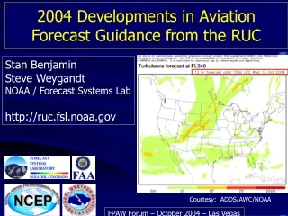
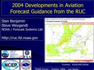
Stan Benjamin Steve Weygandt NOAA / Forecast Systems Lab http://ruc.fsl.noaa.gov 2004 Developments in Aviation Forecast Guidance from the RUC NY Courtesy: ADDS/AWC/NOAA FPAW Forum – October 2004 – Las Vegas
3-d RUC weather data updated hourly 20km x 50 vertical levels x 14 variables Turbulence Ceiling/visibility Convection - 2-12h forecast Terminal / surface Icing Better weather products require improved high-frequency high-resolution models with high-refresh data to feed them Winds
RUC changes • Impact on convection, ceiling/vis forecasts for aviation • 2004 - 20km RUC implementations completed – • April – RUC model • vertical advection of moisture better precip and clouds. More detailed land use/coastline. • September – RUC analysis • – use boundary-layer depth in assimilation of surface/METAR obs better temp/dewpoint/CAPE/convection forecasts • - 13km RUC implementation planned • Real-time testing since spring (see http://ruc.fsl.noaa.gov)
3h CAPE forecast valid 0000 UTC 21 April 2004 Operational RUC Revised RUC Severe weather reports • Two revisions: • Better use of METAR obs using boundary-layer depth (Sept04) • Assimilation of GPS precipitable water observations (2005)
13km RUC • New obs assimilated in 13km RUC • METAR cloud/vis data • GPS precipitable water (~300/hr) • Mesonet surface (temp/wind – 5000/hr) • 915 MHz profilers 20km RUC • Improvements expected from 13km RUC • Improved near-surface forecasts • Improved precipitation forecasts • Better cloud/icing depiction • Improved frontal/turbulence forecasts
LIFR IFR MVFR VFR CLR Assimilation of METAR cloud, visibility, current weather observations into RUC Goal: Modify hydrometeor, RH analysis fields to 1) force near match to current ceiling/vis obs when passed through ceiling/vis translation algorithms 2) improve short-range predictions To be part of oper 13km RUC - 2005
LIFR IFR MVFR VFR CLR Cloud ceiling (m) RUC – with and without METAR cloud assimilation Oper RUC - w/o METAR cloud assim Diagnosed ceiling from RUC hydrometeors 18z Obs 17 Nov 2003 METAR Flight Rules With METAR cloud assim Corresponding Ceiling height - meters
Cloud water mixing ratio (qc), 17z 27 Jan 04 analysis – After assimilation of METAR cloud/ceiling obs Background – 1h fcst MO KY VA MO KY VA 17z – 27 Jan 04
NCAR-RAP CV exp product – Flight Rules GOES visible image Observed – 1315z 7 Oct 04 3h fcst Valid 14z 7 Oct 04 13km RUC w/ c/v assim Oper RUC
RUC20 6h precipitation forecast Valid 18z Thurs 30 Sept 2004 RUC20 (oper) vs. RUC13 RUC13
RUC CONVECTIVE PROBABILITY FORECAST (RCPF) • Ensemble-based thunderstorm likelihood product • 2, 4, and 6-h forecasts every two hours • In-house testing 2003 and 2004 • AWC evaluation planned for 2005 • 2005 – use improved 13km RUC • EVENTUAL GOAL • Seamless 0-6 h convective guidance product (E-NCWF) • Guidance to forecasters, traffic flow managers, automated decision support systems
RCPFv2003 vs. RCPFv2004 6h Forecast Forecast length GMT EDT Forecast Valid Time • Verification for 26 day period (6-31 Aug 2004) • RCPFv2004fcst is a 1-h older thanRCPFv2003 • RCPFv2004 has similar CSI, much improved bias RUC CONVECTIVE PROBABILITY FORECAST (RCPF)
Sample comparison RCPFv2003 and RCPFv2004 products POD = .46 CSI = .18 Bias =2.00 RCPF v2003 25 – 49% 50 – 74% 75 – 100% Verification 15z NCWD 10 July 2004 POD = .49 CSI = .25 Bias =1.44 Forecasts 09z + 6h RCPF v2004 • GOALS in 2004 • Reduce large bias • Improve spatial coherency, temporal consistency
Sample RCPFv2004 product At fcst Time... 15z convection 25 – 49% 50 – 74% 75 – 100% 21z verif 15z + 6h Forecast RCPF v2004 Verification 21z NCWD 23 July 2004 Strength of RCPF - convective initiation RUC CONVECTIVE PROBABILITY FORECAST (RCPF)
Backbone of improved aviation forecast products for • winds, icing, turbulence, convection, TAFs • = weather model forecasts updated at • high frequency with latest observations • Keys to improvement of RUC model aviation forecasts • Higher spatial resolution • – better capture fine-scale weather hazards • (13km resolution) • Use new observations to initialize model • – force more realism in model initial conditions • (METAR ceil/vis obs, GPS moisture, mesonet) • Improved realism of physical processes in model • – clouds, turbulence, land-surface • (revised physics) Collaboration between FSL, NWS, FAA, NCAR, MIT/LL, NASA, customers