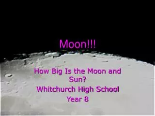
Moon Glint Angle
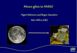
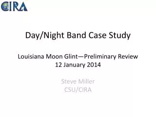
Day/Night Band Case Study Louisiana Moon Glint—Preliminary Review 12 January 2014 Steve Miller CSU/CIRA. G lint Angle. Moon Glint Angle. θ < ~10˚. θ < ~30˚. Ocean Surface. θ.

Moon Glint Angle
E N D
Presentation Transcript
Day/Night Band Case StudyLouisiana Moon Glint—Preliminary Review12 January 2014Steve MillerCSU/CIRA
Glint Angle Moon Glint Angle θ < ~10˚ θ < ~30˚ Ocean Surface θ When the Moon-Satellite geometry is favorable, there is the possibility for brightening of the water surface from lunar reflectance, just as in the day.
12 Jan 2014 0741 UTC 12 Jan 2014 0842 UTC Same Location Outside of Glint Zone 1 hr Later Specular Lunar Reflectance (Smooth Waters) Day/Night Band Radiance (Scaled) Outside Glint Zone (θ >> 30˚) Moon Glint Zone (θ < ~30˚) Lunar Glint Angle (Degrees) Possible Specular Zone
Specular Characteristics Calm waters mirror reflectance of Lunar Disk. (inside of the θ < ~10˚cone) Calm waters mirror reflectance without Lunar Disk (outside of the θ < ~10˚ cone). Wind-roughened diffuse reflectance of Moonlight Cloud Shadow
SSMI+AMSR-E Derived Surface Winds Zoom Area Courtesy NRL Monterey’s NEXSAT Webpage
Zoom Area SSM/I + AMSR-E 12 Jan 2014 0000 UTC VIIRS Day/Night Band 12 Jan 2014 0741 UTC 0 5 10 15 20 25 30 35 40 45 PMW data questionable due to proximity to coast. Moonglint suggests that water surface was smooth…possibly due heavy coastal turbidity or meteorological effect (e.g., ducting of surface winds atop low-level inversion layer)?
Notes and Preliminary Conclusions • The DNB imagery brightening near the Louisiana coast (and accompanying darkness further to the west, and diffuse brightness in the GOMEX) is all consistent with the expected behavior of moonglint. • Glint angle geometry consistent with features observed. • Demarcation of specular/diffuse zones suggests a sharp shift from calm to roughened waters offshore. • Additional analysis of true color imagery may reveal heavy turbidity near coast (one possible means to achieving calm waters even in the presence of light surface wind) • Analysis of other meteorological fields would be useful for understanding any mesoscale features such as low level inversions and ducting/decoupling of surface winds. • Further interpretation of SSM/I and AMSR-E derived wind fields pending with NRL Monterey experts.