Download
1 / 13
130 likes | 231 Vues
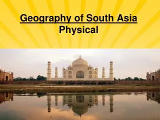
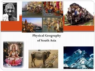
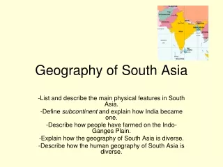
Geography and Early History of South Asia. The Shape of the Land Climate and Resources Early Civilizations of India. India. Subcontinent – Large area of land separated from the rest of the continent by a natural barrier.

E N D
Geography and Early History of South Asia The Shape of the Land Climate and Resources Early Civilizations of India
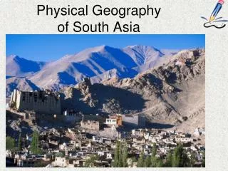
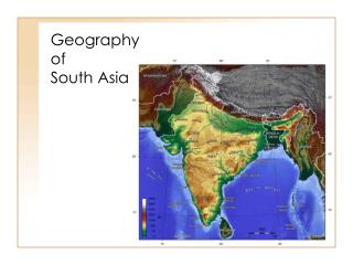
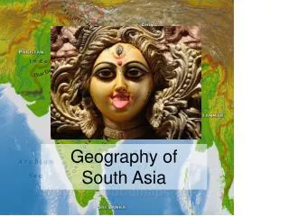
India • Subcontinent – Large area of land separated from the rest of the continent by a natural barrier. • The Himalayan and Hindu-Kush Mountains isolate it from the rest of Asia and its culture. • At its widest, the subcontinent stretches about 2,500 miles. • There are three landforms that shape the region, the northern mountains, the northern plains, and the Deccan Plateau.
The Mountains • Himalayas – highest in the world, over 50 peaks at least 5 miles high. Mt. Everest – highest mountain on land in the world, 29,038 feet above sea level. • Hindu-Kush – Located in Afghanistan and Pakistan. Formidable terrain, Khyber and Bolan passes offer safe route through. • The Vindhya Mountains, with the Eastern and Western Ghats, rim the Deccan plateau.
Rivers • The Indus River – located in the west flowing through India and Pakistan to the Arabian Sea. • It is predictable, deposits silt and minerals for farming. Home of the Harrapans, an ancient civilization. • The Ganges River – It flows 1500 miles from the Himalayas to its 10 mouths at the Bay of Bengal. • It is sacred to the Hindus, and the most populated area is along the banks of the Ganges. • The Brahmaputra – It is located along the northeast region, works its way out of the Himalayas, and flows into the Ganges.
Indo-Gangetic Plains • It stretches from Pakistan across India to Bangladesh. • The Indus, Ganges and Brahmaputra deposit water and silt to the plains. • It has a long growing season, and is densely populated. • Rice, wheat, and jute (a plant used to make twine and burlap) are some major crops.
Deserts • Thar Desert – covers 100,000 square miles of India and Pakistan (Colorado). • It consists of barren landscape of dunes and sandy plains. • Even though rainfall is scarce, some grasses do grow. • Nomadic herders graze flocks of sheep and goats in the Thar.
Deccan Plateau • It lies south of the Indo-Gangetic Plains. • It’s a region of high, flat land crossed by many rivers broken by low rolling hills. • There are millions of tiny farms located in the plateau who raise millet, cotton, wheat, and rice. • The Vindhya, and the Ghats create a mountain border around each side of the Deccan plateau. • The Vindhya mark the border between northern and southern India, they’re much lower than the Himalayas but also create a cultural barrier. • Ghats, (name for passes), border the plateau on the western and eastern sides.
India’s Climate • Warm, dry winters with hot summers. • Monsoons – are seasonal winds, which bring long periods of, rain usually lasting from June through October. (Monsoon means season in Arabic.) • Wet and Dry monsoons are key to farmers and define South Asia. • They plant crops earlier with hopes that the crops will root before the heavy rains wash them away. • Cyclones strike Bangladesh frequently. It’s an area that is very fertile, yet overpopulated.
Indus Valley Civilizations • Existed from 2500 BC to 1500 BC. • There were several cities and villages along the Indus River. • Cities of Harappa and Mohenjo-Daho were the largest, thought to be capitals 350 miles apart. • Farmers and traders. Traded with Sumer. • No one knows why the cities went into decay. • It is now thought the climate changed and made farming nearly impossible.
The Aryans • Nomadic and warlike, they came out of the Caucasus Mountain region. • Skill included iron works and charioteers. • Vedas, oral hymns, prayers, and rituals gave us info. • Later the Aryans developed Sanskrit, written word. • Worshiped many gods, Indra most important, but humanlike, liked eating and dancing. • Varuna, more strict, governed universe and punished sinners. • Became farmers and herders with wealth placed on cattle. • Rajahs, hereditary chiefs, ruled villages.
Social Class • Varna: The 4 Classes of People • Brahmans: priests • Kshatriyas: warrior class. • Vaisyas: landowners, merchants, and herders. • Sudras: Servants and peasants. • Over time, the social class system developed into the more rigid Caste system, one based on birth. Indians use the word Jati.