Download
1 / 83
870 likes | 1.23k Vues
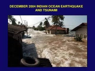
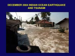
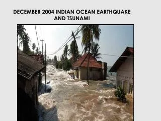
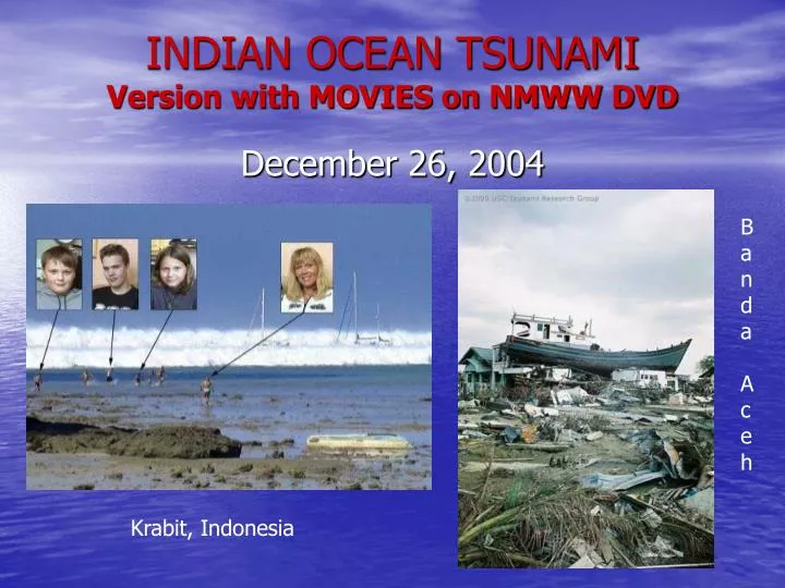
INDIAN OCEAN TSUNAMI Version with MOVIES on NMWW DVD. Banda Aceh. December 26, 2004. Krabit, Indonesia. TSUNAMI WAVES. Caused by Earthquakes under Ocean, or other events – landslides, volcanic eruptions, asteroid impacts, etc. In Deep Ocean the Tsunami Wave is

E N D
INDIAN OCEAN TSUNAMIVersion with MOVIES on NMWW DVD Banda Aceh December 26, 2004 Krabit, Indonesia
TSUNAMI WAVES • Caused by Earthquakes under Ocean, or other events – landslides, volcanic eruptions, asteroid impacts, etc. • In Deep Ocean the Tsunami Wave is only about 3 feet high but 100 miles wide and moving at speed of a jet airplane.
Alfred Wegner observed that South America and Africa continents fit like a gig saw puzzle Proposed Continental Drift of Plates (Plate Tectonics) and that 200 million Years ago a super continent of Pangaea existed.
SEA FLOOR SPREADING Occurs along the Mid-Atlantic Ridge pushing the African and European Plates away from the North and South American Plates at about 1 inch/year This then pushes the Pacific Ocean floor under the Plates on the opposite side of America Plates and Euroasian and Africa Plates
Earthquakes result from Sea Floor Spreading along the Mid-Atlantic Ridge that pushes the Continents over the Pacific Ocean Floor.
Mag 9, 0.58 GMT, 10 km Deep, 250 km SSWof Banda Ache, Indonesia, ~1 m high Tsunami, 20-40 min period, ~350 km wavelength, 200 m/sec
Depth Gauge Record of Mercator anchored 1 mile from coast of Phuket, Thailand. Time in hours, Depth in Meters. Reflected OffCoast -2.7, +3.9, -0.5, +1.7, -0.6, +4.9 meters in 41 minutes
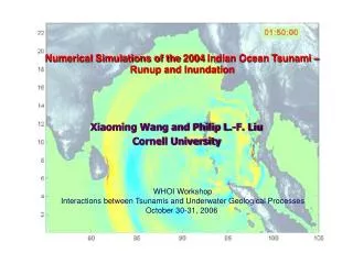
30 Minute Period, 350 km Wave Length, 200 m/s or 750 km/hr having traveled 1500 km in 2 hours since earthquake – 1 meter max wave height. TSUNAMI
Banda Aceh City, SumartaDigital GlobeSatellitePhotos Before After
Damage map of Banda Aceh showing the impact of tsunamis wave fronts from two directions. The numerals indicate the tsunami elevation in meters near the beach (white) and flow depth inland (black). (Damage map source: UNOSAT, Tsunami data: Borrero et al. 2006, Jaffe et al., 2006, Matsutomi et al., 2006).
___ 15 meters Men holding 5 meter staff ___
Phi Phi, Thailand Before Tsunami Initial Withdrawal
Phi Phi Don Island – Pictures taken from Aragon Yacht ¾ mile from land of other Yachts and Boats Withdrawal – Rocks normally underwater First Wave Run-up – 3 minutes later
4 minutes later 5 minutes later
Khao Lak, Thailand – Pictures taken byCanadians – John and Jackie Knill – before they died Withdrawal