Download
1 / 32
320 likes | 497 Vues
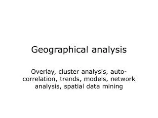
Geogra phical analys is. Overlay, cluster analys is , auto - correlati on , trends, model s , netw o rk analys is , terr ai n analys is. Geogra phical analys is. Combinati on of different geogra ph ic data sets or themes by overlay o r statisti cs Discovery of pat terns , dependencies

E N D
Geographical analysis Overlay, clusteranalysis, auto-correlation, trends, models, networkanalysis, terrainanalysis
Geographical analysis • Combinationof different geographic data sets or themesby overlay or statistics • Discovery of patterns, dependencies • Discoveryof trends, changes (time) • Developmentof models • Interpolation, extrapolation, prediction • Spatial decision support, planning • Consequence analysis (What if?)
Soil type 1Soil type 2Soil type 3 Soil type 4 Birch forest Beech forest Mixedforest Example overlay • Two subdivisions with labeledregions soil vegetation Birch forest on soil type 2
Kinds of overlay • Two subdivisions with the same boundaries- nominal and nominalReligionandvoting per municipality- nominal and ratioVotingand income per municipality- ratio and ratioAverage income andage of employees • Two subdivisions withdifferentboundariesSoil type and vegetation • Subdivisionandelevation modelSoil typeand precipitation
Kinds of overlay, cont’d • Subdivisionandpoint setquarters in city, occurrences of violence on the street • Twoelevation modelselevationandprecipitation • Elevation modelandpoint setelevationand epicentersofearthquakes • Twopoint setsmoney machines, street robbery locations • Network and subdivision, other network, elevation model
Result of overlay • New subdivision ormap layer, e.g. forfurtherprocessing • Tablewith combined data • Count, surface area Soil VegetationArea#patches Type 1 Beech 30 ha 2 Type 2 Birch 15 ha 2 Type 3 Mixed8 ha 1 Type 4 Beech 2 ha 1 …. ….
Buffer and overlay • Neighborhood analysis: data of a themewithinagivendistance (buffer) of objectsofanother theme Sightingsof nesting locations of the great blue heron (point set) Rivers; buffer withwidth 500 m ofa river Overlay Nesting locationsgreat blue heron near river
Overlay: ways of combination • Combination (join) of attributes • One layer as selectionfor the otherVegetation types only for soil type 2Land use within 1 km of a river
Overlay in raster • Pixel-wiseoperation, ifthe rasters have the same coordinate (reference) system Pixel-wise AND Forest Population increase above 2% per year Both
Overlay in vector • E.g.theplane sweep algorithm as given inComputational Geometry (line segmentintersection)
Combined (multi-way) overlays • Site planning, new construction sites depending on multiple criteria • Another example (earth sciences):Parametric landclassification: partitioning of the land basedonchosen, classified themes
Elevation Annual precipitation
Typesof rock Overlay: partitioning based onthe three themes
Analysis point set • Points in an attribute space: statistics, e.g. regression, principal componentanalysis, dendrograms (area, #population, #crimes) (12, 34.000, 34)(14, 45.000, 31)(15, 41.000, 14)(17, 63.000, 82)(17, 66.000, 79) …… …… #crimes #population
Analysis point set • Points in geographicalspacewithout associatedvalue: clusters, patterns, regularity, spread Actual average nearest neighbor distance versus expected Av. NN. Dist. for this number of points in the region For example: craters in a region; crimes in a city
Analysispoint set • Points in geographicalspacewithvalue: auto-correlation (~ up to what distance are measured values “similar”, or correlated). 11 10 12 12 n points (n choose 2) pairs;each pair has a distance and a difference in value 13 19 21 14 20 16 22 17 18 16 21 15
2 difference Averagedifference observed expected difference 2 2 distance distance Classify distances and determine average per class
Model variogram (linear) Observed variogram Averagedifference observed expected difference 2 sill 2 distance distance range Smaller distances more correlation, smaller variance
Importance auto-correlation • Descriptive statistic of a data set • Interpolation based on data further away than the range is nonsense 11 10 12 range 20 13 16 14 ?? 21 16 22 17 19 18 12 21 15
Analysis subdivision • Nominal subdivision: auto-correlation(~ clustering of equivalent classes) • Ratio subdivision: auto-correlation PvdA CDA VVD No auto-correlation Auto-correlation
Auto-correlation, nominal subdivision • 22 neighbor relations among provinces • Pr(VVD adj. VVD) = 4/12 * 3/11 • E(VVD adj. VVD) = 22 * 12/132 = 2 • Reality: 4 times • E(CDA adj. PvdA) = 5.33; reality once PvdA CDA VVD
Geographical models • Properties of (geographical) models:- selective - approximative (simplification, more ideal)- analogous (resembles reality)- structured - suggestive (usable, analyzable, transformable)- re-usable(usable in related situations)
Geographical models • Functions of models:- psychological (for understanding, visualization)- organizational (framework for definitions)- explanatory- constructive (beginning of theories, laws)- communicative (transfer scientific ideas)- predictive
Example: forest fire • Is the Kröller-Müller museum well enough protected against (forest)fire? • Data: proximity fire dept., burning properties of land cover, wind, origin of fire • Model for: fire spread Time neighbor pixel on fire: [1.41 *] b * ws * (1- bv) * (0.2 + cos ) b = burn factor ws = wind speed = angle wind – direction pixelbv = soil humidity
Wind, speed 3 Forest; burn factor 0.8 Heath; burn factor 0.6 Road; burn factor 0.2 Museum Origin < 3 minutes< 6 minutes< 9 minutes> 9 minutes Forest fire Soilhumidity
Forest fire model • Selective: only surface cover, humidity and wind; no temperature, seasonal differences, … • Approximative: surface cover in 4 classes; no distinction in forest type, etc., pixel based so direction discretized • Structured: pixels, simple for definition relations between pixels • Re-usable: approach/model also applies to other locaties (and other spread processes)
d = weight origin j = distance decay parameter c = distance cost betweenorigin j and destination i j ij Network analysis • When distance or travel time on a network (graph) is considered • Dijkstra’s shortest path algorithm • Reachability measure: potential value
Example reachability • Law Ambulance Transport: every location must be reachable within 15 minutes (from origin of ambulance)
Example reachability • Physician’s practice:- optimal practice size: 2350 (minimum: 800)- minimize distance to practice - improve current situation with as few changes as possible
Current situation: 16 practices, 30.000 people, average 1875 per practice Computed, improved situation: 13 practices
Example in table Original New Number of practices 16 13 Number of practice locations 9 7 Number of practices < 800 size 2 0 Number of people > 3 km 3957 4624 Average travel distance (km) 0,9 1,2 Largest distance (km) 5,2 5,4
Analysiselevation model • Landscape shape recognition:- peaksandpits- valleysandridges- convexity, concavity • Water flow, erosion,watershed regions,landslides, avalanches