Download
1 / 19
190 likes | 315 Vues
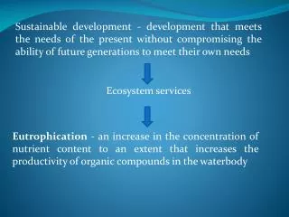
This presentation highlights the need for increased participation of landowners in ecosystem service markets in Virginia, amid significant losses of forest and agricultural land. It discusses critical issues such as carbon sequestration, water quality, and biodiversity, alongside strategies for smart growth and mitigation of environmental impacts. With pressing data on land conversion, carbon emissions, and water quality, the presentation emphasizes the importance of effective metrics, government tools, and community engagement to drive positive environmental outcomes. Collaboration and education are key to success.

E N D
Non Point Work GroupEcosystem Services Presented by Terry Lasher Authored by Buck Kline
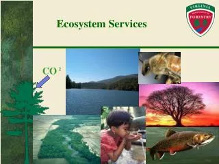
Ecosystem Services CO 2
Externalities CARBON BIODIVERSITY Land Clearing Costs Building Construction Costs Land Value Cost WATER AIR LandownerDecision
3 Million More People1 Million Fewer Forest Acres Population Forest Land
Virginia Status • FY 2006-2007 saw a net loss of an additional 27,300 acres of forest land • Between 1992 -1997, there was a loss of 116,000 acres of agricultural land • How can we enhance landowner participation in existing and emerging ecosystem service markets? • What tools can we provide to state and local government to smartly manage growth and mitigate environmental impacts?
Virginia’s $25 billion forest products industry Needs Support to Conserve Forest Land! • We can’t get our water quality offshore • We can’t get our wildlife habitat offshore • We can’t get our viewsheds offshore • We can’t get our air quality offshore
Current Efforts • Carbon Sequestration • Water Quality • Nutrient load reduction • Sediment loading • Air Quality • Wildlife/Biodiversity
WHY? Carbon • In 1993 China was a net exporter of oil. By 2025, it is predicted that China will import 10,000,000 barrels. (U.S. Dept. of Energy) • 45 million acres of forestland are lost annually worldwide (Food and Agriculture Organization of UN) • Globally, one day’s deforestation produces as much in greenhouse gas emissions as eight million people flying from London to New York (Carbonpositive) • In Virginia, one million metric tons of CO2 emissions occur annually as a result of the loss forest land due to conversion (U.S. Forest Service)
WHY? Water Quality • In the U.S., withdrawals for all uses totaled 408 billion gallons per day in 2000. 79% was surface water (U.S. Geological Survey) • In 2000, 85% of the American population depended on public water supplies In 1950, it was 62% (U.S. Geological Survey) • One-third of the world's major watersheds have lost more than 75 percent of their original forest cover (World Resources Institute)
Credit CalculationThe Foundation of the Effort • Good metrics are important • Must be backed by science • Must meet existing regulatory criteria QUALITY CREDIT (Quantity for market or mitigation)
Environmental or Technological Solution? AND/OR CAP
Water Quality Efforts Sediment Load Reduction – Infiltration • Practices • Ag land conversion to Forest • Agricultural BMPs • Stream restoration work • Potential Applications • Municipal water supplies (reservoir life, treatment costs) • Stormwater management • TMDLs
How Does Forest Cover Influence Air Quality? Pollutants (ozone, PM, SOx, NOx) • Objectives • Determine a science based physical measure for air quality credits • Explore voluntary mitigation opportunities or market-based solutions • Current Effort • Center for Chesapeake Communities/USFS/VDOF • Building on Dr. Dave Nowak’s work
Developing the Tools(Virginia Tech/Interagency Team Effort) • Create a pilot GIS-enabled tract-based ecosystem service credit calculator tool that will provide spatially-referenced information • Tool will incorporate existing GIS data, inventoried inputs (species, age, stocking), and remote sensing • Starting with carbon sequestration, water quality (sediment/nutrients), and biodiversity • User can select tract via spatial or database query, then calculate/quantify the ecosystem service of interest • Alternative land use and management options available for “what-if” scenarios
Potential Applications Cost Share Programs Landowners Web-Based Application CountyGovernment Resource Managers State Agencies Easement Programs Quality Credit Registry/Exchange
Carbon Sequestration Project 18 acres afforested Nutrient Credit Trading Project 8 acres Virginia Landowner Hardwood Stand – 400 MBF 87 acres total forested acres in municipal watershed Wetlands Mitigation Project – 11 acres Riparian Buffer to be planted – 12 acres
Needs • Resource Managers trained in developing ecosystem service portfolios and marketing those services • Landowner Education • Cost analyses to enhance the landowner and community based decision making process • Development process must be dynamic to reflect legislation, existing agency programs, and regulatory drivers. Collaboration is needed. • Create a multiple-use product (markets, voluntary mitigation, land-use planning, program prioritization) • Marketing strategy for voluntary credit purchases (Corporate stewardship, socially responsible investing (SRI), public relations, etc.) • Progress forward is dependent on funding opportunities and bullet #4
Questions? Terry Lasher, Assistant Regional Forester Virginia Department of Forestry Warrenton, VA Phone: 540-347-6305