Download
1 / 17
170 likes | 289 Vues
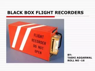
WORKING DRAFT. Commercial Off The Shelf GNSS Flight Recorders (COTS). An Update for the IGC. Proposal.

E N D
WORKING DRAFT Commercial Off The Shelf GNSS Flight Recorders(COTS) An Update for the IGC
Proposal To modify the Sporting Code Section 3 and the Technical Specifications for GNSS Flight Recorders with the express purpose of facilitating the use of Commercial Off The Shelf (COTS) GNSS Flight Recorders (FR) for documentation of all Badge Distance Flights.
Reasons for the proposal • A changed marketplace • Increased capability of COTS equipment • Significantly increased logging capacity • 10,000 trackpoints • Built-in security features • Files transferred into FR memory can be easily identified • Proliferation of third-party transfer programs (SeeYou, G7toWin) • Availability • Strong distributor and support networks • An option for marginal organizations where IGC – approved loggers are not prevalent • Widespread adoption of COTS by glider pilots • Just look at SeeYou connection wizard… Garmin protocol supported • Use of COTS in OLC, national competitions, etc. • In short, a different world than 1995
What do we mean by “COTS” • A GNSS FR not built exclusively for gliding
Impact to Rules Although we recommend a number of changes to the Sporting Code and Technical Specifications, there are only two substantive requirements: • Security • Increase the role of the Official Observer • Describe the security goals and not the precise means of achieving them • Altitude Measurement • Allow GPS altitude for documenting gain/loss of height
Security Philosophy • Pretty Good Security • Address highly likely threats • Flight log manufactured on a PC • Critical flight log elements altered • Address threats commensurate with rewards • Cheating should be “harder” than making the flight BUT • Security should be achieved without modification to COTS hardware or software • Revitalize the role of the Official Observer (OO) • Give the OO the tools he needs • Simple instructions • Context • We trusted him in the days of barographs and film. . .
Badge Security – a system Official Observer!! + + Pilot Flight Recorder Glider Transfer hardware Transfer software Evaluation hardware Evaluation software
Proposed Security Model • Leverage built-in security features • Protected source code • Tamper resistant cases and/or • Easy detection of flight logs transferred into FR • Involve OO for pre-flight inspection • Leverage user interface of COTS FR • Seal interface ports (only if required) • Involve OO for post-flight download • Initial inspection using user interface of COTS FR • Transfer using approved third-party software
Security Example Note: Following is only one potential scenario; several others exist
Phase 1: Preflight OO ensures track memory empty • OO seals data ports with tamper evident label
Phase 2: Preliminary Postflight OO validates seal is unbroken OO ensures track memory populated OO performs cursory track review directly on COTS FR
Phase 3: Transfer OO observes transfer using third-party software
Phase 4: Analysis OO takes control of file and completes analysis either in “real time” or at a later date
GNSS Altitude A rational approach
Altitude requirement for distance badges • Validation requires altitude measurement for: • Release • Start • Finish • In the past (barographs), altitude required to ensure “continuity of flight” • GNSS horizontal position is adequate for this purpose
A little perspective first… • [text and pictures illustrating a mountain and a glider on two different days. Both show a 5,000 foot start on the altimeter, but one is below the top of the mountain and the other is above the peak. Second slide showing a typical smoked foil, calibration chart, and calipers - how precise is this really?]