Download
1 / 65
650 likes | 869 Vues
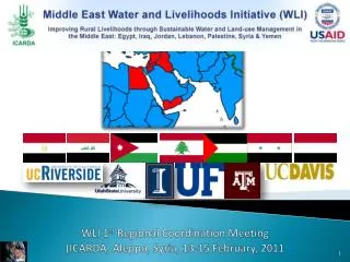
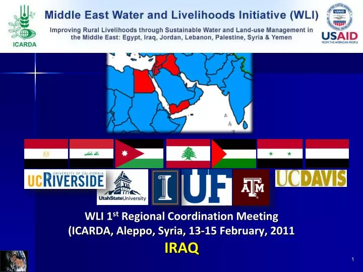
WLI 1 st Regional Coordination Meeting (ICARDA, Aleppo, Syria, 13-15 February, 2011 IRAQ. Prepared by Dr. Ahmed Adnan Alfalahi …… .National Coordinator Bio-physical team 1- Dr. Ahmed Adnan Alfalahi … Ministry of Agriculture 2- Dr. Kasim Ahmed Saliem … .. Ministry of Agriculture

E N D
WLI 1st Regional Coordination Meeting(ICARDA, Aleppo, Syria, 13-15 February, 2011 IRAQ
Prepared by Dr. Ahmed Adnan Alfalahi …….National Coordinator Bio-physical team 1- Dr. Ahmed Adnan Alfalahi … Ministry of Agriculture 2- Dr. Kasim Ahmed Saliem….. Ministry of Agriculture 3- Dr. Raad Omer Salih………… Ministry of Agriculture 4- Mr. Saad Abd Ali Abbs ……. Ministry of Water Resources 5- Mr. Emad Hamed Kamal….. Iraq National program for preparation of Acro-Ecology Zone Map (INP-AEZ) MoA 6-Ms.Alaa Qaddoori Ramidhan.. Iraq National program for preparation of Acro-Ecology Zone Map (INP-AEZ) MoA Soci- economic team 1- Dr. Ahmed Adnan Alfalahi ……. Ministry of Agriculture 2- Mr. Wathiq Abdullah Alrawi ..... Ministry of Agriculture 3- Mr. Mohanad muayad Abdullah.. Ministry of Agriculture
Overviewon Iraq GEOGRAPHICAL LOCATION • Latitudes 29°5¯ to 37°15¯ N and longitude 38°45¯ to 48° 45¯E • Adjoining Iran, Syria, Jordan, Saudi Arabia, Kuwait, Turkey
LAND AREA - Area ofIRAQ is 43.5 m ha - Cultivable area is 12 m ha * Irrigation zone is 8 m ha * Rainfed zone is 4 m ha * 6 m ha under cultivation
Soils - Light to heavy soil texture class differ with different of physiographic unit • Problems • Salinity • Declining in physical, chemical and fertility properties • High level of water table • Soil erosion and desertification • Poor culture for soil maintenance
IRRIGATION • Twin rivers - Tigris and Euphrates • Well water • Ground water • Drainage water
Irrigation waters Problem • Low water productivity • Decline in water quality • Shortage in water recourses • Oldness of irrigation methods • Low rainfall • Water use researches deficiency • Regulation
Bio-physicalandSocio-economic Characterization • The goal of middle East water and livelihoods Initiative ( WLI) to improve the • livelihoods of rural households and communities in Iraq • To achieve the objective of WLI for irrigated eco-system in Iraq a workshop of • Water and Livelihoods which held on 4-5 Aug., 2010 in Amman/ Jordan was • considered the first step of actual activities of WLI for Iraq. • IRAQI– ICARDA teams for WLI where set the components which serve • the project objective to accomplish , the component covering Bio-physical • and Scio-economic characterization
Iraqi Team with Representative Institutions 1- Ministry of Agriculture (MoA). 2- Ministry of Water Resource (MoWR) 3- Iraq National program for preparation of Agro-Ecology Zone Map (INP-AEZ) MoA.
Socio-economicCharacterization • The team was targeted a local community at Abu- Ghraib • benchmark site to assessment the livelihood of farmers, • gender issue, farmer's skills, farmer‘s revenue, rural employment • The team of Scio-economic study is developing a formatted • investigation form including standard questions which were • agreed on it in Amman workshop • This task was achieved by interviews which take place with 50 • selected farmers on randomized basis at benchmark site. These • collected data were classify and treated and analysis by SPSS • program
Part I:Socio-economic Characterization I.1 Livelihood assessment Targeted local communities at the benchmark site Population, family size, life standards, education level, adult literacy rate, main agricultural and non-agricultural activities of the rural communities) Farmers' participation/associations Roles and potential of membership. If not, is it targeted to be established in future? Farm revenue- baseline data Average crop return, average households income Rural employment to include non-agriculture The types of employment on farm or non-farm activities Farmers' skills, awareness and attitudes The main farmers' skills vis-à-vis development with emphasis on water management and irrigation practices, the awareness level on water, land, fertilizers and pesticides use, the attitudes and common farm ethics Gender-related data The % of girls enrolled in schools, gender equality in education, female share in agricultural labor force, participation of women in irrigation activities, participation of women in decision-making
Socio-economic Characterization • Family size The distribution of the sample villages as part of AGP, which the majority of the sample shows the presence in the villages of Radwaniyah, Shiha, which accounted for 30% and 28% of the sample respectively.
Socio-economic Characterization…cont Family size • Mix no. of female are 16 and min. no. is • 1 • Maximum no. of child under age of 15 • year are 20 and the minimum no. is zero • % of male, female and child represented • 40, 32 and 28% of the total number of • selected sample respectively. • Family size are 4 -33 per capita • between males and females • Maximum number of male are 17 and • minimum no. is 1
Socio-economic Characterization…cont • Family size /No. of Family The distribution of the sample household ranged between 4 – 33 family and the maximum reached to 12% , 14% , 16% at family size 7 , 9 , 10 respectively
Socio-economic Characterization…cont • Family size The distribution of the sample, according to the sectors adopted within the Abu Ghraib Irrigation Project, which shows most of the sample within sectors no. 16 and 17, which amounted to a percentage of 24% and 20% respectively.
Socio-economic Characterization…cont • Family size • The data of frequency and the percentage of females according to their size in family's sample selectedshowed that the female with a percentage of 28% of the total sample were distributed among 14 families with number of 2 female. • The table also was showed that 17 of the females belonged to one family and this presented 2% of the total sample.
Socio-economic Characterization…cont • Family size The table show the frequency and the percentage of males according to their size in family's sample selected . The data showed that the male with a percentage of 26% of the total sample were distributed among 13 families with number of 3 male. Total 50 100
Socio-economic Characterization • Education Level • The percentage of 44% of the sample • have secondary school certificate , • The illiteracy rate is 12% of the • sample • 18% of the sample get them Bsc • degree in the different fields of • knowledge. • 6% of sample selected have read • and write only
Socio-economic Characterization • Experience in Agribusiness The above table explained the years of experience of farmers, which ranged between 10 - 60 years old with average of 31 years .
Socio-economic Characterization • Sources of income • Most income for the AGP's families come from working in • Agriculture career with a percent of 64% , but about 36 • % of total income of the families come from other career .
Socio-economicCharacterization..cont • Membership in farm associations Most of the farmers in selected sample have jointed to farmers associations as a membership and in agricultural cooperative associations (NGO), these framers are representing 82% of total number of selected sample.
Socio-economic Characterization…cont • Type of land tenure • Most of the Farmers own the Lands and are representing • 86% of their land in possession.
Socio-economic Characterization…cont • Gender / Education level secondary 11 22 50 100 Total • Most Gender with percent of 66% of total selected sample • at AGP have primary level certificate and 22% of them have • secondary level certificate.
Socio-economic Characterization • Gender / Activities Gender is performing all agricultural activities in different percent on farm level . As well as to food preparing for family and child care.
Part II: Bio-physical characterization Site name, Region II.1 General Information Location, geographic boundaries, coordinates of the benchmark (Insert a map of the site preferably 1:50000 scale) Area and topography The surface area in km2, altitude and topography , general geomorphology) . A topography map (contour and stream lines, roads …), a landscape (dams, lakes,drainage systems, etc…) and a cadastral map showing cities and villages Climate The climate prevailing at the benchmark, in relation to (i) annual seasonal rainfalldistribution, temperature patterns and the availability of weather station(s) at the benchmark site) weather data maps (rainfall and temperature) at national level (if available). A map showing the distribution of the weather stations in the benchmark site is encouraged.
Soil characteristics soil type a, soil map , tabulate soil physical properties (depth, texture, water retention capacity, organic matter content, porosity, specify if the soil is well or fair drained) & soil chemical properties (pH and macro/micro nutrient levels, salinity and alkalinity levels) . a land degradation/soil erosion map Water sources/characteristics water sources (surface, ground, marginal, treated wastewater….), tabulate water chemical characteristics, mainly with relation to salinity/alkalinity levels). an aquifers’ map or the region or sub-region in which the site is located, a map showing water courses (permanent and temporary) . I.2 Agro-ecosystem characterization Common cropping patterns in the benchmark site Winter and summer crops, fruit trees, if there is intercropping, crop system (free or rotation), crop intensification & diversification) Land cover/land use maps (LCLU) at different scales. Average of landholdings/land fragmentation land tenure, the average farm size in the command area served by the benchmark site, if there is any land consolidation in some agricultural practices such as laser leveling or mechanized harvesting)
Bio-physical characterization..cont Procedure The concerned groups of the Iraqi team were: 1- Filtered the huge quantity of existing data. 2- Start to mapping some information as layers by using the GIS technique. 3- A samples of soils and water were collected from benchmark to determination some properties and check some existing data.
Abu-Ghaib Benchmark Site • Location and geographic boundaries • AGP is situated 20 km west of Baghdad in Mesopotamian plain, between T.& E. Rivers • Boundaries are Alfaluja/w, Baghdad/E, Salah Aldin/N and Babylon/S. • latitudes 36°.68¯and 37°.06¯ • Longitude 38°. 50¯ and 34°10¯
Area and Topography • The area is roughly 3212 Km2 ( 110 Km • long, (SW to NE), between 20 – 30 Km wide • The Altitude (elevation) of the benchmark varies from 30m a.s.l in the north – east to 23m and 24m a.s.l. in the south – east. • The topography of benchmark area is flat to almost flat in the cultivated area.
Geomorphology 1-Most of the Holocendeposits in the AGP belong to the flood plain of the Euphrates river, with only a relatively narrow strip in the east containing sediments from the Tigris, For the greater part, this flood plain is underline by Bakhtiari formation. 2- Thick Holocen deposits are overlying sandy clayey deposits which become definitely upper Fars in character at a depth of 20-30 m. In the western and northern part of the AGP, the Bakhtiari formations emerge from the flood plain and from remnants of old terraces which are commonly called high-desert deposits. Only south – west of the project area, the high desert area north of the Iskandariya canal can be identified as a plateau deposit, which is of Euphrates origin.
Geomorphology….(cont) 3- The mostly medium and fine textured Euphrates – Tigris flood plain is of the meander-belt type. This flood plain is characterized by river levees and river basins, sandy point – bar deposits and sandy crevasse deposits overlying medium and fine textured layers. These crevasse deposit find their origin in breaches of the river levees during high floods. 4- Besides, man has strongly influenced sedimentation of the flood plain in Holocene time. The first irrigation system introduced into the flood plain area about 5000 years old and are found in the immediate surrounding of ancient river beds- it was most probably a wild irrigation system with rather short irrigation canal made by breaking through the river levees at such convenient sports as the outer bends of the river. This irrigation method occasioned winding streams behaving like small river on either side. The profile of these levees shows mostly sandy layers and many of them can be traced from aerial photo and borings. Gradually these small rivers were canalized by man, or their course altered in such a way that water was brought to places where no irrigation had been possible before.
CLIMATE Sub-tropical, arid to semi arid with two well-marked seasons with short transitional periods. The long, dry and hot , rainless summer from May to October and comparatively short cool winter from Dec. to Feb
Table 1: Climatic data for the Abu – Ghraib Project ( Benchmark site)for a period of 1971 to 2009.(Baghdad metrological station, Baghdad Airport (Lo 44°24¯,Ln33°02¯) . There are wide diurnal and annual ranges of temperature. The absolute maximum temperature recorded 43.8 ° C and the minimum 3.7 °C . The diurnal difference in temperature is often 15 °C and may even be more than 20 °C.
Table 1: Climatic data for the Abu – Ghraib Project ( Benchmark site)for a period of 1971 to 2009.(Baghdad metrological station, Baghdad Airport(Lo 44°24¯,Ln33°02¯). • The average rainfall is about 123mm/ year but is extremely variable • from years to years as well as in distribution over the season.
Table 1: Climatic data for the Abu – Ghraib Project ( Benchmark site)for a period of 1971 to 2009.(Baghdad metrological station, Baghdad Airport (Lo 44°24¯,Ln33°02¯) • The air humidity is low during the summer months and average is 30%. The prevailing wind • throughout the year in the northwesterly (shamal) wind with a percentage of occurrence of • 35%, followed by strong southeasterly wind in winter and early spring with a 10% • occurrence. These southeasterly wind are often accompanied by unsettled weather with rain • and dust- storms. Though dust –storms many occur in any month of the years, their frequency • is greatest in spring and summer.
Table 1: Climatic data for the Abu – Ghraib Project ( Benchmark site)for a period of 1971 to 2009.(Baghdad metrological station, Baghdad Airport(Lo 44°24¯,Ln33°02¯) The average daily wind speed is highest during summer the record average for July is 4.3 m/sec.
Table 1: Climatic data for the Abu – Ghraib Project ( Benchmark site)for a period of 1971 to 2009.(Baghdad metrological station, Baghdad Airport(Lo 44°24¯,Ln33°02¯) The evaporation from the free water surface is very high in the summer months and the max. rate is 561mm on July and the max rate is low in the winter seasons from Nov-March. These values are high than the rate of rain fall in that area
Soil type • Almost all the soil in irrigable area of the AGP belong to Holocene alluvial deposits and are according to Soil Taxonomy 1975, USDA, Typic Torrifluvents with hyper thermic soil temperature regime and a mixed( calcareous) mineralogy They are calcareous and in places, salty. These soils belong to the irrigation deposits of the controlled irrigation system, but in some cases they are river –levee deposits . These loamy soil are widely distributed over the AGP. In some cases they are highly saline, but often they belong to the best soils in the project area. The silt and very fine sand content of these soils is always high.
Soil Texture of Abu-Ghraib Soils • Soils are very uniform in • texture with the exception • of the sandy or coarse • loamy deposits. • Soils content of fine or • coarse sand in mostly • below 15% by weight. • The clay content is seldom • higher than 45% . • Silt content is mostly • between 30 and 60 %. This means that the vast majority of the soils in the AGP are fine silty and fine-textural for 1 meter depth.
Soil Texture…Cont • The silt and very fine • sand content for the soil • surface with the depth of • ( 25 cm )is always high • The surface loamy • horizon are widely • distributed over the AGP • Dispersion of soil • structure elements is • common (weakly • structure).
Physical, Chemical Characteristics of AGP Soils Physical, Chemical Characteristics of AGP Soils • The soils depth of AGP are very deep (more than 5 • meter). • The soil specify as a stratified soil , with different • thickness of layers. • The lime content of the soils is generally rather high, • ranging between 20 and 30 %. • The gypsum content varies between 0.3 and 0.4 %, • but it may locally increase 4 % where basins soils • overlay gypsiferous desert soils.
Physical, Chemical.. (Cont) The organic matter content in the surface soils is very low and varies between 0.55 and 1.4 % decreasing irregularly with depth
Physical, Chemical.. (Cont) • Upper soils of AGP are a well drained • The hydraulic conductivity for • horizontal (Kh) varies widely (0.1 to • 3.0 m/day). • The hydraulic conductivity for • vertical flow (Kv), is considerable • less than that horizontal flow, due to • micro and macro- stratification.
Physical, Chemical.. (Cont) • All data used in this map represent a • mean weight of salinity value for 1 • meter soil depth. • The survey showed that the salinity of • most area of AGP is 3.37-9.0 dS/m • These conditions may vary widely • because of irrigation practices, • different in soil characteristics and • capillary rise of water table. • AGP has a different level of salinity • for soil surface (0- 25 cm). • Most of area of AGP soils contain • moderately level of salinity (8-16 • dS/m).
Physical, Chemical.. (Cont) • The soil pH values for the • AGP show that the soil • reaction is moderately • alkaline (7.4 – 8.00) for 1 • meter depth 1 meter soil depth of.
Water resources / characteristics • Most of area at AGP is irrigated by the Euphrates rivers • Irrigation network runs roughly from west to east, great part of area is irrigated by gravity • A portion of area are irrigated by pumps • Small portion of area is irrigated by pumps from Tigris river
Water resources/ characteristics….Cont Chemical analysis of Euphrates River • The salinity of Euphrates river Increase after construction of • many dams in Syria and Turkey. • The Tigris water is of better quality with value vary between 0.5 – • 0.6 dS/m. • Al-Massab Alam drain canal is collecting the drainage water from • the north of AGP to deliver it to the south of Iraq
Water resources/ characteristics….Cont Many farmer in AGP are using the drainage water of AlMasab Alam for irrigating their crops. when they facing shortage in water supply in Euphrates.
Water resources/ characteristics….Cont Table showed the analysis the water of Al-Masab Alam.
Water resources/ characteristics….Cont • Because of shortage in water • supply for AGP,!!!!! • Many farmers are digging wells • with a depth of 12 – 15 meter • in different locations of project. • Bio-physical team was • collected a samples from • 16 well and analysis for • salinity, chemical composition