Download
1 / 23
240 likes | 430 Vues
Groundfish Essential Fish Habitat (EFH) GIS Mapping. Van Hare Pacific States Marine Fisheries Commission. PSMFC managed the contracts that supported development of the Pacific Coast Groundfish Essential Fish Habitat (EFH) EIS. The final EIS was published in December of 2005.

E N D
Groundfish Essential Fish Habitat (EFH) GIS Mapping Van Hare Pacific States Marine Fisheries Commission
PSMFC managed the contracts that supported development of the Pacific Coast Groundfish Essential Fish Habitat (EFH) EIS. The final EIS was published in December of 2005. Through the EFH EIS process a wealth of data was assembled related to West Coast Groundfish.
A Habitat Use Database (HUD) was developed documenting the habitat preferences for individual species and life stage combinations as gathered from the literature.
The HUD was used in combination with spatial data to model the Habitat Suitability Probability for each of the species / lifestage combinations based on: 1. Benthic Habitat Type, 2. Depth, and 3. Latitude Zone
Essential Fish Habitat: 100% of areas identified to have a Habitat Suitability Probability (HSP) >0 for all species and additional areas with depth less than 3500m
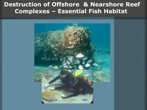
Habitat Areas of Particular Concern (HAPCs): includes areas of seagrass, canopy kelp, rocky reef, estuaries, oil platforms and ‘areas of interest’
Ecologically Important Areas (EIAs): including gear type restrictions
Access documents and links related to Pacific Coast Groundfish management
Interactively map areas off the west coast and browse the EFH EIS data using a standard web browser.
Select between viewing the Table of Contents or the map legend