Download
1 / 82
820 likes | 965 Vues
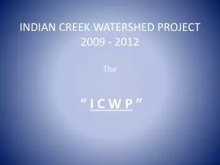
INDIAN CREEK WATERSHED PROJECT 2009 - 2012 The. “ I C W P ”. Indian Creek Watershed Project. The ICWP grant is administered by Historic Hoosier Hills RC&D , one of the project’s 13 Partners and also our project’s SPONSOR. HHH RC&D ICWP. ICWP.

E N D
INDIAN CREEK WATERSHED PROJECT2009 - 2012The “ I C W P ”
Indian Creek Watershed Project • The ICWP grant is administered by Historic Hoosier Hills RC&D, one of the project’s 13 Partners and also our project’s SPONSOR. HHH RC&D ICWP
ICWP • Cary Louderback is the Coordinator. • Bonnie Fancher is the primary volunteer monitor and President of the Steering Committee. • Switzerland County High School students are the primary volunteer water samplers. • “BMPs” are Best Management Practices (the conservation practices installed).
ICWP VISION A watershed with a healthy natural resource base that will improve the quality of life within our community
ICWP MISSION To lead efforts to better the natural resources of the Indian Creek Watershed for present and future generations
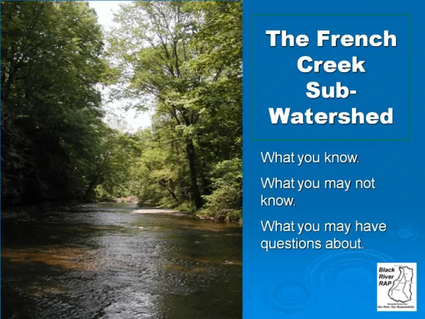
Watershed Description A watershed is the area of land that catches rain and snow and drains into a marsh, stream, river, lake or groundwater. Homes, farms, forests, small towns and big cities can make up watersheds. Watersheds come in all shapes and sizes.
Watershed Identification Hydrologic Unit Codes (HUCs) are a way of identifying drainage basins or a region of land that catches precipitation that falls within an area and funnels to a particular creek, stream or river until the water drains into the ocean.
ICWP HISTORY The ICWP began in 2001……
ICWP HISTORY • In 2001, Mrs. Bonnie Fancher and a group of her Switzerland County High School AP Environmental Science students sampled the water of Indian Creek. They found very high levels of E.coli bacteria. The group became very concerned and took their concerns to community officials. Long story short; a community task force, including the students and their teacher, discussed the problem and investigated potential ways to remedy.
ICWP HISTORY • The group gained the help needed, applied and received grant funding, and in late 2004, began the work of developing a Watershed Management Plan (WMP) to document the causes of high levels of E.coli and also to document recommended actions necessary to improve water quality. The next step was to apply for grant funding to cost-share with local producers willing to implement those
ICWP HISTORY • Conservation Best Management Practices, or BMPs, needed for water quality improvement. That funding was received, a Coordinator was hired in March, 2009, a Cost-Share Program and a Quality Assurance Project Plan were developed and approved, and implementation of BMPs began in 2010. Students and Mrs. Fancher continue to sample the waters of the Indian Creek Watershed and record the data.
ICWP VOLUNTEERS • There are specific requirements for water sampling in the ICWP grant. • There was no funding requested (or needed). • 100% of the water sampling is done by volunteers (largely students of SCHS) and Bonnie Fancher. • The Quality Assurance Project Plan (QAPP) was written by Bonnie Fancherand approved by IDEM, to fully ensure accuracy and reliability of the data.
ICWP LOCATION • The Indian Creek Watershed is located on the western side of Switzerland County. The headwaters area begins near Avonburg. It flows approximately 15 miles before it reaches the Ohio River, just west of Vevay. The watershed covers approximately 43,840 acres.
ICWP POPULATION • Human Population • The total population living within the Indian Creek watershed area was estimated using the population statistics from the 2000 Census. The total population within the watershed is estimated at 2,520.
ICWP POPULATION • Wildlife Population • The Indian Creek Watershed has a wide variety of habitats. Steep wooded hillsides, upland agriculture, and Indian Creek and its tributaries provide diverse habitat and extensive edge habitat for wildlife. The agriculture of the area includes soybean, corn, and hay fields. This habitat provides excellent food, water and cover for wildlife.
ICWP POPULATION • Switzerland County is recognized for its abundant wild turkey and Virginia Whitetail Deer harvests. The 2007 Spring Turkey Harvest was 467 turkeys for Switzerland County, the highest of any Indiana counties, according to the Indiana Department of Natural Resources. The total harvest for the State of Indiana for 2007 was 11,163. Many wild turkeys are observed in the Indian Creek Watershed.
ICWP POPULATION • The deer population and harvest is also extensive in Switzerland County. In 2006, the county had the fourth largest deer harvest in Indiana with 2,821 deer taken. This included 929 antlered and 1892 anterless deer. In 2005, Switzerland County had the third largest deer harvest in Indiana with 3,135 deer taken. This included 1,038 anterled deer and 2,097 anterless deer. Information from the Indiana Department of Natural Resources.
Indian Creek’s Subwatersheds • (1) Indian Creek Headwaters • (2) Northwest Tributary Indian Creek • (3) Tumblebug • (4) Upper Indian Creek • (5) Pendleton Branch • (6) Long Run • (7) Indian Creek
Sedimentation source: Livestock • The critical areas for sedimentation from livestock sources were determined using the windshield survey results. Subwatersheds with more than 50% occurrence of livestock with access to the creek received a high priority. Those that had between 10-50% occurrence received a medium priority, and those under 10% received a low priority.
Sedimentation source: Tillage • The critical areas for sedimentation from conventional tillage were determined using the total acreage of cultivated cropland in each subwatershed. Subwatersheds with more than 1,000 acres of cultivated cropland received a high priority. Those that had between 100 – 999 acres received a medium priority, and those under 100 acres received a low priority.
Changes in farming • An interesting note: • Switzerland County farmers have changed “how” they grow crops over the past few years. Currently, most row crop farming is done using no-till methods versus earlier methods of tilling. These recent changes have a positive impact on water quality by reducing the sedimentation and chemical runoff !
Sedimentation source: Urban • The critical areas for sedimentation from urban areas were determined using the total acreage of developed land in each subwatershed. Subwatersheds with more than 100 acres of developed land received high priority. Subwatersheds with 11-99 acres of developed land received medium priority. Subwatersheds with 10 acres or less of developed land received low priority.
Sedimentation source: Urban Development of more urban areas is likely to continue which will require implementation of urban erosion control methods to maintain or improve water quality.
E.coli: From Livestock • The critical areas for E.coli from livestock sources were determined using the windshield survey results. Subwatersheds with more than 50% occurrence of livestock with access to the creek received a high priority. Those that had between 10-50% occurrence received a medium priority, and those under 10% received a low priority.
E.coli: Human Sources • According to Joe Spiller, Switzerland County Health Department Inspector (circa 2001), the best soils for a leach field are those that are deep, well-drained, and strong to moderate structured soils such as silt loam or loam soil types. The Switzerland County Soil Survey indicates that each of the soil associations found in the Indian Creek watershed are not suitable for septic tank absorption fields.
E.coli: Human Sources Septic systems installed in soils unsuitable for leach fields have a high chance of malfunctioning, leading to the contamination of both land and water. In addition, the critical areas for E.coli from septic system sources were also determined by using the water testing results taken throughout the year.
E.coli: Human Sources Subwatersheds that averaged more than the state standard of 235 colonies per 100 mL received a high priority. Those that were below the state standard received a low priority.
Nutrients source: Agriculture • The critical areas for nutrients from agricultural land were determined using the total acreage of cultivated cropland and pasture/hayland. Subwatersheds with more than 2,000 acres of combined pasture and hayland and cropland received a high priority. Those with between 1,000 – 2,000 acres of combined cropland and pasture/hayland received a medium priority, and those with less than 1,000 acres of combined cropland and pasture/hayland were given a low priority.
Nutrients: From lack of riparian buffers • The critical areas for nutrients from lack of riparian buffers were determined using windshield surveys and aerial photographs. Subwatersheds 010, 040, and 050 had moderately buffered streams and were given a medium priority. Subwatersheds 020, 030, 060, and 070 had sufficiently buffered streams and were given a low priority. Because the watershed is adequately buffered, no areas were given a high priority.
Chemicals: From chemical applications • The critical areas for chemicals from chemical application were determined using the total acreage of cultivated cropland in each subwatershed. Subwatersheds with more than 1,000 acres of cultivated cropland received a high priority. Those that had between 100 – 999 acres received a medium priority, and those under 100 acres received a low priority.
Chemicals: From lack of riparian buffers • The critical areas for chemicals from lack of riparian buffers were determined using windshield surveys and aerial photographs. Subwatersheds 010, 040, and 050 had moderately buffered streams and were given a medium priority. Subwatersheds 020, 030, 060, and 070 had sufficiently buffered streams and were given a low priority. Because the watershed is adequately buffered, no areas were given a high priority.
Dumping • The critical areas for dumping were determined using windshield surveys and field days. Subwatersheds where more than one illegal dump site was found or a clean-up field day was performed received high priority. Areas where only one illegal dump was found were given a medium priority, and the 050 subwatershed with no dump sites was given a low priority.
ICWP 2010/2011 PROGRESS • 11 producers are being assisted with the $143,000 in cost-share . • 81 BMPs have been funded & installed. • Over $75,000 worth of BMPs were completed in 2010 and the producers paid. • Another $62,000 worth of BMPs were completed in 2011. All producers paid.
ICWP 2012 PROGRESS • The remaining $6,000 of the original $143,000 is in the process of being expended. • Thanks to funding for 6 months from the Switzerland County Council, work continues. • ICWP recently received a grant extension of one year and $50,000 in cost-share funds. • About 98% of that new funding, from IDEM, has already been allocated. Expenditures will begin very soon- weather permitting.
ICWP PROGRESS • BMPs installed include: • Fencing • Pasture & hayland reseedings • Heavy Use Area Protection (HUAP) • Alternative Watering Systems, that include Watering Facilities Ponds, spring developments or wells Pipelines
ICWP PROGRESS Progress toward LOAD REDUCTIONS, to date: • Sedimentation reduction- 421% • Phosphorous reduction- 32% • Nitrogen reduction- 129% (In terms of percentage of annual targets, as per the Watershed Management Plan goals, calculated by using NRCS-accepted methods).
ICWP PROGRESS MATCH FUNDS: • Original grant requirement: $188,141.00 • Grant extension added: +66,667.00 • Total required: $254,808.00 • Reported to date (Feb. 2012): (204,931.00) • Still required: $49,877.00 From 2009 thru present, ICWP has been on or ahead of schedule regarding Match Funds.
ICWP FUTURE • More producers are awaiting funding, should more funds become available. • A grant application was submitted in August, 2010, requesting $202,000 in cost-share funding. It was not funded. • Another grant application was submitted in August, 2011, again requesting $202,000 for cost-share. So far, the prospects of that grant being funded appear to be positive.