OneGeology
IC GS. OneGeology. Ian Jackson, March 2007. IC GS. Introduction to OneGeology And this Workshop and the week ahead. Ian Jackson, March 2007. Thank you. John Broome, ESS, Canada Harvey Thorleifson, AASG, USA Kathryn Bull, BGS, UK Jenny Forster, BGS, UK Katy Booth, BGS, UK

OneGeology
E N D
Presentation Transcript
IC GS OneGeology Ian Jackson, March 2007
IC GS Introduction to OneGeology And this Workshop and the week ahead Ian Jackson, March 2007
Thank you John Broome, ESS, Canada Harvey Thorleifson, AASG, USA Kathryn Bull, BGS, UK Jenny Forster, BGS, UK Katy Booth, BGS, UK Marie Cowan, BGS, UK (OneGeology Workshop Organising Team)
Contents of this presentation • What is OneGeology • From humble origins…. to international project • The principles and objectives of OneGeology • Why do it? • How do we plan to do it? • This Workshop and its goals • Summary and where we are now
What is OneGeology? A project to make web-accessible the best available geological map data worldwide at a scale of about 1:1 million, as a Geological Survey contribution to the International Year of Planet Earth
Humble origins Just an idea February 2006
Collecting support……. March - August 2006
Support for OneGeology grows… September – December 2006
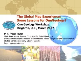
Brighton, UK International Workshop ….and Project … March 2007
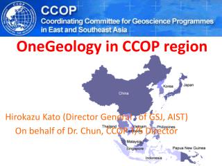
IC GS Who is involved? International Bodies International Year of Planet Earth (IYPE) www.yearofplanetearth.org International Consortium of Geological Surveys www.icogs.org Commission for the Geological Map of the World (CGMW) http://ccgm.free.fr/ International Steering Committee for Global Mapping (ISCGM) www.iscgm.org International Union of Geological Sciences (IUGS) www.iugs.org/ UNESCO http://portal.unesco.org/en/ Co-ordinating Committee for Geoscience Programmes in East and Southeast Asia (CCOP) www.ccop.org.th/ Commission for the Management and Application of Geoscience Information (CGI) www.cgi-iugs.org International Lithosphere Program http://sclilp.gfz-potsdam.de/ EuroGeoSurveys http://www.eurogeosurveys.org/
Who is involved? Surveys and organisations who are participating
Steering Group “Transparent Earth” CGMW 5-25 proposal (25M) CGMW Leadership and Teams and Resources (5M) CGMW Continental Leadership and Teams and CGMW Member Resources IC GS Operational OneGeology in context OneGeology (c1M) Geological Survey Leadership, Teams and Resources
The principles behind OneGeology The givens • geological map data are essential to societal well-being and development • society has contributed through taxation for the geological map data that exists and they have a right of access to it
The principles behind OneGeology Geological surveys and geoscientists around the world have a responsibility to: • make accessible the best geological map data they have available now • work towards consistent standards for data and access and thus a consistent data architecture and schematic interoperability • enhance and increase use of their data
The objectives of OneGeology • Making available geological map data accessible • in whatever digital format is available in the participating country • Transferring know-how to those who need it • Stimulate a rapid increase in interoperability (ie disseminate GeoSciML further and faster)
That means OneGeology is: • focusing on Internet access to digital data rather than paper maps • society increasingly wants its information on-demand and thus digitally • adopting an approach that recognizes that different nations have differing abilities to participate. • Some are very well developed and provisioned, others barely have stable power supplies, let alone equipment and know-how . • facilitating the transfer of technical expertise and data between nations • Cutting the learning curve and costs to nations with limited resources but for whom the need for accessible geological data and the benefits they bring are just as great.
A crucial point • OneGeology is about geological data available in a standard data structure first, • i.e. making geological map data accessible without geological reconciliation • The prime objective is not about harmonising geological units and scientific classification across frontiers - that is something to be considered for the longer term
Why do it? (1) • The UN General Assembly of 1997 (Agenda 21) urged the world to decrease the gaps in the availability, quality, standardisation and accessibility of data between nations. • The need to understand our global environment to solve global environmental problems at a global scale. • International Year of Planet Earth and the fact that geological surveys were looking for a tangible way to contribute • Around the world each geological survey had a treasure chest of data that just needed unlocking • The geoscience community needs to accelerate development of basic digital geological map standards to improve interoperability, sharing and accessibility of data and ……
Why do it? (2) • …the great progress of GeoSciML, - the “technical engine” and OneGeology is the “wheels” it needs to spread • The development of Spatial Data Infrastructures • The lessons learned in making digital map cover available and accessible in UK and Europe • The availability of the computing/information systems we need • Create a benchmark for all nations • Transfer know-how to developing countries and produce maps/data to attract interest and investment. • A project that could involve and focus all geological surveys • Raise the profile of geoscience. • The “Google Earth” approach and the great example it sets
Implementation Plan and Develop OneGeology project stages Hearts/Minds/Politics Hearts/Minds/Politics Principles Specification Design Science and technology The UK Workshop
Brighton Workshop Objectives/Success Criteria • Understand the visions and concerns of the participants • Develop consensus and share understanding of OneGeology • Produce a project plan and schedule for project governance • Communicate project status • Review what map/data content is available in participant nations. • Define formats/ways to participate (including participation strategy for nations needing assistance) • Develop consensus on a high-level geological specification • Develop consensus on data structure, input and output • Draft communication and recruitment plan • Produce a “Brighton Accord” – our agreed recommendations • End the Workshop with broad participation in place (and a happy bonded team!)
Workshop Schedule Tuesday 13 March MorningWelcome, scene-setting and introducing OneGeology. AfternoonInitial break-out discussions on OneGeology. Related projects and initiatives. Wednesday 14 March Morning Interoperability and future aspirations. Focused OneGeology Break-out sessions. Afternoon Field Trip. Thursday 15 March Morning Break-out groups’ presentations and discussions. AfternoonBreak-out groups’ reports. Related proposals and initiatives. Friday 16 March Morning 2 Parallel sessions A: Workshop progress and plans. B: GeoSciML course. Afternoon Departures.Geology Workshop programme at a glance
Workshop Schedule Tuesday 13 March - morning 0900 – 0915 Workshop Welcome Address and Chair Peadar McArdle 0915 – 0945 Introduction to OneGeology Ian Jackson 0945 – 1030 Statements by representatives of global bodies 1030 – 1055 Global Mapping and the lessons learned Fraser Taylor 1055 – 1100 Questions 1100 – 1120 Coffee break 1120 – 1140 The OneGeology project Ian Jackson 1140 – 1150 Questions 1150 – 1215 Introduction to the geological specification Harvey Thorleifson 1215 – 1225 Questions 1225 – 1250 Introduction to the informatics, data & technology John Broome 1250 – 1300 Questions 1300 – 1345 Lunch
Workshop Schedule Tuesday 13 March - afternoon 1345 – 1400 ‘Break-out’ briefing Harvey Thorleifson 1400 – 1450 Break-out table discussions of the morning’s presentations 1450 – 1600 Report back of Break-out table discussions 1600 – 1620 Coffee break 1620 – 1700 Antarctica and marine domains Phil Leat and Colin Jacobs 1700 – 1715 Questions and discussion 1715 – 1735 A national contribution to OneGeology — the example of the Italian national map database Leonello Serva Related projects and initiatives 1735 – 1750 CGMW and its role in Transparent Earth Jean-Paul Cadet 1750 – 1810 The CGMW 25 million and1 million proposal Philippe Rossi 1810 – 1815 Close of day summary and briefing Peadar McArdle 1930 Dinner & Geo-quiz & Scotland’s Geology in Spirit
We are using break-out groups - why? • Because a plenary session of 80+ people is too many to have a thorough discussion of all the issues • Because many people find it easier to contribute in a smaller group, especially in a language that is not their own • Because we want to try and get the most value from the different types of expertise we have available
Summary OneGeology will …… • help to make existing data accessible to the world (adding value to existing resources) • transfer know-how • spread standards and interoperability (GeoSciML) One Geology is about …… • pragmatism (accept what is given) • not about geological harmonization • any format: paper/raster/vector • 1:1M is only a target scale
Progress in 56 weeks (6 February 2006 – 13 March 2007) • 53 Nations/Geological Surveys have to date expressed interest in OneGeology • 6 global bodies, 4 international geoscience organisations, 2 multinational companies and 3 famous celebrities are actively supporting OneGeology! • Kick-off Workshop organised: +80 participants from +40 nations (you !) are here to plan the project • BGS have allocated an initial $200 000 to move project forward in 2007 • OneGeology has momentum and has captured the imagination of people inside and outside the geosciences – see the international press coverage!
If this is what can we do in the first 56 weeks…… Think how much we can achieve together in the next 56 weeks!