Download
1 / 13
140 likes | 328 Vues
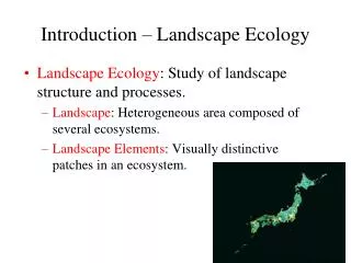
Landscape ecology methods. An overview of a few of the methods used in landscape ecology studies. UBC Geography 471. Commonly used methods. Some of the more commonly used methods include: Markov analysis Simulation models Spatially-explicit population models New indices. Markov analysis.

E N D
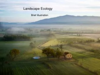
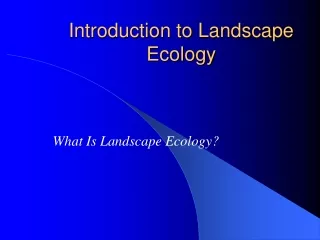
Landscape ecology methods An overview of a few of the methods used in landscape ecology studies UBC Geography 471
Commonly used methods • Some of the more commonly used methods include: • Markov analysis • Simulation models • Spatially-explicit population models • New indices
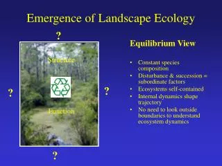
Markov analysis • Markov chainA random process in which the probability that a certain future state will occur depends only on the present or immediately preceding state of the system, and not on the events leading up to the present state.
Integrating landscape Models in Forest landscape Analyses using GIS: An Example in Taiwan The transition matrix and transition probabilities of the observed landscape changes from 1988 to 1996 http://www.gisdevelopment.net/aars/acrs/1999/ps1/ps1729.asp
Simulation models • A computer simulation or a computer model is a computer program that attempts to simulate an abstract model of a particular system. Computer simulations have become a useful part of mathematical modeling of many natural systems in physics, chemistry and biology, human systems in economics, psychology, and social science, and in the process of engineering new technology, to gain insight into the operation of those systems. • Traditionally, the formal modeling of systems has been via a mathematical model, which attempts to find analytical solutions to problems which enables the prediction of the behaviour of the system from a set of parameters and initial conditions.
Simulation models: Harvest • HARVEST was designed as a strategic research and planning tool, allowing assessment of the spatial pattern consequences of broad timber management strategies. The model is well suited to evaluate alternative strategies, providing comparable predictions about how the alternatives affect the age (or successional stage) distribution of the forest, the spatial distribution of forest interior and edge habitats, and the patch structure of the resulting forest landscape.
Harvest With HARVEST, the object is not to find a scheduling solution (i.e., determining the order in which individual stands should be harvested), but to assess the spatial pattern consequences of general management strategies. HARVEST has been shown to generate patterns similar to those produced by timber management (Gustafson and Crow 1999). http://www.ncrs.fs.fed.us/4153/Harvest/v60/v6_0.htm
SPATIALLY EXPLICIT POPULATION MODELS • Spatially explicit models have a structure that specifies the location of each object of interest (organism, population, habitat patch) within a heterogeneous landscape, and therefore the spatial relationships between habitat patches and other features of the landscape (e.g., landscape boundaries, corridors, other patches) must be defined. • Since the spatial layout of the landscape is explicitly incorporated, the models can be used to indicate how populations or communities might be affected by changes in landscape structure, including changes in landscape composition (the relative or absolute amount of habitat types or features in a landscape) or landscape physiognomy (the exact placement of habitat patches and other features within the landscape) (Dunning et al. 1992).
Northern Spotted Owl • Perhaps the most common use of SEPMs to date has been in the study of individual and population response to landscape change. • How do the risks to persistence of the owl population vary among five alternative logging schemes during the transitional period? Do some alternatives have unacceptably high risks of crossing a habitat threshold, beyond which the population declines inescapably to extinction?
Northern Spotted Owl • Questions such as these can be addressed only by considering the amount, geometry, and rate of change of habitat in a spatially and temporally explicit fashion. The transient behavior of the Spotted Owl population in Oregon is being examined using OWL, a SEPM integrated with a GIS database of the forested landscape in Oregon (McKelvey et al. 1992, Turner et al. 1995). • Preliminary studies indicate that whatever management strategies are selected will significantly affect the population trajectory during the transition until the final reserve design is reached.
Northern Spotted Owl • Projected change in the amount of Spotted Owl habitat on National Forests for five alternative strategies (numbered solid lines) that establish a Spotted Owl reserve design in the Pacific Northwest (USDA 1992). The dashed line indicates the current amount of owl habitat. Note that alternatives 3-5 project a continuing loss of habitat during part or all of the simulated time span. This loss occurs even though the owl is currently listed as threatened due to past loss and fragmentation of its habitat (USDI 1992). http://www.szooek.slu.se/~EcoForest/Block3/dunn95.html
Landuse change in Dublin This index (Green Edge) shows how much of a region’s urban fabric is adjacent to (i.e. has an edge with) vegetated areas. Areas with a high value for the index will have greater access to recreational facilities (e.g. gardens, parks, wooded areas, sports fields), and will be less affected by noise and air pollution from traffic. Nature-deficit disorder http://moland.jrc.it/technical_tools/frag/moland_fra.htm
Explore • These are a few of the different methods that are used in landscape ecology (and in crime analysis and medical geography as well). • In the papers you review you are likely to come across other methods—the ability to map the results of analyses has added considerably to the utility of many methods.