Download
1 / 23
240 likes | 271 Vues
European Forest Fire Information System (EFFIS) supports EU regulations on forest fires, providing tools for risk assessment, monitoring burnt areas, and estimating CO2 emissions. Key modules include fuel/biomass mapping and fire detection. Efforts focus on data collection, burn area mapping, and smoke dispersion monitoring, aiding in fire management and environmental assessment.

E N D
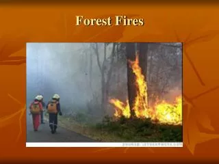
Forest Fires in Europe: an overview Paulo Barbosa Joint Research Centre – European Commission Institute for Environment and Sustainability 21020 Ispra (VA), Italy http://natural-hazards.jrc.it
European Forest Fire Information System EFFIS • Objectives: • Support the existing European Commission regulation Forest Focus on forest fires • Customer/users: • Customer DGs: DG ENV, DG REGIO • Users: Civil Protection Services, Forest Fire Services, Environmental Services
European Forest Fire Information System EFFIS Modules Fuel/Biomass Fire Risk Customer and user: Fire Risk Products: EP • Cartography • Tables • Statistics Burnt Areas Member States Risk zoning EC CO2 emissions Regeneration Common Core Database (Forest Focus)
Common Core Database (since early 80’s) Existing information on forest fires events collected by the Countries • Number of fires • Fire location (commune level) • Date: start (first alarm) / end • Time of intervention / Time of extinction • Burnt area: forest / non-forest • Cause (unknown, natural, accident, deliberate)
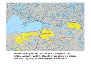
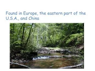
Some Statistics • In average around 500 000 ha burn per year throughout Southern Europe (P, E, F, I, EL). • Around 96% of the fires are human caused • > 50% of the fires start between 12:00 and 18:00 h • > 50% of the burnt area is burned in the same period • 50% of the fires have a delay of less than 15 minutes between fire detection and initial attack • The average final size of a fire after an initial attack delay of 15 minutes is ~ 8 ha
1’ Forest Fires and Remote Sensing Applications in Europe • Pre-fire (fuels mapping, risk mapping) • During fire (Detection, Monitoring, smoke management ) • Post-fire (Burnt Area Mapping, fire emissions)
Fire Detection and monitoring • AVHRR • ATSR • MODIS • Most of these fire products show a more or less large overestimation of fire detections (false alarms) in Southern Europe • They are only a sample due to reduced number of daily acquisitions
Fire Detection Requirements PROPERTY USER MSG REQUIREMENT Detection time 15 – 20 minutes 15 minutes Minimum detected fire 50 m2 (0.005 ha) 0.06 – 0.5 ha ? Geo-location accuracy 300 – 500 meters 0.5 pixels ? Alarm classification Intensity Fire Radiative Energy False alarm discrimination 5 – 15 % Diurnal Cycle+ saturation
Smoke Dispersion • MSG can be used for tracking smoke dispersion • MSG can be used to calibrate smoke dispersion models (SPREAD Project)
Burnt Area Mapping • Landsat TM (> 1ha) • IRS WiFS (> 50 ha) • IRS AWIFS (> 5 ha) • MSG…..?
Fire emissions • MSG useful for fire emission estimates? • Sugested use of Fire Radiative Energy as a surrogate of Burned Biomass (Flasse, Roberts)
Av burned area (m2) Bv biomass (g m-2) C burning efficiency (g g-1) Evemission coefficient for CO2 Regional estimates of CO2 emissions