Wisconsin
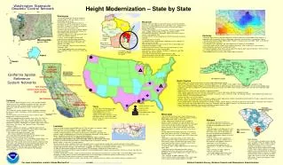
Existing CORS. Existing CORS. New CORS. Washington Statewide. Geodetic Control Network. Northern California Densification. Glenn County. Tuolumne County. San Joaquin Valley. Louisiana

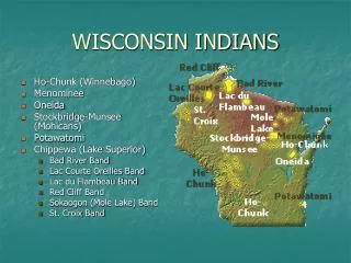
Wisconsin
E N D
Presentation Transcript
Existing CORS Existing CORS New CORS Washington Statewide Geodetic Control Network Northern California Densification Glenn County Tuolumne County San Joaquin Valley • Louisiana • Louisiana State University received $800K grant in FY02 to establish the Louisiana Spatial Reference Center (LSRC) to address the state’s geospatial needs. • The LSRC has since received $400K in FY03, $440K in FY04 and $440K in FY05. • Priorities include development of a network of high precision, continuously operating GPS reference stations and development of a Vertical Time-Dependent Positioning (VTDP) model to address the dynamic vertical control issues caused by subsidence. • In May 2005 NOAA officially released NOAA Technical Report 50: Rates of Vertical Displacement at Benchmarks in the Lower Mississippi Valley and the Northern Gulf Coast, an analysis of historical leveling observations used to compute rates of subsidence and help identify “reliable” survey marks for control purposes. Spatial Reference Centers Regional Leaders Lead Agencies Height Modernization States Interested States • GPS and leveling surveys conducted along major evacuation routes in coastal Louisiana to determine up-to-date elevations of the roadways • Evacuation route profiles were measured using a new technology, the Applanix POS LV blended navigation system. NGS is conducting a proof-of-concept study to develop techniques and specifications for applying this technology to the problem of route surveying. • In 2004 GPS observations performed on monumented VTDP control points throughout the southern parishes. • As the first state in the Gulf of Mexico region to implement the Height Modernization Program, Louisiana provides technical assistance and leadership to neighboring Gulf States. • Outreach and education activities include a Louisiana Elevations Workshop held in New Orleans in January 2005, a GIS Height Modernization Forum in Shreveport in October 2004, a Louisiana Height Modernization Summit and Regional Coordination Meeting in Baton Rouge in June 2004. • LSRC, NGS and NOS representatives involved in hurricane response efforts. • LSRC and NGS personnel present seminars and overviews to the surveying community, Federal, state, and local agencies and governments. Height Modernization – State by State • Washington • Washington Department of Natural Resources received $440K in FY04 and $440K in FY05 in Height Modernization grants. • Established the Spatial Reference Center of Washington (SRCW), a member-driven non-profit organization to improve the reliability of positioning information within Washington State. • Partnering with Pierce County to conduct a project with nearly 200 miles of leveling and related GPS Height Modernization observations. • Floodplain Mapping Partnership activity with other several state and local agencies. • Training - SRCW and NGS held two 2-dayLeveling Seminars and Workshops combining theory and actual field work examples of 1st and 2nd order leveling techniques in in Renton and Spokane (June 2005). • SRCW sponsored a Real-Time GPS conference (September 2005). • Three Height Modernization User Forums were held in September 2004 in Vancouver, Seattle, and Spokane. • Wisconsin • Between 1998 and 2005, the State of Wisconsin invested over $6.5M to the Wisconsin Height Modernization Plan (WI-HMP), using a combination of state funds and federal planning and research funds from the Federal Highway Administration. • The Wisconsin Department of Transportation (WisDOT) received NOAA grants of $400K in FY03, $2.66M in FY04, and $2.66M in FY05. • Developed WI-HMP phases (geographic regions of the state) to ensure seamless and compatible data. • Leveling and GPS surveys conducted with WisDOT personnel and private contractors • Five of eight phases complete. • No field observations were possible in 2005 due to severe reductions in state staffing of the WI-HMP. • Monumentation continued in the first half of Phase 7 during 2005 and is scheduled for completion in 2006. • Field surveying in the Phase 6 area, both GPS and leveling, are now scheduled beginning in the early spring of 2006. • Mark recovery -Phase 8 ongoing; completion scheduled for early 2006. • Education and outreach program. • Users Forum held in Wisconsin Rapids, November 2003. • Wisconsin continues to be very active in sharing technology and experience with other interested states. Phase 6 marksetting completed in 2004. • Kentucky • Morehead State University received $440K grant in FY05 to implement a Height Modernization Program, in cooperation with the Kentucky Division of Geographic Information and the Kentucky Transportation Cabinet. • The goal of the Kentucky Height Modernization Program is to bring accurate and reliable heights to any location in the Commonwealth at any time. • The realization of this goal begins with the establishment of a Kentucky CORS Network. • The existing vertical control network will be studied in pilot project areas to determine the best method to transfer orthometric elevations to the HARN and CORS. • The improved geodetic control will be used to improve the regional geoid model and provide a reference frame for surveying and remote sensing measurements. • Height Modernization User Forum held (October 2004) in Somerset. Phase 5 GPS submitted to NGS; leveling to NGS by late 2005. Survey data submitted and loaded for Phases 1,2,3 and 4. Alaska Hawaii California Spatial Reference System Networks • North Carolina • North Carolina one of the two original states to receive Height Modernization funding. • The North Carolina Geodetic Survey (NCGS) received $1.0M grant in FY01, $890K in FY02, $890K in FY03, $890K in FY04 and $890K in FY05. • North Carolina Floodplain Mapping Program uses Height Modernization to gather elevation data to evaluate and improve the accuracy of the floodplain maps. • Cooperative effort with the Department of Homeland Security to use the results of the HMP surveys and the CORS to cover the State with modernized Flood Insurance Maps. • Approximately 40 CORS in the state, with plans to expand the network. • North Carolina established Real-Time Kinematic CORS Networks in several urban areas, with plans to expand coverage. • Several Height Modernization projects have been completed: Buncombe, Gaston, Henderson, Wake, and Watauga Counties. Height Modernization projects are currently underway in Ashe and Haywood Counties. • Leveling connections to CORS are ongoing. • Outreach, education, technology transfer, and software support for Height Modernization activities conducted by NOAA and NCGS through a cooperative agreement with North Carolina Agricultural and Technical State University (NCA&T). • Current NCA&T projects include the development of a Windows interface software program for ADJUST which will be made available to the public when complete. • NCA&T hosted twp 2-day Height Modernization workshops (September 2004 and 2005) for beginners and advanced users of GPS. • NCA&T developing a GeoSpatial Curriculum and anticipates a program offered in 2006. • In FY04, User Forums were conducted in Raleigh and Charlotte. Yolo County Contra Costa County South SF Bay San Simeon Resurvey • California • The California Spatial Reference Center (CSRC) provides geodetic services to ensure the availability of accurate, consistent, and timely • spatial referencing data, including coordinates and data from the Continuously Operating Reference Stations (CORS) stations in California. • The CSRC also monitors temporal changes in geodetic coordinates due to tectonic motion, earthquakes, volcanic deformation and land subsidence. • In FY01 California was one of the first states to receive Height Modernization funding through NOAA. • $1.0M was appropriated for the creation of the CSRC. The CSRC has since received $1.0M in FY02, FY03, and FY04 and $0.5M in FY05. • Several Height Modernization projects (GPS and leveling) have been completed in California, including the San Joaquin Valley Project, Contra Costa County, Yolo County, and Tuolumne County. Other projects underway include: • - Northern California Densification, a cooperative project with the California Department of Transportation (reobservation of 800 to 900 passive geodetic stations in Northern California), • - Yolo County (new project of 65 stations), and • - Glenn County (subsidence monitoring project). • The CSRC determined NAVD88 heights on 20 California CORS through conventional leveling and GPS surveys. • In Orange County, Riverside County (Metropolitan Water District), San Diego County, and Parkfieldusers can access a “real-time” CORS network (one to two-second latency) for their dynamic positioning needs. • The CSRC is also developing the Pocket GPS Manager (PGM), a set of platform-independent software designed for handheld PDAs to replace hand-written field logs used in GPS campaign surveys. • CSRC providing assistance to the UNAVCO Plate Boundary Observatory project. CGPS Only CORS Leveling • Texas • In FY05Texas A&M University-Corpus Christi received a grant of $665K for Height Modernization in Texas. • Height Modernization has been underway in the Harris-Galveston Coastal Subsidence District since the mid-1980’s when GPS was first used to measure and monitor subsidence. • Mississippi • The University of Southern Mississippi (USM) received a $400K grant in FY03, $440K in FY04, and $530K in FY05 for Height Modernization efforts in Mississippi. • Height modernization initiative to install a network of reference stations throughout the state and water level stations along the coast through USM's Gulf Coast Geospatial Center at the Gulf Coast Research Laboratory (GCRL). • Higher accuracy in data on land elevations and to relate those measurements to changes in sea level in the Gulf of Mexico. • In May 2005 NOAA and USM inaugurated a new tide and water level station at the GCRL in Ocean Springs -- the first on the Gulf Coast that is co-located with a GPS system based CORS. • Applications supported by linking a CORS station with a long-term water level station include: long-term subsidence measurement, relative sea level trends assessment, storm surge monitoring from hurricanes and other coastal storms, shoreline change and habitat restoration. • In December 2003, a Height Modernization User Forum was held in Biloxi. • Technology transfer and cooperative efforts among neighboring Gulf states with similar issues will expedite the development of the Height Modernization Program in the Gulf of Mexico region. • Plans underway for adding additional CORS. • Future activities include a large project in the Coastal region of Mississippi to further develop support for the HMP. • Alabama • The Alabama Department of Revenue received a $1.77M grant in FY04 and $1.77M in FY05 for Height Modernization efforts in Alabama. • GPS observations, technology transfer, and cooperative efforts among neighboring states with similar issues such as Mississippi and Louisiana will expedite the development of the Height Modernization Program in the Gulf of Mexico region. • Through a voluntary effort supported by private and local agencies, Alabama has re-observed their basic geodetic network as a starting point for the HMP program. • This massive effort involved over 120 geodetic points in Alabama and neighboring states. • Plans underway to establish additional CORS as a part of the HMP. • Three Height Modernization Forums have been held (two in 2005 and one in 2003). • South Carolina • The South Carolina Geodetic Survey received grants of $400K in FY03 and $440K in FY04 for Height Modernization efforts in South Carolina. • Although the Geodetic Survey of South Carolina did not receive Congressional funding in FY05, South Carolina continues to use HMP guidelines and survey procedures to improve the National Spatial Reference System in a mapping partnership with counties throughout the State. • Map shows counties (in blue) with completed HMP surveys. Surveys are underway in other counties (in red). For more information, contact Juliana Blackwell at htmod@noaa.gov or visit www.ngs.noaa.gov/heightmod/ National Geodetic Survey, National Oceanic and Atmospheric Administration