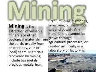
Revolutionizing Mining Operations with Pix4D: Drone Mapping Technology
Pix4D, a leading photogrammetry technology company, generates accurate 2D and 3D information solely from images. This innovative solution provides operational risk management, asset lifecycle management, construction support, and industrial inspection for mining companies. By utilizing drone mapping, Pix4D helps improve efficiency, safety, and decision-making in various mining operations worldwide.


Revolutionizing Mining Operations with Pix4D: Drone Mapping Technology
E N D
Presentation Transcript
About Pix4D 8000+active users per month 100’000 acres of reality modeled 200+countries & territories SAN FRANCISCO U.S.A. LAUSANNE SWITZERLAND BERLIN GERMANY SHANGHAI CHINA MADRID SPAIN
“44,354,881,622 Cameras in the world by 2022, at minimum” LDV Capital Pix4D generates accurate 2D and 3D information purely from images with cutting-edge photogrammetry technology
What is it about ? {} Information from images for better and faster decisions
What is photogrammetry ? “Evolution favours eyes that perceive the world in 3D” Christoph Strecha Founder and CEO of Pix4D
Integrated image based solution Mobile • Data capture & review • Field operations • Flight management Cloud • Processing & digitization • Annotation & collaboration • Data storage & management Desktop • Processing & digitization • Quality control over data & projects • Ubiquitous
Behind Pix4D technology • Accurate & robust, images from any sensor, geometrically and radiometrically • A tool for professionals, with innovative instructional approach, and unique tools for quality control • Deep scientific knowledge of photogrammetry and how to mine meaning from images
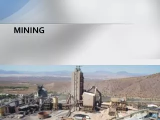
Mining Operational risk and compliance management •Aerial surveying & 3D mapping • Drill & blast planning & topography engineering • Asset & infrastructure inspections • Geotechnical inspection & structure characterization Supply chain management • Stockpile management •Production inventory • Delivery forecasting Asset lifecycle management • Base mapping for site designing • Site surveys during construction •As built versus as designed comparison
Construction Earthworks management • Topographic surveys • Stockpile measurements & cut/fill calculations • Visual records of excavations As-built monitoring •Regular visual status reports of the as-built situation •Site progress tracking against BIM project schedule and design •Online project documentation for visualisation, measurement, annotation and sharing Inspection •Building & infrastructure inspections •Online results with intuitive viewing/analysis tools
Industrial inspection Digital database of industrial assets • All data is visually accessible in accurate 3D models • Connect to ERPs and automation software for integrated workflows Frequent inspetions of assets •Roads •Tunnels •Turbines• Refineries •Cell towers • Dams• Airports
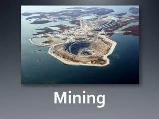
How does drone mapping create value for mining operations?
Pix4D is trusted by... Many of the leading mining companies have already embraced Pix4D technology.
Five common uses of drone imagery in mining 1 2 3 4 5 Transform Field Operations Traffic Management Support Infrastructure Inspection & Planning Blast Planning Asset Management and Surveillance Monitor Progress Enable easy data sharing Produce Accurate and Timely Volumetric Measurements Environmental Monitoring
Traffic management Optimize: • Fuel consumption • Haul roads design • Stockpile locations Generate updated haul road plans using interactive 3D polyline tool
Support infrastructure inspection & planning Aerial data. Close to real time tracking. Access hard to reach areas
Blast planning and monitoring Lower cost. Safer work conditions. Higher accuracy
Enable easy data sharing Data products can be: • Shared at anytime and anywhere • Used in other software • Annotated and commented Empower on-site supervisors and management team with real time data
Produce accurate and timely volumetric measurements Problem: • Accurate volume measurement and inventory management are two of the biggest challenges in the mining industry Advantages: • Flexibility to collect data quickly • Faster and more efficient operations • Drones are about half the cost compare to traditional ground-based volumetrics Benefits: • Higher profitability from more accurate volume measurements • Improved safety and reduced risk on jobsites
Stockpile inventory example Photogrammetric survey with a fine ground sampling distance can achieve average error estimation from 2 to 5%
Environmental monitoring Monitor erosion and contamination for active and abandoned mining sites
Use case:Quarry survey in Switzerland Orthomosaic 3D model of the mine
Looking ahead… Enterprise integration
Enterprise integration unlocks higher value • Fully integrate drone and image-based end-to-end solutions into the existing enterprise systems • Achieve higher business impact in critical operations • Seamlessly integrated into the existing ERP, field operations and data-driven business decisions
Thank you www.pix4d.com