Download
1 / 34
340 likes | 484 Vues
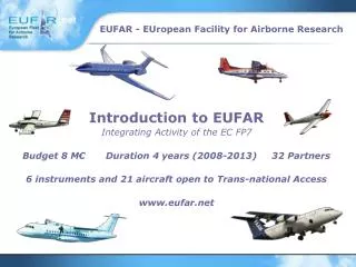
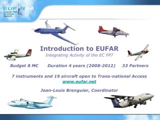
Introduction to EUFAR Integrating Activity of the EC FP7 Budget 8 M € Duration 4 years (2008-2012) 33 Partners 7 instruments and 19 aircraft open to Trans-national Access www.eufar.net Jean-Louis Brenguier, Coordinator. EU-DG Research Work Program for Research Infrastructures.

E N D
Introduction to EUFAR Integrating Activity of the EC FP7 Budget 8 M€ Duration 4 years (2008-2012) 33 Partners 7 instruments and 19 aircraft open to Trans-national Access www.eufar.net Jean-Louis Brenguier, Coordinator
EU-DG Research Work Program for Research Infrastructures EUFAR is an Integrating Activity of the 7th EU Framework Program for Research Infrastructures Objectives • To provide scientists with access at equal terms to the most complete range of research infrastructures To develop trans-national access to national infrastructures Reduce redundancy and fill the gaps • Improve the service by strengthening expertise through exchange of knowledge, development of standards and protocols, constitution of data bases, and joint instrumental research activities • Promote the use of research infrastructures, especially for young scientists from countries where such infrastructures are lacking
European Support to Airborne Research Infrastructure PREPARATORY PHASE STUDY COPAL-FP7 - 1 M€ WP2 : Legal Structure WP3 : Aircraft selection and Costs WP4 : Designation of the operators WP5 : Network for Instrumentation WP6 : Scientific Governance INTEGRATED INFRASTRUCTURE INITIATIVE EUFAR-FP6 25 aircraft, 230 users, 420 flight hours Networking (0,9 M€) , TA (2,9 M€), JRA (0,9 M €), MGT (0,3 M€) TOTAL : 5 M€ INTEGRATED INFRASTRUCTURE INITIATIVE EUFAR-FP7 25 aircraft or instruments, 205 users, 520 flight hours Networking (2 M€) , TA (3 M€), JRA (2,3 M €), MGT (0,7 M€) TOTAL : 8 M€
The existing European Fleet Which aircraft model ? Pay-load / Ceiling
The existing European Fleet Which aircraft model ? Pay-load / Endurance
The existing European Fleet Which aircraft model ? Cost (flight hour, excluding depreciation, EU cost model) DE FR UK NL ES FI IT
The EUFAR-FP7 Consortium • Météo-France (FR) • MetOffice (UK) • DLR (DE) • NLR (NL) • Enviscope (DE) • INSU-CNRS (FR) • NERC-ARSF (UK) • INTA (ES) • GTK (FI) • FUB (DE) • FZK (DE) • AWI (DE) • CNR (IT) • UNIMAN (UK) • VITO (BE) • FZJ (DE) • JOGU (DE) • BADC (UK) • USZ (HU) • UCAM (UK) • UHEI (DE) • UWAR (PL) • COSINE (NL) • IRSN (FR) • COMAT (FR) • VKI (BE) • UZH (CH) • WU (NL) • ISBE (CZ) • TAU (IL) • UEDIN (UK) • GFZ (DE) • PML (UK)
The EUFAR-FP7 Activities • Management (0,6 M€) • Networking Activities (2 M€) • N1. Scientific Advisory Committee (CNRM-FR) • N2. TA coordination (MetOffice-UK) • N3. Future of the Fleet (Jülich-DE) • N4. Expert Working Groups (U Mainz-DE) • N5. Education and Training (VITO-BE) • N6. Standards and Protocols (DLR-DE) • N7. Airborne Data Base (BADC-UK) • N8. e-Communication (CNRM-FR) • N9. Sustainable Structure (CNRM-FR) • Trans-National Activities (TA) (3 M€) • Joint Research Activities (JRA) (2,4 M€) • JRA1 Evaluation of hygrometers (Jülich-DE) • JRA2 Quality layers for hyperspectral imaging (VITO-BE) • JRA3 Optical cloud drop spectrometer (IRSN-FR)
The EUFAR-FP7 Activities NETWORKING To provide the EUFAR Consortium with independent strategic recommendations on EUFAR objectives and long term developments N1-SAC The Scientific Advisory Committee (SAC) will • Provide advice to EUFAR on the needs of the broad scientific user community for airborne measurements • Provide advice and guidance about the strategic directions that EUFAR is taking • Assist the EUFAR management team in prioritizing activities, and identifying redundant and missing activities to meet the strategic goals Chair: Prof. Bjorn Stevens, head Climate Research at MPI Hamburg - Sandro Fuzzi (CNR Italy) - Andreas Kääb (Univ Oslo, Norway) - Jose Moreno (Univ Valencia, Spain) - Kevin Noone (Univ Stockholm, Sweden) - Michael Petrakis (Nat Observatory Athens, Greece) - Ulrike Seibt (Univ Paris VI, France) - Iwona Stachlewska (Univ Warsaw, Poland) - Jeff Stith (NCAR, Boulder Colorado)
The EUFAR-FP7 Activities NETWORKING To provide the EUFAR Consortium with independent strategic recommendations on EUFAR objectives and long term developments N1-SAC N2-TAC To co-ordinate EUFAR Trans-national Access activities In FP6, 74 proposals have been submitted to EUFAR, 46 user groups (corresponding to 232 users) were selected by the User Group Selection Panel. A total amount of 2 361 998 € (+ T&S) was allocated to 44 projects, for a total of 404 flight hours. 2 projects were cancelled due to logistical reasons. In FP7, more than 2.9 M€ is provisioned for access costs. To improve the scientific impact of Trans-national Access, new evaluation criteria will be defined. The new strategy will be to reduce the number of field experiments, increase the amount of access units allocated to the selected ones and, when possible, allow clustering with existing cutting-edge experiments. To avoid double funding, the EUFAR contribution in a cluster will be distinct from the other contributions, and separately measurable.
The EUFAR-FP7 Activities NETWORKING To provide the EUFAR Consortium with independent strategic recommendations on EUFAR objectives and long term developments N1-SAC N2-TAC To co-ordinate EUFAR Trans-national Access activities To evaluate the performance of the existing fleet and identify gaps. To provide solutions for the long-term development of the fleet. N3-FF In FP6, the N3-FF working Group concluded that the main limitation of the European fleet was the endurance (5 flight hours max). HALO (Gulfstream-V), operated by DLR, will soon provide 3 tons of payload and more than 12 FH of endurance for research in the upper troposphere / lower stratosphere. The priority for a new infrastructure was thus given to a heavy payload and long endurance aircraft for research in the middle and lower troposphere. The proposal was selected in the ESFRI roadmap and the COPAL Preparatory Phase project funded by the European Commission. In FP7, the priority will be to develop operational solutions for providing access to a stratospheric aircraft in Europe.
In FP6, 10 expert workshops have been organized on the following scientific fields: Certification and Operational Issues, Certification and Operational Design of New Instruments and Installations, maging Remote Sensing, Active Remote Sensing, Gas-Phase Chemistry, Radiation, Stratospheric Measurements Aerosols / Cloud Microphysics Turbulence Thermodynamics. The EUFAR-FP7 Activities NETWORKING To provide the EUFAR Consortium with independent strategic recommendations on EUFAR objectives and long term developments N1-SAC N2-TAC To co-ordinate EUFAR Trans-national Access activities To evaluate the performance of the existing fleet and identify gaps. To provide solutions for the long-term development of the fleet. N3-FF To improve the expertise among the specialized scientists in the field of airborne research. To facilitate the transfer of expert knowledge to users, operators, and funding agencies. To compile the knowledge in a high-level handbook on “Airborne Physical Measurements – Methods and Instruments”. N4-EWG
The EUFAR-FP7 Activities NETWORKING In FP7, new EWGs have been constituted, especially in the field of hyperspectral observation of the surface. International experts will contribute to the handbook on airborne measurements. Support to airborne measurements: Calibration/Validation (Tim Malthus) Certification/Operation (Stefan Kommallein) Instrument Integration (Phil Brown) Imaging sensors (Koen Meuleman) Processing (Daniel Schlaepfer) Unmanned Aerial Systems (Jochen Reuder) Polar Research (J. E. Kristjannson) Stratospheric Research (Cornelius Schiller) Handbook on Airborne Measurements – Methods and Instruments 1. Introduction (Wendisch, Brenguier) 2. Basic Thermodynamic and Dynamic Parameters (Lenschow, M. Esposito) 3. Gas Phase Measurements (McQuaid, Schlager) 4. Particle Sampling Issues (Krämer, Twohy) 5. In Situ Measurements of Aerosol Particles (Petzold, Coe) 6. In Situ Characterization of Clouds and PrecipitationParticles (Brenguier, Baumgardner) 7. Radiation Measurements (Wendisch, Pilewskie) 8. Hyperspectral Remote Sensing (Eyal Ben-Dor, Müller) 9. Active Remote Sensing (Pelon, Vali) Specific measurement fields: Thermodynamics (Martin Zoeger) Turbulence (Marco Esposito) Active Remote Sensing (Jaques Pelon) Radiation (Jonathan Taylor) Gas-Phase Chemistry (Jim McQuaid) Cloud Microphysics (Manfred Wendisch) Aerosols (Paola Formenti) Vegetation applications (Michael Schaepman) Water applications (Steve Groom) Soil applications (Eyal Ben-Dor)
The EUFAR-FP7 Activities NETWORKING To provide the EUFAR Consortium with independent strategic recommendations on EUFAR objectives and long term developments N1-SAC In FP6, 2 Training Courses on Airborne Research Methodology have been organized N2-TAC To co-ordinate EUFAR Trans-national Access activities Boundary layer Iasi, Roumania 10-20/07/2007 40 candidates, 27 selected SAFIRE ATR-42 To evaluate the performance of the existing fleet and identify gaps. To provide solutions for the long-term development of the fleet. N3-FF To improve the expertise among the specialized scientists in the field of airborne research. To facilitate the transfer of expert knowledge to users, operators, and funding agencies. To compile the knowledge in a high-level handbook on “Airborne Physical Measurements – Methods and Instruments”. N4-EWG Aerosol/cloud Utrecht, The Netherlands 17–25/04/2008 53 candidates, 20 selected. FAAM BAe-146 To attract new early-stage researchers to airborne research. To educate and train (theoretically and practically) new early-stage researchers in airborne atmospheric research and airborne hyperspectral remote sensing. To train trainers (e.g. university lecturers) in airborne atmospheric research and airborne hyperspectral remote sensing. N5-ET
The EUFAR-FP7 Activities NETWORKING N6-SP To develop common protocols for airborne hyperspectral remote sensing To support users and operators with recommendations on best practice and state-of-the-art software for airborne data pre-processing To develop and publish open source software toolboxes for higher level data products, and data analysis To define standards for data transfer in real-time To provide a centralised gateway to data acquired onboard aircraft (both in situ and remote sensed) along with supporting metadata, collected by the aircraft of the EUFAR Fleet. N7-DB N8-EC To elaborate solutions on Internet for the dissemination of the EUFAR information, for facilitating the electronic submission of trans-national access proposals, and their evaluation by the EUFAR User Group Selection Panel, and for providing all EUFAR working groups with a secured domain for collaborative activities.
The EUFAR-FP7 Activities NETWORKING N6-SP To develop common protocols for airborne hyperspectral remote sensing To support users and operators with recommendations on best practice and state-of-the-art software for airborne data pre-processing To develop and publish open source software toolboxes for higher level data products, and data analysis To define standards for data transfer in real-time To provide a centralised gateway to data acquired onboard aircraft (both in situ and remote sensed) along with supporting metadata, collected by the aircraft of the EUFAR Fleet. N7-DB N8-EC To elaborate solutions on Internet for the dissemination of the EUFAR information, for facilitating the electronic submission of trans-national access proposals, and their evaluation by the EUFAR User Group Selection Panel, and for providing all EUFAR working groups with a secured domain for collaborative activities. To develop a framework for a sustainable EUFAR structure, by - evaluating possible models of legal structure for a joint management of the network, - promoting the extension of trans-national access beyond Community support - compiling information on the activities of the fleet and their scientific impact to support strategic decisions - developing coordination with the COPAL Preparatory Phase study and the international community of research aircraft operators N9-SST
The EUFAR-FP7 Activities NETWORKING ISPRS-WG I/1 - Standardization of Airborne Platform Interface 1.Chair : Andrew Roberts / USA / NASA / andrew.c.roberts@nasa.gov 2.Co-Chair: Jean-Louis Brenguier / France / Meteo / jlb@meteo.fr Secretary: James Huning / USA / SAIC / jimhuning@gmail.com 1) Coordinate a forum for discussion between the international airborne science communities 2) Develop airborne sensor interface format standards in coordination with other working groups to promote maximum sensor portability between aircrafts increasing science yield from the sensors. 3) Develop airborne satellite data relay systems use for science research programs between aircraft and ground in coordination with other working groups 4) Develop an airborne science literature search to identify peer reviewed published papers and citations and make a available in a data base. 5) Support the regulatory agencies in supporting airborne science sensor certification and approval requirements for Lidar, Dropsonde and electromagnetic spectrum emissions. 6) Maintain an inventory of the international airborne science capabilities and report annually. 7) Develop a forum to discuss transnational access system(s) for airborne users. 8) Support the use of UAS vehicle activity for science observations in civil and restricted airspace on an international basis and engage the ICAO. 9) Promote the education and outreach on an international basis of airborne based science activity. 10) Develop a forum to coordinate expert international workshops in categories of airborne science sensors for both Remote Sensing and insitu systems.
The EUFAR-FP7 ActivitiesJOINT RESEARCH Development and characterisation of novel or improved compact airborne hygrometers for different airborne applications within EUFAR; including investigation of the sampling characteristics of different gas/ice inlets and the development of an improved ultra fast thermometer for near- and in-cloud measurements JRA1 - To develop quality indicators and quality layers for airborne hyperspectral imagery - To develop quality indicators and quality layers for higher level data products - To implement and to test quality layers in existing processing chains of airborne hyperspectral imagery - To develop higher performing water and soil algorithms as demonstrators for end-to-end processing chains with harmonized quality measures JRA2 To design and construct an airborne drop spectrometer based on a new principle, that provides absolute measurements of the drop size and a large sampling section (laser interferometer). JRA3
The EUFAR-FP7 ActivitiesJOINT RESEARCH In FP6, a consortium of European laboratories developed a unique system for measurement of aerosol physical and optical properties in two portable pods
European Support to Airborne Research Infrastructure PREPARATORY PHASE STUDY COPAL-FP7 - 1 M€ WP2 : Legal Structure WP3 : Aircraft selection and Costs WP4 : Designation of the operators WP5 : Network for Instrumentation WP6 : Scientific Governance INTEGRATED INFRASTRUCTURE INITIATIVE EUFAR-FP6 25 aircraft, 230 users, 420 flight hours Networking (0,9 M€) , TA (2,9 M€), JRA (0,9 M €), MGT (0,3 M€) TOTAL : 5 M€ INTEGRATED INFRASTRUCTURE INITIATIVE EUFAR-FP7 25 aircraft or instruments, 205 users, 520 flight hours Networking (2 M€) , TA (3 M€), JRA (2,3 M €), MGT (0,7 M€) TOTAL : 8 M€
COPAL Preparatory Phase Project COPAL aims at providing the European scientific community in the field of environmental and Geo-sciences, with a unique research aircraft platform, capable of reaching and operating in any remote area in the world. It will offer an unprecedented opportunity to countries that are not yet operating research aircraft to develop expertise in airborne measurements and participate to international multidisciplinary experiments. With a payload of 10 tons or more and an endurance of 10 hours, a heavy-payload, long endurance (HPLE) aircraft will more than double the capabilities offered to European scientists.
COPAL Feasibility Study for procurement, refurbishing, modification and instrumentation of a heavy-payload (10 Tons) and long-endurance (10 hours) aircraft for research in the lower and middle troposphere. • Propose a legal structure for joint management of the COPAL aircraft • Quantify the costs for procurement, refurbishing, modification for research, certification, and operation of the COPAL aircraft • Designate the aircraft operator and scientific operator of the COPAL aircraft • Constitute a network of academic laboratories and SME for development, maintenance and operation of research instrumentation • Define the governance model for access proposals evaluation and allocation of flight time
The endurance is the main limitation of the European fleet With and endurance of 5.5 hours, the Bae-146 (UK) is limited to a few hours of scientific activities in remote areas such as the ocean, polar regions or underdeveloped countries (Sahel))
The Origin of COPAL As part of the EUFAR FP6 activity on the Future of the Fleet, a survey of the scientific demand was completed by the European Science Foundation in 2006 : Among the 6 options that were suggested by ESF, the majority of the 203 responses supported as the first priority for the development of the fleet : “A European medium-altitude / heavy -payload / long-endurance research aircraft, for atmosphere / low-troposphere campaigns (in multi-disciplinary / multi-national settings): a turboprop aircraft (Lockheed C130, Airbus A400M)” A proposal was thus submitted to ESFRI for the construction of a heavy-payload and long endurance research aircraft for tropospheric research, indicating that two options had to be considered : a Lockheed C130 and an Airbus A400M After selection of the proposal by ESFRI in October 2006, a proposal was submitted to the Commission at the first FP7 call for Infrastructures in May 2007 for the construction of a heavy-payload and long endurance research aircraft for tropospheric research, indicating that three options had to be considered : a Lockheed C130 and an Airbus A400M, and a CASA-295 The proposal was selected by the EU Commission and started on 1st November 2007
The concept of Community Airborne Laboratory (NCAR/C130) During international experiments, 15 to 20 research laboratories contribute to the multidisciplinary instrumental setup (dynamics, chemistry, aerosol, radiation, remote sensing) that is necessary to address crucial issues such as climate and general circulation.
The concept of Distributed Infrastructure Because of its limitations in term of available space and weight, a research aircraft is generally a tightly integrated measurement platform, that shall be managed by a single operator. When space and weight are no longer a constraint, the instrumented aircraft can be managed following a different approach: One operator shall still be designated to act as the aircraft responsible for aviation authorities and registration. He is in charge of the operations and of the maintenance of a basic measurement system, that includes standard atmospheric parameters, positioning, and time. He also manages the central acquisition system and defines standards for integration and certification of innovative instruments developed by other laboratories.
The concept of Community Airborne Laboratory This concept of distributed infrastructure is particularly interesting at the present stage of integration of European Research Infrastructures. It allows all countries in Europe to contribute to the overall system, at their possible level of investment . It allows to mobilize the best teams in Europe over the very broad range of expertise that is required for today research on the Earth System . It will have a strong integrating impact on the « measurement and instrumentation » scientific community, because field campaigns on an aircraft always create durable links between groups of different origin working towards a common objective
The concept of Community Airborne Laboratory Benefits : With an endurance of 10 to 12 hours, the COPAL aircraft will be able to reach any area of the globe, and still perform a significant amount of scientific time on site. With a scientific payload of 6 T, a comprehensive multidisciplinary set of instruments will be installed on the COPAL aircraft, without severe constraints of miniaturization A turboprop, limited to an altitude of 9 km, is two times cheaper than a jet, with a lower payload and similar endurance, but a much higher ceiling of 15 km. Contraints : For optimal operation (600 hours/year), the COPAL aircraft shall be open to a broad community of scientific users, like the NCAR in the US, which operates the C130 turboprop and G-V jet.
Estimated COPAL Construction Costs(ref NCAR-C130 2006) The procurement, refurbishing, modifications for research and civil certification amount to 30 M$ for a C130K with a potential of 15000 hours). Construction costs : The fixed costs, including indirect costs (60% of direct costs), insurance, training, navigation service, maintenance and provision for inspection, plus salaries and overheads (53.4%) for 3 pilots, 2 navigators, 2 flight engineers et 3 mechanists, amount to 3,5 M$. Operation Fixed costs : The variable costs, on the basis of 600 flight hours per year, including fuel, spare parts, maintenance for engines, propellers and APU, amount to 3,6 M$, i.e. $6000 per flight hours. Operation Variable costs :
Financing Scheme for Construction & Operation Construction costs : 30 M$ The European Commission develops new tools for the financing of research infrastructure of pan-European interest. The European Investment Bank is ready to support the COPAL project with a long term (25 years) loan of 30 M€ over 25 ans. Reimbursement of the debt: 2 M€/ year. Operation costs : 3,5 M$/year Cumulating operation costs and reimbursement of the debt, the COPAL annual budget will be less than 5 M€. The variable additional costs ($6000/hour) is comparable to the one of the existing large pay-load EUFAR aircraft UK-BAe146 or FR-ATR42
Long Term Commitments for COPAL Participation in COPAL is a strategic decision for countries, which have not yet invested in airborne research infrastructures An investment of 5 M€ is just sufficient for procurement, modification and instrumentation of a medium size tropospheric aircraft (Merlin-IV), with less than 1 ton of payload and 3 hours of endurance It is difficult to develop rapidly all fields of expertise necessary to operate a research airborne infrastructure (dynamics, radiaiton, chemistry, microphysics,…) At the national level, the facility will therefore be focused to address some specific fields, for a limited user community. The aircraft will therefore be used well below its optimum potential (600 flight hours /year). An initial budget of 5 M€ is difficult to obtain from research funding institutions
SUMMARY There are no long endurance and heavy payload instrumented aircraft in Europe for tropospheric research, while 7 such aircraft (C130s and P3s) are currently available to the US scientific community COPAL aims at providing the European users community with the same capabilities as in the US Year 1 : - Examine possible legal structure models - Select aircraft models that fulfil the specifications for quantification of costs - Define criteria to select the aircraft and data management operators - Build the network of instrument providers - Define the scientific governance model Year 2 : - Select the legal structure models - Select aircraft models that fulfil the specifications for quantification of costs - Start the selection of the aircraft and data management operators - Build the network of instrument providers - Finalize the scientific governance model Year 3&4 : - Towards the signature of long term commitments