Download
1 / 29
290 likes | 394 Vues
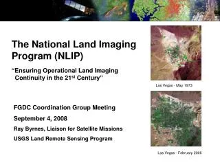
The National Land Imaging Program (NLIP) “Ensuring Operational Land Imaging Continuity in the 21 st Century”. Las Vegas - May 1973. FGDC Coordination Group Meeting September 4, 2008 Ray Byrnes, Liaison for Satellite Missions USGS Land Remote Sensing Program. Las Vegas - February 2006.

E N D
The National Land Imaging Program (NLIP)“Ensuring Operational Land Imaging Continuity in the 21st Century” Las Vegas - May 1973 FGDC Coordination Group Meeting September 4, 2008 Ray Byrnes, Liaison for Satellite Missions USGS Land Remote Sensing Program Las Vegas - February 2006
National Land Imaging Program • In December 2005, the President’s Science Advisor stated: “It remains the goal of the U.S.Government to transition the Landsat program from a series of independently planned missions to a sustained operational program…” • Throughout 2006, an OSTP-appointed interagency working group developed a plan, subsequently released by the White House in August 2007 See interagency working group report at http://ostp.gov/cs/nstcunder “Documents and Reports, 2007”
Why NLIP? • No long-term U.S. commitment for providing Landsat-like data. • Landsat has been a series of independent missions, funded in an ad hoc manner. • No U.S. agency has responsibility to meet U.S. operational requirements. • Advancement of land imaging technology and applications has been delayed or disrupted. • No U.S. commercial alternative. • Landsat commercialization has failed twice. • U.S. commercial and foreign systems can augment, but not replace Landsat. • No resources to sustain an operational land imaging program for the U.S. • No satellite funding or plans beyond Landsat Data Continuity Mission (LDCM)/Landsat 8.
Interagency Working Group Recommendations • The U.S. must commit to continue the collection of moderate-resolution land imagery. • The U.S. should establish and maintain a core operational capability to collect moderate-resolution land imagery through the procurement and launch of a series of U.S.-owned satellites (Landsat 9 and beyond). • The U.S. should establish the National Land Imaging Program, hosted and managed by the Department of the Interior, to meet U.S. civil land imaging needs.
Federal Government Responsibilities • National Land Imaging Program (NLIP) Mission: • To serve the Nation by acquiring and providing operational land imaging capabilities and applications to support U.S. economic, environmental, foreign policy, and security interests. • Federal Government to run an operational program to: • Coordinate a Federal Land Imaging Council composed of data users and other interested agencies and a (FACA) Land Imaging Advisory Committee; • Gather U.S. land imaging requirements (e.g. data needs); • Manage the acquisition of U.S. land imaging systems and data; • Coordinate acquisition and data distribution plans with U.S. industry, foreign governments, and foreign commercial firms; • Ensure timely data delivery to all users; • Permanently archive these data for future generations; • Develop new applications for Federal, State, local and tribal governments; and • Investigate and develop new remote sensing technology to meet land imaging requirements. • Above all else, ensure availability, access, and ease of use of land imaging data for the Nation.
NLIP Program Elements • Current (under USGS Land Remote Sensing Program) • Landsat 5 and 7 satellite and data operations. • Landsat Data Continuity Mission (LDCM)/Landsat 8 Development: Space and Ground Systems development, test, and satellite launch plus satellite and data operations • For current information on Landsat/LDCM see http://landsat.usgs.gov • Proposed (under authorized NLIP) • New NLIP Baseline: Stable program management, advanced technology and mission concept studies, new science applications, and outreach initiatives. • Future Land Imager Development: Satellite design and development, ground systems augmentation, and mission and data operations. NASA to provide technical and procurement support. • Expand existing International Cooperator partnerships to augment global collection of moderate-resolution land image data.
NLIP Ground Segment Plans • Multi-Mission USGS Operations: • Operate U.S. Government-owned satellites. • Receive data downlinks from domestic or international government or commercial partners. • Purchase global or regional satellite or aerial-platform data sets. • Consolidate Landsat data holdings of International Cooperators. • Ingest selected “purged” commercial or government data sets.
Landsat Data Policy Update • Updated Landsat data policy was approved in January 2008. • Located at: http://ldcm.usgs.gov/pdf/Landsat_Data_Policy.pdf • Policy Goals • Extend the principles of the Landsat 7 Data Policy established in Section 5615 of U.S. Code Title 15, Chapter 82 to Landsats 1-7, LDCM, and future U.S.-owned moderate resolution land-image data sets. • The goals ensure • Unenhanced data are available to all users at no more than the Cost of Fulfilling User Requests (COFUR). • Timely delivery of unenhanced data to civilian, national security, commercial, and foreign users. • U.S. retains ownership of all unenhanced data generated by the Landsat series of satellites. • Development of the commercial market for remote sensing data.
NLIP Governance The Federal Land Imaging Council will provide guidance and recommendations. A Committee of non-Federal land imagery users and suppliers will advise the National Program.
USGS Operations for Landsat 8 • Landsat 8: • USGS/EROS to operate satellite and ground system. • Ground command/control/data-reception network sites under study. • Seasonal, global data set collection. • Data management and distribution at USGS/EROS. • International Cooperators invited to participate; many showing interest in local data reception.
Landsat 8 Ground System Status Requirements development work is nearing completion. Completed Ground System Requirements Review on Sept 26-27, 2008. Completed the Science and Mission Requirements Document (SMRD) (Level 2) and the Ground System Requirements Document (Level 3). 6 of 8 ground system element requirements reviews completed (Level 4). Ground Network Element (GNE) SRR is scheduled for April 10th. Mission Operations Element (MOE) SRR to be held after NASA’s contract award. Ground System preliminary design activities have commenced. Ground System Preliminary Design Review (GSPDR) planned for Nov 2008. Element PDRs are scheduled and will complete before the GSPDR. Ground System Critical Design Review scheduled for April 2009. Provides the detailed ground system designs for system development.
U.S. Landsat Archive Overview(Scenes through May 31, 2008) • ETM+: Landsat 7 • 830,440 scenes • 771 TB RCC and L0Ra Data • Archive grows by 260 GB Daily • TM: Landsat 4 and Landsat 5 • 745,235 scenes • 373 TB of RCC and L0Ra Data • Archive Grows by 40 GB Daily • MSS: Landsat 1 through 5 • 652,174 scenes • 20 TB of Data
Current Ground Station ArchitectureLandsat 5 and 7 System View
Landsat Data Policy Details Non-discriminatory access to unenhanced Landsat data in Internet-accessible digital formats. Products compliant with recognized data standards, formats, and metadata descriptions. Open and unrestricted exchange of unenhanced Landsat data products globally in order to improve the availability and applications of the data. No restrictions on users of unenhanced Landsat data products obtained from the USGS. The USGS (with State Dept) establishes and supports agreements with foreign governments for the USGS to provide Landsat data via direct downlink or by other means to the international Landsat data user community.
Landsat 8 Data Distribution Synopsis Data distribution methods and formats may be revised during detailed system design
Landsat 8 Data Synopsis(cont.) Data distribution methods and formats may be revised during detailed system design Calibration Parameter and Bias Parameter Files will be available for download via the UPE.
Data Policy – The Bottom Line . . . “In accordance with OMB Circular A-130 and USGS Data Policy, the USGS provides selected satellite data products for retrieval via the Internet at no charge to users. Other products that may be ordered by users from the NSLRSDA are provided at no more than COFUR; this includes special arrangements made for users who require higher volumes of Landsat data products than can be provided by standard USGS distribution mechanisms.”
Storage and Archive Approach Archive Subsystem • Operational Archive Near-line Storage • L0Ra • Auxiliary Data • Algorithms • Documentation, • FRB, QB • Backup Archive Offline Storage (Media) • Mission (Raw) Data • L0Ra • Auxiliary Data • Algorithms • Documentation • FRB, QB Storage Subsystem Online Storage (Disk) • Internal Cache • Data Bases • Shared files • Online Cache • L1T, L0Rp • FRB,QB • GCP image chips Off-Site Archive Offline Storage (Media) • Disaster Recovery • Mission (Raw) Data • Auxiliary Data • Algorithms • Documentation • Software Backups • FRB, QB
Landsat Ground Station Historical Perspective • Over the past 35 years, over 50 ground stations have been configured to receive Landsat data. • Currently, there are 24 ground stations around the world that are configured to operationally receive Landsat data (19 currently active). • Beyond the current stations, there are 9 historical collection sites operated by 7 organizations that we believe could have a significant, unique historical archive.
Current Ground Station ArchitectureLandsat 5 and 7 Ground Segment Data Flow Production and Distribution Capture and Initial Processing Archiving Nearline (Silo) Archive (LAM) L1-5 MSS / TM, and L7 ETM+ (RCC and L0Ra for All Sensors) L7 Archive Processing (LPS) Product Generation (LPGS) RCC Data Capture (DCS) L7 – L1R/G/Gt/T Delivery to Customer CD, DVD, DLT, FTP L7 – L0Rp L1-5 Archive Processing (LACS) Product Generation (NLAPS) L1-5 Historical Archive Tapes (Completed) Offline (Shelf) Archive (MSS-X Data) IGS L5/7 Data Tapes L1-5 – L1G/Gt/P/T L7 – L1G/Gt/P/T
Landsat 5 Spacecraft Status • HIGH GAIN ANTENNA • 8/85 Transmitter A failure • GPS ANTENNA • Not Operational • MULTI-SPECTRAL SCANNER • 8/95 Band 4 failure • COMM & DATA HANDLING MODULE • Located back side of s/c OMNI ANTENNAS • ACS MODULE • 07/03 FHST#1 Degradation • Skew wheel tack anomaly 10/92 • 11/92 Earth Sensor 1 failure • 02/02 Earth Sensor 2 failure • Intermittent operations possible • SOLAR ARRAY DRIVE / PANELS • 01/05 Primary Solar Array Drive failure • Nominal Solar array panel degradation (12/04) • 11/05 Redundant Solar Array Drive Malfunction COARSE SUN SENSORS • PROPULSION MODULE • 3/84 Primary Thruster D failure • POWER MODULE • 05/04 Battery 1 failure / Removed from power circuits • 10/07 1 of 22 Cells fails on Battery #2 • WIDEBAND COMM. MODULE • 07/88 Ku-band TWTA Prime failure (OCP) • 07/92 Ku-band TWTA Redundant failure (OCP) • 08/87 X-band TWTA Prime failure (OCP) • 03/06 X-band TWTA Redundant Anomaly X-BAND ANTENNA • THEMATIC MAPPER • 10/94 Power Supply 1 stuck switch • 06/02 TM switched to bumper mode • DIRECT ACCESS S-BAND • 03/94 Side A FWD Power Sensor failure
Landsat 7 Spacecraft Status Electrical Power System Enhanced Thematic Mapper + Batteries: Solar array: •5/31/2003 SLC Failure Performance nominal • 5/14/2002 Circuit #14 Failure • 5/16/2005 Circuit # 1 Failure • 14 circuits remain operating • no impact to ops •4/01/2007 SAM -> Bumper mode Reaction Control System • 1/07/04 Fuel line #4 thermostat #1a failure. • 2/24/05 Fuel line #4 thermostat #1b failure • Thermostat 2a shows signs of failure • No impact to ops; extended plan in place Attitude Control System •05/05/2004 Gyro 3 Shut Off •Singe gyro control system in development Solid State Recorder • 11/15/1999 SSR PWA #23 Loss • 02/11/2001 SSR PWA #12 Loss • 12/07/2005 SSR PWA #02 Loss • 08/02/2006 SSR PWA #13 Loss • 03/29/2008 SSR PWA #22 Loss • Each PWA is 4% loss of launch capacity • Boards are likely recoverable X-band System S-band System Performance nominal Performance nominal
Landsat Global Archive Consolidation • The USGS is evaluating the process, cost and relative merit for consolidating a copy of the global archive of historical Landsat imagery. • There is growing concern about the state of historical archives, especially at inactive stations where we have no active contacts. • At this point, it is not known what the historical archive extent is. • There is an increasing interest from user community and USGS/NASA for more frequent surveys. • New tools such as Large Area Scene Selection Interface (LASSI) are being developed and made available to support large scale scene selections/data mining. • A consolidated archive would better support/facilitate global change analysis and assessment. • Determine the location, extent and condition of the historical Landsat archives around the world. • Generate a list of the instrument (RBV, MSS, TM, ETM+), data format and media type at each location. • Assess the equipment, software, logistics and level of effort necessary to acquire, ingest, process and archive the data. • Develop an estimated cost and schedule for project.