Download
1 / 16
160 likes | 278 Vues
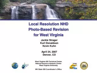
Jackie Strager Kurt Donaldson Kevin Kuhn April 24, 2007 Denver, CO. Local Resolution NHD Photo-Based Revision for West Virginia. West Virginia GIS Technical Center Natural Resource Analysis Center West Virginia University WV State GIS Coordinator’s Office. Introduction.

E N D
Jackie Strager Kurt Donaldson Kevin Kuhn April 24, 2007 Denver, CO Local Resolution NHD Photo-Based Revision for West Virginia West Virginia GIS Technical Center Natural Resource Analysis Center West Virginia University WV State GIS Coordinator’s Office
Introduction • Status of NHD in West Virginia • 33 sub-basins • Medium, high resolution NHD complete • Pilot projects underway for Local Resolution (LR) NHD creation
Local Resolution Pilot Project • Objectives • Meet with potential data users • Develop methods and standards • Assemble 1:4800 source data statewide • Assemble final LR-NHD for two pilot watersheds • Show benefits of LR-NHD for water resource applications
LR NHD Process Steps 1. Capture local hydro features 2. Data prep and revision 3. Pre-conflation steps 4. Conflation/QAQC steps 5. Ensure data stewardship
1. Capture local hydro features • Statewide aerial photography, 2003 • Contractor digitized hydro features from stereo pairs • Features with visible water only • Single-lined up to 50ft wide • Double-lined over 50ft wide • Lakes/ponds (min. 100ft wide) • Swamps/marshes • No name or code attributes • Correct flow direction • Edge-matched Local scale hydro features from SAMB photos 1:4800 streams 1:4800 polygons Sutton Lake, WV
1:4800 streams in source Additional 24K streams added 2. Data prep/revision • Systematically examine contractor’s hydro data for incomplete and missing features • Close double-lined streams • Add DLG codes Approximately 15-20% of streams were not adequately captured in source local datasets.
3-4. Pre-conflation, conflation For pilot watersheds: • USGS routines and NHD Geo-Conflation Toolkit (NHDGCT) • Pre-conflation • Conflation • QAQC • Load into national dataset
5. Long term maintenance • Involve interested cooperators • Encourage NHD stewardship process • Project communications • Show benefits of LR-NHD data Website: http://wvgis.wvu.edu/stateactivities/LRNHD.html
Benefits of LR NHD • Common data framework among NHD scales Sutton Lake 1:100,000 scale NHD Medium resolution 1:24,000 scale NHD High resolution 1:4800 scale streams Local resolution (approximated from SAMB stream data)
Benefits • Provides more highly detailed cartographic base 24K NHD streams Flatwoods WV LR NHD streams
Benefits • More accurate source data Source for 24K NHD: Big Chimney quad Last revised: 1976 Source for LR NHD: 2003 Aerial photo Revised LR NHD streams shown in yellow
Benefits • Quantifies recent changes in stream drainage 24K NHD streams LR NHD streams Valley fill area EPA: Up to 1,200 miles of streams lost in multi-state mountaintop-removal mining region Active mine permit, Lockwood quad
Benefits • Supports modeling of flow and hydrology at detailed local scale • More accurate stream mileage for stream mitigation projects, riparian buffers • Aids in floodplain mapping and emergency planning • More detailed dataset for resource management and planning, permitting, cumulative impact analysis
Benefits • Supports WV legislative requirement • WV Water Resources Protection Act • Quantify nature and extent of water resources
Future Considerations • Completion of LR NHD • Cartographic issues • Edge-matching • Encouraging partnerships • Data stewardship • Updates, maintenance