GIS and evaluating ecosystem services
180 likes | 200 Vues
This paper explores the economic outputs of sustainably managed ecosystems, such as marketed goods, recreational opportunities, and carbon sequestration. It highlights the importance of considering non-market values, such as wildlife stewardship, in land use planning. The study also identifies the need for better information on non-point source threats, groundwater recharge zones, and water delivery pricing. Using modeling techniques, it examines future land use scenarios and their impact on economic performance and watershed exports.

GIS and evaluating ecosystem services
E N D
Presentation Transcript
GIS and evaluating ecosystem services Jim Quinn Information Center for the Environment UCDavis jfquinn@ucdavis.edu
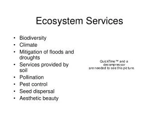
Economic Outputs of Sustainably Managed Ecosystems • Marketed goods • Food and fiber • Recreational opportunities • Water • Coming – Carbon Sequestration
Economic Outputs of Sustainably Managed Ecosystems • Costs avoided • Health impacts of air and water pollution • Fire • Flooding • Non-market values • Wildlife • Stewardship values, etc.
Big money • New York City • $4.5 billion in water treatment avoided • Millennium Assessment • Hundreds of billions of savings to cities in water supply and water quality alone • Just because large amounts of money are hard to measure doesn’t mean they should be ignored
Charge to land use agencies, planners, and NGOs • A land use plan that provides an effective portfolio of production and ecosystem values • Institutional framework so beneficiaries reimburse providers
What do we know pretty well? • Land use and land cover • Drinking water quality • Watershed management projects
Drinking Water Sources for Public Water Systems* in California
Where do we need better information? • Non-point-source threats • (e.g. nutrients and pathogens from septic systems) • Groundwater recharge zones • Water delivery and pricing
What can we model? • Future land use • Watershed exports • Economic performance of competing land use scenarios (as in the Blueprint process)?
Future Land UseSJ Valley Growth Scenarios (UPlan) • Many Different types: • Compact • Species Protection • Ag. Protection • Urban Cores • Economic Development
Restoring Impaired WaterwaysRiparian-Topographic Shading Model Vegetation Distribution Converted to Height by DBH Class & Percent Hardwood / Conifer Hourly Solar Incidence for Critical Date: July 22 Riparian Corridor Delineation 200 meter radius from streams 1996 Aerial Photographs Reach Averaged Values attributed to linear hydrographic network for Current Conditions & Potential Conditions Digital Elevation Model 10 meter resolution
RipTopo Model Results Current Shading Conditions Potential Shading Conditions