
Uploaded by
herman-neal
12 SLIDES
352 VUES
120LIKES
認識香港地勢
DESCRIPTION
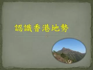
認識香港地勢. 同學有 5 分鐘的時間,閱讀地圖集有關香港地勢的部分。. 1. 香港最高的山是 ________ 。. 鳳凰山. 大東山. 大帽山. 大老山. 2. 香港最高的山的高度是多少?. 957 米. 934 米. 869 米. 702 米. 3. 以下哪 項有關香港 地勢的描述是 不正確 的?. 山多平地少. 海岸線曲折. 山脊沿西北至東南走向. 有很多島嶼. 4. 香港面積最大的島嶼是 _____ 。. 香港島. 大嶼山. 南丫島. 長洲. 5. 香港最大 面積 的低地位於 ___ 。. 新界西北部.
Download
1 / 12
Télécharger la présentation 
認識香港地勢
An Image/Link below is provided (as is) to download presentation
Download Policy: Content on the Website is provided to you AS IS for your information and personal use and may not be sold / licensed / shared on other websites without getting consent from its author.
Content is provided to you AS IS for your information and personal use only.
Download presentation by click this link.
While downloading, if for some reason you are not able to download a presentation, the publisher may have deleted the file from their server.
During download, if you can't get a presentation, the file might be deleted by the publisher.
E N D
Presentation Transcript
同學有5分鐘的時間,閱讀地圖集有關香港地勢的部分。同學有5分鐘的時間,閱讀地圖集有關香港地勢的部分。
1. 香港最高的山是________。 鳳凰山 大東山 大帽山 大老山
2. 香港最高的山的高度是多少? 957米 934米 869米 702米
3. 以下哪項有關香港地勢的描述是不正確的? 山多平地少 海岸線曲折 山脊沿西北至東南走向 有很多島嶼
4. 香港面積最大的島嶼是_____。 香港島 大嶼山 南丫島 長洲
5. 香港最大面積的低地位於___。 新界西北部 新界東南部 香港島南部 新界中部
香港最常見的岩石是______。 流紋岩 粉砂岩 花崗岩
7. 以下哪河流不在香港? 梧桐河 流溪河 林村河 雙魚河
8. 香港大部分天然山坡的坡度是 _______。 65°以上 45°- 60° 15°- 35°
10.香港哪季節常有山泥傾瀉發生? 春季 夏季 秋季 冬季
More Related