Pablo Sastre Olmos
180 likes | 365 Vues
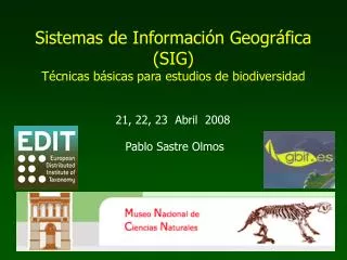
Pablo Sastre Olmos. Sistemas de Información Geográfica (SIG) Técnicas básicas para estudios de biodiversidad. 21, 22, 23 Abril 2008. Sistemas de Información Geográfica. Los criterios utilizados para cartografiar el paisaje deben ser relevantes para los organismos o procesos de interés.

Pablo Sastre Olmos
E N D
Presentation Transcript
Pablo Sastre Olmos Sistemas de Información Geográfica(SIG)Técnicas básicas para estudios de biodiversidad 21, 22, 23 Abril 2008
Los criterios utilizados para cartografiar el paisaje deben ser relevantes para los organismos o procesos de interés.
1:18.000 1:6.500 1 km 1 km 1 km Análisis del paisaje a distintas escalas de resolución Mapa 1:50.000 1 x 1 Km UTM 30T VK3796
Análisis del paisaje a distintas escalas de extensión (tamaño de las muestras)
Consulta espacial: muestra los atributos Consulta por atributos: muestra la localización
Almacenaje del atributos Modelo ráster (código digital)
Almacenaje del atributos Modelo vectorial (tabla asociada a los objetos)
Ráster Modelo Digital del Terreno (MDT) Vectorial Curvas de nivel (dist. cotas=500m)
Georreferenciación Referencias geográficas Collection Database (Darwin Core):Country = Spain Digital map “Countries-World” (GIS layer with database): Country = Spain
Georreferenciación Referencias geográficas Collection Database (Darwin Core):Country = Spain Digital map “Countries-Europe” (GIS layer with database): Country = Spain
Referencias geográficas Campos Darwin Core ¿Que?: Phylum, Species, Sex, ... ¿Como?: BasisOfRecord, PreparationType ¿Quién?: Collector, ... ¿Cuándo?: YearCollected, ... ¿Donde?: ContinentOcean Country (País) Province County (Municipio) Locality Longitude Latitude CoordinatePrecision, BoundingBox MaximumElevation, MaxDepth, ... • Límites tierra-mar: • Continentes • Islas, archipiélagos • Límites administrativos: • Países • Autonomías • Provincias • Municipios • Distritos, barrios, etc. • Calles, carreteras (dir. postales) • Ríos, etc. • Montañas, etc. Sistemas de coordenadas X,Y Lat./Long. (grados decimales) UTM (metros, …) Etc.
Madrid / Counties Genus Parus Forest Genus Circus Agriculture Birds Colection – Spanish Museum of Natural Sciences (MNCN-CSIC)