Enhancing Cloud Detection and Retrieval Techniques for GOES-R: The AWG Cloud Application Team
10 likes | 131 Vues
The GOES-R AWG Cloud Application Team, led by Andrew Heidinger at NOAA, aims to improve cloud detection and retrieval algorithms utilizing insights from NOAA and NASA's existing cloud products. The team will optimize cloud detection through multi-spectral methods and leverage CO2 slicing and VIIRS techniques for accurate cloud height and phase. Focused on prototype GOES-R systems, they engage with users to refine cloud products while addressing scientific challenges related to HES and ABI data integration. Collaboration with the broader community is essential for developing effective cloud applications.

Enhancing Cloud Detection and Retrieval Techniques for GOES-R: The AWG Cloud Application Team
E N D
Presentation Transcript
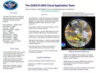
The GOES-R AWG Cloud Application Team Andrew Heidinger, NOAA/NESDIS Center for Satellite Applications and Research Andrew.Heidinger@noaa.gov The Team The team was chosen to maximize experience with the current NOAA and NASA operational cloud products Andy Heidinger* – NOAA, Chair Bryan Baum – NASA Jim Jung – CIMSS Alexander Ignatov* - NOAA Jun Li – CIMSS Jeff Key – CIMSS Patrick Minnis* – NASA Mike Pavolonis* - NOAA Steve Platnick* – NASA Tony Schreiner* - CIMSS Ping Yang* – Uni. Texas A&M * - funded member Figure Below shows a GOES-12 Imager CO2 Slicing Result from UW/CIMSS. With additional IR channels on ABI, we will overcome many of the shortcoming of the single-channel CO2 approaches on GOES-12. HES will provide far superior cloud height information for cirrus. Our Plan Cloud Detection – Working to optimize cloud detection approaches that is useful to all applications. Baseline approach is a multi-spectral 4-level approach similar to AVHRR and MODIS masks. Will also use CSBT experience. Cloud Height – Rely on CO2 slicing heritage as a first guess for more complex methods Cloud Phase/Type – Use the VIIRS approach as a first guess and allow modification by retrieval algorithms. Daytime Cloud Properties (Cloud Optical Thickness and Particle Size) – Rely heavily on the MODIS experience Nighttime Cloud Properties – (optical thickness, particle size, height) – Rely heavily on the demonstrated NASA Langley approaches Once we construct our baseline, we will explore advanced techniques to increase performance We are generally focusing on ABI until HES spectral coverage is formalized. • Team Goals • Exploit NOAA, NASA and the research communities experience with cloud remote sensing to derive optimal cloud retrieval approaches for GOES-R • Validate our results and continue to interact with the wider community including the GOES-R Risk Reduction Team. • Work within the AWG to meet the deadlines for a prototype GOES-R processing system • What we want from GOES Users • Many of the GOES-R cloud products are made today on the GOES Imager and Sounder. We feel they are under=utilized. • While they don’t meet he GOES-R specifications, they provide a useful information and good demonstration. • Please contact us to help us refine the current and future cloud products to meet your needs. • Scientific Challenges • Optimal combination of HES and ABI information • Optimal use of GOES-R’s improved temporal information • Use of the triple window – 10.4 mm channel on ABI is new to imager cloud remote sensing.