Download
1 / 44
440 likes | 593 Vues
This resource, authored by Christopher Douwes, Community Planner at the Federal Highway Administration, explores the design and implementation of shared use paths. A shared use path is defined as a multi-use trail separate from motorized traffic, accommodating pedestrians, cyclists, skaters, equestrians, and more. It discusses the differences between sidewalks and trails, accessibility considerations, suitable materials, surface conditions, and width requirements for shared use paths. The guidelines also address gap minimization and maintenance strategies to ensure user safety and comfort.

E N D
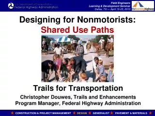
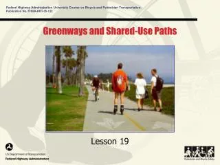
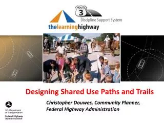
Designing Shared Use Paths and Trails Christopher Douwes, Community Planner, Federal Highway Administration
What is a Shared Use Path? FHWA Working Definition • The term “shared use path” means a multi-use trail or other path, physically separated from motorized vehicular traffic by an open space or barrier, either within a highway right-of-way or within an independent right-of-way, and usable for transportation purposes. • Shared use paths may be used by pedestrians, bicyclists, skaters, equestrians, and other nonmotorized users.
Sidewalk or Trail? What is the difference between a sidewalk and a trail? Part function, part location. • If it acts like a sidewalk, it’s a sidewalk. • If it acts like a trail, it’s a trail. • If it is in between….. • Facilities on park land parallel to streets. • Doesn’t matter who maintains (parks or streets department). The function matters. • People will always argue fine details…….. • US Access Board puts Shared Use Paths in the Public Rights-of-Way Guidelines
Provisions If you build a shared use path…. • Make sure it works for all users. • Accommodate pre-existing legal users, including equestrians. • Ensure Accessibility: to be covered in the Accessible Design course. • Ensure construction to guidelines: Verify!
Good Examples Oregon integrates recreational trails and transportation facilities: Portland Esplanade Trails connect parks and recreation: MKT Trail, Columbia MO
Bad Example What do these curves do? • Landscape architect vs Engineer? • Practical vs pretty? • Transportation vs recreation? • Opposite side of the road from a high school and other origins or destinations; no crosswalks. • It may be part of a larger plan.
Shared Use Paths: Guidelines American Association of State Highway and Transportation Officials (AASHTO) • Guide for the Development of Bicycle Facilities: 2012.https://bookstore.transportation.org/. • Guide for the Planning, Design, and Operation of Pedestrian Facilities: 2004.https://bookstore.transportation.org/ • US Access Board Accessibility Guidelines for Shared Use Paths. • Consider other sources, as appropriate.
Shared Use Paths: Surface Surface: Firm, stable, and slip resistant. • Must accommodate wheelchairs. • Accommodate narrow-tire bicycles. • Accommodate people pushing baby strollers (good “test equipment”). • Pavement is not required. Pavement may not be appropriate in some settings (rural). • Slip resistance required, but may be difficult on unpaved surfaces.
Shared Use Paths: Surface • There are no Federal laws or regulations that require a shared use path to be paved.
Shared Use Paths: Surface Firm and stable. • Some crushed aggregates can be firm and stable. • Rotational Penetrometer: Measures firmness and stability of ground and floor surfaces. • www.beneficialdesigns.com/surfaces/surface.html#rotational
Shared Use Paths: Surface Pavement • Asphalt or Concrete? • Asphalt often cheaper to construct, but may suffer water, frost, and tree root damage. • Concrete may be cheaper in the long run: may better withstand flooding, frost, roots, etc. • Concrete: use “saw cut” for joints. • Check for accessibility and a smooth surface.
Shared Use Paths: Tread Obstacles Tread Obstacles: Avoid, Minimize, and Prevent. • Prevent roots, rocks, ruts, bumps, cracks, etc. • Maintain a smooth path: sweep, fix irregularities. • Exception: Detectable warnings at crossings.
Shared Use Paths: Gaps Gaps: Avoid, Minimize, and Prevent. • Keep drainage grates off the trail. • Minimize: openings, pavement and bridge joints, open bridge decks, railroad crossings, boardwalks. • Openings shall not permit passage of a 0.5 inch / 13 mm diameter sphere. • Elongated openings should be perpendicular to travel direction.
Shared Use Paths: Width • How much use will there be? • 8 foot minimum for low-use facilities: • Connectors between cul-de-sac neighborhoods. • To avoid inviting cut-through motor vehicles. • Prefer 10 foot minimum, recommend 12 foot, more if needed. • Avoid designing only for the minimum.
Shared Use Paths: Width • High use facilities: Consider separating “heels and wheels” on two separate paths.
Shared Use Paths: Width Passing Space • Accessibility requirement: At least 60 inches (1525 mm) width within 200 foot (61 m) intervals. • Should not be an issue for Shared Use Paths. • Avoid designing only for the minimum.
Shared Use Paths: Grade Grade: Accessibility is the primary consideration. • Use Access Board’s Shared Use Path Guidelines in the Public Rights-of-Way Guidelines. • Grade: <5% to the extent practicable. • There may be situations were “compliance is required to the extent practicable.” • At highway crossings: Highway slope is trail cross slope, highway cross slope is trail slope.
Shared Use Paths: Grade • Grade: <5% to the extent practicable. • Avoid abrupt grade changes: • Annoying and can be dangerous. • No provision or requirement for rest intervals, but could be considered on sustained grades.
Shared Use Paths: Cross Slope • Cross Slope: <2%. • At highway crossings: Highway slope is trail cross slope, highway cross slope is trail slope. • Superelevation? Accessibility trumps. • NOTE: The Outdoor Developed Areas Guidelines allow steeper cross slopes for recreational trails. Shared Use Paths must use a higher standard.
Shared Use Paths: Vertical Clearance • Accessibility: 80 inches minimum. • Equestrian Use: 10 feet minimum.
Shared Use Paths: Vertical Clearance • Maintenance vehicles: 12 feet? More? • Provide warnings or barriers for low overhead clearance: detectable by people with visual impairments.
Shared Use Paths: Protruding Objects • Avoid protruding objects in the treadway: • Poles, wires, signs, other objects. • Tree branches, hanging vines. • Mark unavoidable objects with retroreflective markings. • Covered in Accessible Design Course.
Shared Use Path Crossings • Use Public Rights-of-Way Guidelines. • Treat as an intersection. • Who gets the right of way? Where is the volume? • Include detectable warnings.
Trails in Freeway Rights-of-Way QUESTION: Can trails be built along an Interstate or other freeway right-of-way? ANSWER: • Yes! There are examples. • Ensure barrier separation between the trail and freeway lanes. www.fhwa.dot.gov/environment/bikeped/freeways.htm
Shared Use Paths Near Railroads QUESTION: Can Shared Use Paths (or other trails) coexist with railroads? ANSWER: • It depends. • Right-of-way. • Safety • Security • No trespassing!
Shared Use Paths Near Railroads • Many factors to consider. • See FHWA/FRA Rails-with-Trails: Lessons Learned: www.fhwa.dot.gov/environment/rectrails/rwt/index.htm • Trail may reduce trespassing on railroad property. • Trail is easier to use than walking on tracks. • Use a barrier: • Fence or vegetation. • Ditch. • Vertical grade.
Rails-to-Trails • Good examples of shared use paths. • Low grade, good sight lines, wide, stable base. • It could handle trains, it can handle bicyclists and pedestrians! • Access points must be accessible. • Pay attention to property rights issues.
Bollards: A Bad Idea. Why? What are some possible problems?
Bollards: A Bad Idea • Bollards should never be a default treatment. • Don’t use unless intrusions are documented. • Bollards are a potentially fatal safety hazard. • Unjustified bollards may create liability. • Bollards, gates, fences, or other barriers can slow emergency response access. • Bollards are often ineffective: people go around, or damage the bollards or area. • A landscaped median is better.
Bollards: A Bad Idea If installed, bollard, gates, fences, or other barriers: • Must not restrict access for people with disabilities. • Must be easily visible in low light conditions. • Have enough sight distance so users can adjust speed. • Should permit passage, without dismounting, for adult tricycles, bicycles towing trailers, and tandem bicycles. • Accommodate all users legally permitted to use the trail. • Must be easily removable for emergency vehicle access. • Never use even numbers of bollards, possibly creating head-on collisions….. (see previous examples).
Environmental Impacts Shared use paths may qualify for Categorical Exclusions, but they can impact: • Drainage patterns and wetlands. • Wildlife: threatened and endangered species. • Historic, cultural, archaeological resources. • Privacy perceptions for adjacent properties. • Light pollution.
Bridges: Essential Links Bridges are needed in any transportation network. • Union Street Railroad Bridge, Salem OR. • A half-mile span over the Willamette River. • The project improved bicycle and pedestrian safety and access, and provided a critical link in local, regional, and State transportation and trail networks.
Bridges: Essential Links • Be creative. • Reuse historic bridges. • Reuse railroad flatcars.
Rail Bridge to Trail BridgeWalkway Over the HudsonPoughkeepsie – Highland NY
Big Dam BridgeNear Little Rock AR Over Lock & Dam. Built and managed by by Pulaski County.
Tunnels and Underpasses Design for the tallest likely user: • Maintenance vehicles • Equestrians • Snow level Think about maintenance.
Tunnels and Underpasses Design for Perception of Security • Good visibility through the underpass: • No hiding places. • Lighting if needed. • Highway underpasses: • Underpass approach grade may be easier than a bridge over. • Drainage issues.
Signs See MUTCD Chapter 9: http://mutcd.fhwa.dot.gov/.
Support Facilities Trailside and Trailhead Facilities • Rest rooms, water. • Benches along trails, hitching posts, bike racks. • Buildings and built site facilities must meet accessibility guidelines for built facilities. • Not our job: Park amenities: picnic pavilions, campgrounds, ball fields, boat launches, etc. • Not our job: school running tracks, field lighting, etc.
Motorized Use on Shared Use Paths • Generally prohibited. Exceptions: • Motorized wheelchairs • Snowmobiles or electric bicycles at State or local option • Framework for Considering Motorized Use on Nonmotorized Trails and Pedestrian Walkways www.fhwa.dot.gov/environment/bikeped/framework.htm • Electric vehicles: currently not allowed (except electric bicycles at State or local option).
Motorized Use or Larger Vehicles on Shared Use Paths • Coming soon to a trail near you?
Critique? • What do you see that you like? • What do you see that you don’t like?