Download
1 / 22
250 likes | 495 Vues
Using GNSS to establish a Height Datum on a Survey. Richard Stanaway QUICKCLOSE. www.quickclose.com.au. Overview of GNSS Heighting. Height systems and Geoid models. AHD and MSL. Measuring ellipsoid Heights. Working with height datum offsets. Victorian case-study - Murray Valley LiDar.

E N D
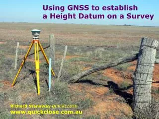
Using GNSS to establish a Height Datum on a Survey Richard Stanaway QUICKCLOSE www.quickclose.com.au
Overview of GNSS Heighting Height systems and Geoid models AHD and MSL Measuring ellipsoid Heights Working with height datum offsets Victorian case-study - Murray Valley LiDar
The Geoid Universität Stuttgart
Differences between MSL and the geoid (Mean Dynamic Topography)
H = h - N N = h - H
local AHD offset (o) can computed by GNSS/GPS measurements at local PMs. o = H(AHD) – h(GDA94) + N(Ausgeoid98) H(AHD) = h(GDA94) - N(Ausgeoid98) + o
Complications….. AHD20?? – 0.1 to 0.2 m higher (sea level rise) Regional and localised subsidence (groundwater changes) Levelling errors and mark disturbance
Antenna Reference Point and Phase Centre GNSS measurements made to phase centre (and not antenna reference point) “trunnion axis of the GPS” Different antennas have different phase centre offsets!! Good advice to use phase centre heights rather than ARP heights if different antennas are used
Steps to get “local” AHD using GNSS/GPS 1. Determine phase centre offsets / models • Ensure correct geoid model is used (Ausgeoid98 or Ausgeoid09 in Victoria) 3. Take measurements at local high order (3rd order or higher) PMs/PSMs to compute offset (o) (The Ausgeoid surface should be parallel with AHD over a localised area) • Apply the offset to Ausgeoid derived elevations in order to align them with local AHD Some later GNSS systems have a local geoid builder in their software (local AHD calibration). Alternatively, a local geoid model can be created and loaded into a GNSS controller or software
Baseline solutions Results
Thank You! More information at: www.quickclose.com.au/publications.htm richard.stanaway@quickclose.com.au