Climate
Explore the factors that influence climate, including temperature and precipitation. Learn about latitude, proximity to water and mountains, altitude, ocean currents, and prevailing winds. Gain insight into how these controls shape an area's long-term weather patterns.


Climate
E N D
Presentation Transcript
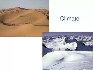
Climate is… • An area’s long-term pattern of weather. • It includes characteristics such as how hot summers are, how cold winters are, and how much precipitation falls at different times of year. 2 main characteristics: • Temperature & • Precipitation
Climate Controls • Climate depends on a set of conditions called climate controls. These include: • Latitude: how much solar radiation a location receives. • Proximity to water • Altitude/Elevation • Proximity to mountains • Ocean currents • Prevailing Winds
1. Latitude • A location’s position relative to the equatordetermines how much solar radiation it receives, and therefore affects its temperature. *Remember as Earth revolves around the Sun, the tilt influences how much solar radiation a location receives & seasons change.
1. Latitude • Also, the latitude relative to convection cells in our troposphere affects precipitation. • Dry at 30 N & S • Moist at equator
2. Proximity to Water Because water heats and coolsslowly, it has a low temperature range. Therefore land masses beside large bodies of water usually have mild climates. Large bodies of water add water vapor to the air, so precipitation is more likely downwind of water Ever heard of “lake effect” snow?
3. Altitude/Elevation • As you go up in the Troposphere (bottom layer of the atmosphere) temperature decreases. • Therefore, the higher the elevation of the land, the colder it is, generally.
4. Proximity to Mountains On the windward side of the mountain, air is forced to rise. As it rises, it cools. As it cools, it loses its ability to hold water, and precipitation occurs on the windward side. As the air travels to the leeward side, it no longer contains moisture, the air is arid, or dry. This is why there are deserts on the east side of our Rocky Mountains • Mountains can affect precipitation by making a Rain Shadow.
5. Ocean Currents • Global circulation of heat in the oceans moves heat energy around the world. Use this map to help you answer the questions in your notes.
Warm Ocean Currents • Where is the water the warmest ? Why?
6. Prevailing Winds • Global Wind Patterns cause there to be a predominant wind direction in some areas. This influences the type of weather that approaches you. Prevailing Westerlies cause weather patterns to move from west to east across the United States. Answer the weather map review questions in your notes