Download
1 / 9
90 likes | 127 Vues
Understand the importance of clipping basins with water bodies like lakes and reservoirs to improve Flash Flood Monitoring and Prediction (FFMP) accuracy. Clipping helps prevent overestimation of precipitation and ensures precise calculations. Learn how to identify, clip, and update basin attributes for better FFMP outcomes.

E N D
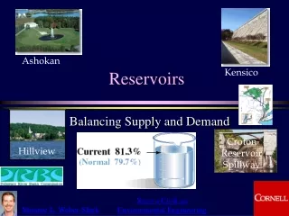
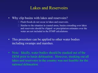
Lakes and Reservoirs • Why clip basins with lakes and reservoirs? • Flash floods do not occur in lakes and reservoirs. • Similar to the situation in coastal areas, basins extending over lakes and reservoirs should be clipped so precipitation estimates over the water are not included in the FFMP calculations. • This procedure can be applied to other water bodies including swamps and marshes. • Note:Ideally, water bodies should be masked out of the DEM prior to basin delineation. However, masking out all lakes and reservoirs in the country was not feasible for the national delineation.
Lakes and Reservoirs In general, the location of lakes and reservoirs can be identified from the DEM-derived streams.
Lakes and Reservoirs Lake Paula, TX Overlaying the NHD waterbody shapefile verifies the location of the lake.
Lakes and Reservoirs 1. Original basins 2. Overlay lake polygon Perry Lake, KS 3. Clip basins with lake The basins intersecting the lake can be clipped using the lake polygon(s) from the NHD shapefile. After clipping basins with the lake, basin outlets will be located along the shoreline. These basins will result in more accurate FFMP calculations than those prior to clipping.
Lakes and Reservoirs Clipping basins generally results in “split basins” or “clip artifacts”. What appears to be two basins highlighted in the figure is actually a single basin feature comprised of two geographically separate parts (note the pre-clipped basin outline in green). FFMP calculations for these clip artifact basins are often not particularly meaningful. For this reason, it is advised that they are either broken into their separate parts and allowed to be unique basins or removed from the dataset. Clip Artifact
Lakes and Reservoirs If clip artifacts are removed, there will be areas along the shoreline that are not represented by a basin (the blank areas in the figure). If they are relatively small, these areas may not be of significant concern for flash flooding because their flow consists primarily of local runoff directly to the lake. The decision to remove a clip artifact should only be made after careful consideration of all relevant factors (population density, local hydrology, etc.). Note: The best way to deal with clip artifacts is to convert them to unique basins.
Lakes and Reservoirs After clipping basins, it is necessary to check and update certain basin attributes. In particular, any basin with its outlet along the lake shoreline must have its [Parent_id] value set to 0. This indicates that there are no basins downstream from that basin. The highlighted basins in the figure should have [Parent_id] = 0. In addition, it is a good idea to check the [Streamname], [State], [Countyname], [CWA], and [FIPS] attributes in the clipped basins. [Parent_id] = 0
Lakes and Reservoirs The lake and reservoir polygons can be inserted into the basin shapefiles if desired. FFMP calculations of average rainfall over the lake may be useful to water resource managers and others concerned with lake or reservoir water levels. 1. Clipped basins without lake polygon 2. Clipped basins with lake polygon
Lakes and Reservoirs If the lake polygon is added to the shapefile, it must be assigned a unique [Basin_id] and [Pfaf_id], and the upstream and downstream links must be updated using the AMBER Basin Customization Extension. To update the links, the lake polygon must first be linked to its immediate downstream basin. Then each contributing basin must be linked to the lake polygon. 1. First link the lake polygon to its immediate downstream basin. 2. Then link the each contributing basin to the lake polygon.