Download

1 / 23
230 likes | 351 Vues
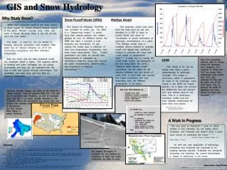
This project explores the integration of Geographic Information Systems (GIS) in hydrology for more effective weather coverage in Central Texas, an area known as "Flash Flood Alley." We examine current media practices, including severe weather warnings and social media interaction, while emphasizing the role of organizations like the National Weather Service and local meteorologists. The project proposes methods to enhance viewer safety and information access by combining various data sources into an interactive interface, providing a comprehensive resource for both broadcasts and emergency responses.

E N D
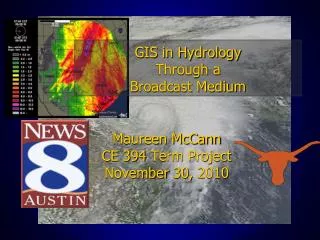
GIS in Hydrology Through a Broadcast Medium Maureen McCann CE 394 Term Project November 30, 2010
Central Texas = Flash Flood Alley Source: The Flood Safety Education Project
What’s the worst type of weather in Texas?
Severe T’storm and Tornado WARNINGS • Significant Flood Events • Maintain “first on, last off” coverage • Meteorologist(s) in the studio, reporters in the field • Social media interaction News 8 Austin Severe Weather Coverage
What do we use now? • National Weather Service, NOAA Branches • LCRA • CoCoRAHs • News 8 Weather Watchers • WSI Suite
What would be useful? • Accessing GIS data in TV graphics to enhance coverage and provide viewers with pertinent information GIS
WISH LIST • Collaborated with Dr. Maidment, Chief Meteorologist, ESRI professionals, held workshops… • How could we combine…
NEXRAD/Precip data • Time-based estimates • Manually corrected rainfall estimates Source: CRWR Group Maps, ArcGIS.com
NEXRAD data sites Source: NWIS precip map, Scoffield
Ground Observations • Surface data • ASOS/AWOS sites • CoCoRAHs • Mesonet data (LCRA, Brazos River, Guadalupe River, Brushy Creek, etc) Source: West Texas Mesonet Source: Upper Brushy Creek WCID
Flood Info • Stream gauges: LCRA, USGS, other water authorities • Inundation levels • Hypothetical flood scenarios • Flood history/ comparable events Source: CRWR Group Maps, ArcGIS.com
Low Water Crossings • Usually prone sites • Alternative routes • Road closures • TXDot data Source: Hays County Online
Emergency Response • Live data from emergency response showing where rescues are occurring (from real-time fire call data?) • Available shelters?
Social Media • Twitter/Facebook • #hashtags relevant to the weather event (#TXwx, #weather, #Hermine etc) • tweets by geographical proximity • Photos/live web cams where available, geotagged • News 8 Weather stations
Next Steps • Combine all of these ideas into a usable interface – toggle between data sources • Written in one language… WaterML? • Merge GIS to TV Weather Vendor graphics (WSI, Weather Central, AccuWeather etc) • Use on air!
http://news8austin.com/weather For More Information
Thank you! Maureen McCann AMS Certified Broadcast Meteorologist mmccann@news8austin.com @maureenmccann8