Spatiotemporal Tile Indexing Scheme for Satellite Image Metadata Management
Develop a system to efficiently store and retrieve metadata from satellite images, facilitating faster data discovery and improved management. The application prototype allows easy access via web services with search parameters for date and location.

Spatiotemporal Tile Indexing Scheme for Satellite Image Metadata Management
E N D
Presentation Transcript
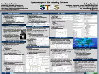
Spatiotemporal Tile Indexing Scheme Oscar Alejandro Perez Cruz Polytechnic University of Puerto Rico Research Alliance in Math and Science http://wiki.ornl.gov/sites/rams09/o_perez_cruz oscar_alejandro@onelinkpr.net Dr. Ranga Raju Vatsavai Geographic Information Science and Technology Group Computational Sciences and Engineering Division Oak Ridge National Laboratory r7v@ornl.gov Application Prototype Problem Background System Architecture Web Service • Advantages • Easy access • Easy to use • Only one application • Features • Option for search parameters • Date • Location • Date and location • Format for location parameter • DMS format • Decimal degrees format • Past decade witnessed • Increasing number of operational satellites • Satellites brought • Spectral coverage • Spatial coverage • Temporal coverage • Difficulty increased in meta data management, and data discovery • System Components • Meta Data Harvesting System • Spatiotemporal Database Management System • PostgreSQL Database Server • PHP Server (Web Service Server Side) • Web Page (Web Service Client Side) Research Objective Meta Data Harvesting • Create a system that can read meta data from satellite images (or ancillary data) to store in a spatiotemporal database that generates • Efficient search and data discovery • Easier access to the meta data • Faster results • Improves data management • Current application for the system • Geographic satellite images from • Moderate-Resolution Imaging Spectroradiometer (MODIS) • Advanced Wide Field Sensor (AWIFS) • Meta data - data that provides information about data. • Harvesting - process of extracting the meta data from the ancillary data sources • Features • Uses GDAL open source library • Supports 50/60 image formats • Not dependent of any particular satellite or sensor • Meta data elements • Pixel size • Image size • Central meridian • Latitude of origin • Last modified date Querying the Database • Spatial Query retrieves all objects whose geometry contains a given point. Example: • SELECT * FROM <table_name> WHERE ST_WITHIN(‘POINT(3 2)’, LOCATION); • Temporal Query retrieves all objects whose time has to do with an event. Example: • SELECT * FROM <table_name> WHERE DATE = “12/12/2000”; • Spatiotemporal Query retrieves all objects whose time has to do with an event and whose geometry contains a given point. Example: • SELECT * FROM <table_name> WHERE ST_WITHIN(‘POINT(4 2)’, LOCATION) AND DATE = “12/12/2000”; Research Background • Database - large collection of interrelated data • One database record = one object • Spatiotemporal objects have • Identifier • Spatial attribute • Timestamp • Data types of a spatial attribute are • Point – represent location of entities • Line – represent networks • Region – represent entities with large areas • Indexes: • Ensure fast access to database records • Based on a search key • Avoid sequential scan through the database • Structures • Tile • Geometric • Temporal • Spatiotemporal Spatiotemporal Database Management System Conclusion and Future Direction • Features • Connect to database • Create, delete, view, and index table • Harvest meta data to insert in table • Search for images • System enables a much easier data management of satellite images. • System can be extended to • Other kinds of search criteria like • Cloud coverage percentage • Forestation percentage • Interface other data formats • Meta data search through the network References • Hartmut Güting, R., and Schneider, M. (2005). Moving Objects Databases. San Francisco: Morgan Kaufmann Publishers. • Rigaux, P., Scholl, M., and Voisard, A. (2002). Spatial Databases With Application To GIS. San Francisco: Morgan Kaufmann Publishers. • PostgreSQL 8.3.3 Documentation, The PostgreSQL Global Development Group. • Neufeld, K. (2009). PostGIS 1.4.0rc2 Manual. • Geospatial Data Abstraction Layer (GDAL), GDAL/OGR Project Management Committee, http://www.gdal.org/. The Research Alliance in Math and Science program is sponsored by the Office of Advanced Scientific Computing Research, U.S. Department of Energy. The work was performed at the Oak Ridge National Laboratory, which is managed by UT-Battelle, LLC under Contract No. De-AC05-00OR22725. This work has been authored by a contractor of the U.S. Government, accordingly, the U.S. Government retains a nonexclusive, royalty-free license to publish or reproduce the published form of this contribution, or allow others to do so, for U.S. Government purposes. I would like to thank Dr. Ranga Raju Vatsavai for the opportunity to work on this project. Finally, special thanks go to Debbie McCoy, who made provisions for this research experience.