Download
1 / 7
70 likes | 172 Vues
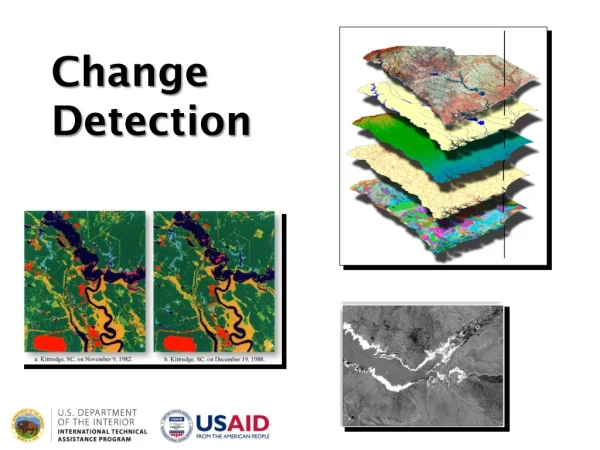
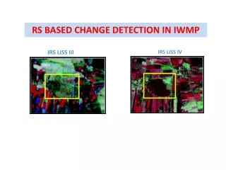
Implementing real-time satellite image correlation with field data in Integrated Watershed Management Program (IWMP) using IRS LISS III and IV data overlaid with cadastral maps. The system integrates cadastral map information with slope layers and enables geotagging of field images in Google Earth. Real-time data collection through GPS, digital photos, and user-specified parameters is facilitated, with data transmission to a central processing server. Mobile PDAs are used for field data collection and dissemination.

E N D
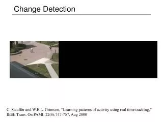
RS BASED CHANGE DETECTION IN IWMP IRS LISS III IRS LISS IV
Real time data collection on GPS coordinates, Digital Photos & user specified parameters and transmission from field to central processing server Mobile PDA for Collection & Dissemination of Field Information