Download
1 / 37
370 likes | 470 Vues
Explore the importance of land monitoring under UNFCCC, emphasizing key variables, incentive mechanisms for REDD, and the role of remote sensing. Understand the challenges and strategies for effective forest monitoring to reduce emissions and ensure environmental sustainability.

E N D
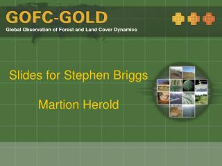
Current focus: Land monitoring and the UNFCCC • Observing essential climate variables (ECV) • Reduce uncertainties in monitoring the global climate system • Land cover, biomass and fire as key variables • Development of standards and prepare implementation programmes • Reducing emissions from deforestation and forest degradation (REDD) • Stronger mitigation role of developing countries in post-2012 agreement • Remote sensing capabilities to build national forest carbon monitoring systems • www.fao.org/gtos/topcECV.html • Major investments in land monitoring, estimation and accounting • http://www.gofc-gold.uni-jena.de/redd
Observing land cover as ECV www.fao.org/gtos/
Suriname Vanuatu Design Incentive Mechanisms for REDD Design positive incentives: • Carbon Stock • Sectoral Crediting Baselines • Direct Barter International incentive mechanisms need to work for all nations PNG Solomon’s Bolivia Indonesia • Programatic or sectoral scale • Similar to programmatic CDM • Calculate historical and future baseline carbon stock – credits gained for performance below baseline Carbon Stocks Costa Rica China India Time
Foundations for REDD monitoring • Guidance for monitoring and implementation provided under the UNFCCC; • Monitoring should be part of the national REDD implementation strategy and objectives; • Knowledge in the use and application the methods of IPCC LULUCF good practice guidelines; • Existing national forest monitoring capabilities; • Expertise in estimating terrestrial carbon dynamics and related human-induced changes; • The consideration of different capabilities for monitoring forest changes in the historical and for the future.
IPCC principles and developing country capacities • Consistency:use of heterogeneous data sources rather than a systematic and consistent monitoring • Transparency:expert opinions, independent assessments or model estimations are commonly used as data • Comparability:few countries have experience in using the IPCC GPG as common estimation and reporting format • Completeness:lack of suitable forest data in many non-Annex I countries is evident for both area change and changes carbon stocks • Accuracy:limited information on the uncertainty and error sources of estimates by countries and approaches to analyze, reduce, and deal with them for international reporting
Variability in capacities for REDD monitoring Capacity gap Consideration of factors: Requirements for monitoring forest carbon on national level (IPCC GPG) Existing national capacities for national forest monitoring Progress in national GHG inventory and engagement in REDD REDD particular characteristics: importance of forest fires, soil carbon, deforestation rate etc. Specific technical challenges (remote sensing): cloud cover, seasonality, topography, remote sensing data availability and access procedures
Earth observation contribution to UNFCCC-REDD GOFC-GOLD working group est. GTOS/GOFC report 1.+ 2. REDD Sourcebook draft 3. REDD Sourcebook version 2nd GOFC-GOLD workshop 3rd GOFC-GOLD workshop 1st GOFC-GOLD workshop ED/GOFC SBSTA side event ESA/GOFC Side event + booth ESA/GOFC-GOLD side event WINROCK/GOFC-GOLD side event GTOS/GOFC-GOLD side event PNG / GOFC-GOLD side event GOFC-GOLD side event GTOS submission II GTOS submission I GTOS submission III COP11 Montreal COP12 Nairobi COP13 Bali COP14 Poznan SBSTA 26 SBSTA 28 COP15 Copenhagen SBSTA 24 SBSTA 30 3rd SBSTA workshop 1st SBSTA workshop 2nd SBSTA workshop Informal REDD workshop Subm. of view by parties II Subm. of view by parties III + IV Subm. of view by parties I 2005 2007 2008 2006 2009
REDD Sourcebook • http://www.gofc-gold.uni-jena.de/redd
Landsat-calibrated change estimates for Humid Tropics biome 2000-2005 Source: Matt Hansen 27.2 Mha lost equaling 2.36% of year 2000 forest cover, 47.8% of total in Brazil
JRC/FAO sampling in Central Africa – changes 1990-2000 degradation deforestation Source: F. Achard, EC-JRC
Fine-scale land cover/use change • Suite of national / regional experiences: • National monitoring programs (i.e. CORINE, Australia) • UNFCCC Kyoto reporting on LULUCF/AFOLU • UNFCCC process on reducing emissions from deforestation in developing countries: • National case studies (GSE forest monitoring) • Readiness activities in evolution (Worldbank, UN-REDD) • Projects with global/large scale focus: • EU/JRC: TREES 3 (sampling approach) • UMD/SDSU: combined MODIS/Landsat approach • GLOBCOVER and ECV monitoring • FAO-Forest Resources Assessment 2010
Current availability of fine-scale satellite data sources and capacities for global land change observations Increase usefulness through demonstration (Note: dark gray=common or fully applicable, light gray=partially applicable/several examples, white=rare or no applications or examples)
Addressing technical challenges for remote sensing Country coverage of Landsat 5 receiving stations Meanannualcloud cover Percent Mean annual cloud free country coverage with SPOT data 2006-08 Seasonality Variability in cloud cover (%) Average internet download speed Topography Area with steep slopes (%)
GEO forest carbon tracking task Scope and work items to improve situation
4 Evolving technologies different foci – degradation, carbon etc.
Monitoring carbon stock change in degraded forests • Inventory based approaches and long-term field observations • Remote sensing to detect degraded area: • Direct detection of degradation (i.e. canopy damage) • Indirect approaches (detection of human infrastructure) • Operational fire monitoring systems • Country objectives and importance of degradation: • Changes in forests remaining forests as key category? • Monitoring forest degradation important to avoid displacement of emissions from reduced deforestation • Country aiming to claim credits on reduced emissions from forest degradation (which processes)
The role of LIDAR observations LIDAR (LIght Detection And Ranging) sensors: directly measure three-dimensional distribution of vegetation canopy components and sub-canopy topography Tool for a range of forest inventory information primarily for estimation of tree/stand heights, also volume, crown closure and biomass Most operational examples using airborne systems (footprint size of 0.1 – 2 m) Global space-borne ICESAT/GLAS with limitations caused by 70 m footprint diameter
Synthetic Aperture Radar (SAR) observations Active system independent of atmosphere Data of several space-borne systems archived ALOS L-band global observations strategy since 2007 Requirements and status of preprocessing Baseline forest mapping Cloudy areas Project case studies Source: Josef Kellndorfer, WHRC
Remote sensing support for carbon estimation • Direct biomass mapping from space remains a challenge • Existing capabilities: • Satellite observation may help to map some specific forest types (i.e. mangroves, plantations etc.) • Targeted remote surveys to support carbon monitoring: • Very high resolution satellite or airborne data of air-photo quality to assist field surveys • Sensitivity of LIDAR and long-wave RADAR observations • (few regional examples) • Integration of in-situ and satellite data for large scale biomass mapping • Direct estimation of emissions from fire radiative power • Technologies are not operational globally but evolving
National carbon assessment through carbon budget model • Choice of methods depends on national circumstances which include available data and their characteristics • Two forest inventories (Sweden, US) • One forest inventory plus area change - empirical yield-data driven modeling (Canada) • Limited Inventory – process modeling (Australia) • Mixed approaches • Convergence of methods can be expected
3.4 National carbon assessment through carbon budget model Components of the Carbon Budget Model of the Canadian Forest Sector (CBM-CFS3)
Data collection at local level: Carbon assessment by communities • What is it? • With very little training and support, local people can accurately assess basic properties of the forest: Species, tree count, dbh • Measurements are part of forest management aimed at local income generation from forest resources • Low-intensity traditional forest inventory to be used for quality control and conversion to biomass • Data is processed by professional staff, communicated locally • Correlation can be made with satellite imagery • Areas without sampling • Quality control
Satellite coverage for S-Pacific Island State of Vanuatu ASTER (2005/07) 36 scenes Landsat (1989/91) 18 scenes Landsat (2000/03) 14 scenes ASTER (1999/00) 14 scenes SPOT data (1990/92) 17 scenes
Hot spots Forest loss [ha] Tree canopy cover [%]
GSE Forest Monitoring Examples Cameroon and Bolivia
Biomass forest monitoring examples Christiane will provide slides
GOFC-GOLD biomass working group www.fao.org/gtos/gofc-gold www.gofc-gold.uni-jena.de Global Observations of Forest Cover and Land Dynamics
Initial set of goals and objectives • Establish a platform for coordination and cooperation for biomass monitoring • Develop a community-consens framework for monitoring biomass globally • Dedicated contributions to key international activities: • Consensus framework on how to observe biomass as ECV and support of evolving programs • GOFC-GOLD contribution to GEO tasks • GOFC-GOLD technical REDD sourcebook • Support of space agencies and plans for dedicated missions (BIOMASS, Desdiny etc.) • Integrate activities with other ECV observation products (land cover and fire) • Foster comparison and synergy among existing datasets
Web resources • GOFC-GOLD: • http://www.fao.org/gtos/gofc-gold/ • GOFC-GOLD land cover project office: • http://www.gofc-gold.uni-jena.de/ • GOFC-GOLD REDD sourcebook: • http://www.gofc-gold.uni-jena.de/redd • IPCC background paper on use of remote sensing in LULUCF sector (GOFC-GOLD 33): • http://www.fao.org/gtos/gofc-gold/series.html • UNFCCC/SBSTA technical paper on costs of monitoring for REDD • http://unfccc.int/resource/docs/2009/tp/01.pdf