Ki – Yi Treasure Hunt
290 likes | 456 Vues
Ki – Yi Treasure Hunt. Using GPS/GIS in the Classroom. GPS Receivers. Hand-held unit “Digital compass” with a brain. Receives latitude and longitude data Receives time data. Survey grade Mapping grade Recreational grade. <1 meter accuracy 1-2 meter accuracy 10-20 meter accuracy.

Ki – Yi Treasure Hunt
E N D
Presentation Transcript
Ki – Yi Treasure Hunt Using GPS/GIS in the Classroom
GPS Receivers • Hand-held unit • “Digital compass” with a brain. • Receives latitude and longitude data • Receives time data
Survey grade Mapping grade Recreational grade <1 meter accuracy 1-2 meter accuracy 10-20 meter accuracy GPS Receivers – Quality Levels
Geographic Information System • Called GIS • Includes • GPS Unit • Computer software • Database information • Satellites • Control stations
ArcView Software • GIS programs by ESRI • World leader in GIS software and data production • Partnership with state of South Dakota • Interactive mapping software • Database information • Retrieve public data • Input end user data
GPS/GIS Uses • Military • Emergency response • Economic development • City planning • Real Estate • Recreation
Why Teach GPS/GIS? • Hands on learning • Kids love to use technology • SDSU Geography majors • Real world application
GPS/GIS at WHS • Attended GPS/GIS TTL summer 2003 • Created a unit in World Geography course on GPS/GIS • Attended GIS workshop spring 2004 in Pierre
GPS/GIS at WHS - Unit • Covered background information • 2 days GPS unit training • 1 day of Ki-Yi Treasure Hunt • 3 days of ArcView software training • 3 days mapping our routes in WTN
9-12 WORLD GEOGRAPHY STANDARDS 1. use maps, globes, and other geographic tools to acquire, process, and report information from a spatial perspective by selecting appropriate maps, map projections, and other graphic representations to analyze geographic problems; constructing maps using fundamental cartographic principles including translating narratives about places and events into graphic representations; interpreting maps and other geographic tools through the analysis of case studies and using data; and using geographic tools to represent and interpret the earth’s physical and human systems.
Ki-Yi Unit Objectives: After completing this unit the student will be able to understand… • how to care and operate the handheld GPS units. • the many real-world applications of GPS and GIS systems. • how GPS/GIS have affected their world and possible uses for them in their future. • how to correctly generate and use map projections of various types.
Ki-Yi Unit Tasks • Discuss misconceptions and current knowledge of GPS or GIS systems handout. • View the website GPS Uses in Everyday Life – Aerospace Corporation GPS primer and complete worksheet. • Go over Location Review document and website World Atlas.com Latitude and Longitude • Hook – How GPS is used today. Military and civilian uses. • Ambush in Iraq • Laser Guided Missiles • GPS Guided boat to Cuba
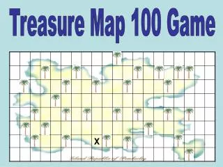
Ki-Yi Unit Tasks • GPS/GIS consumer uses Internet activity. • With the GPS unit in hand, read through the User Guide overview. • Learn to set a waypoint and navigate to it. Enter ______________ as the goto point and determine what is at that location. • Partner up and do Ki-Yi Treasure Hunt.
GPS/GIS Unit Tasks • Upload waypoints from Ki-Yi treasure hunt into your computer using OziExplorer. Ozi instructions • Complete Mapping Our World module one in ArcView. • Complete Mapping Our World module five in ArcView. • Work with Treasure Hunt shapefile to map route and home. • Print map and turn in. • Take GPS overview quiz. • Complete GIS/GPS journal prompt.
Implementing GPS/GIS • Request ArcView software • http://www.state.sd.us/deca/ddn4learning/statewide/GPS/GISlicense.htm • Train your teachers • Purchase GPS units • Implement unit into curriculum • Sources • http://www.esri.com • http://www.precisionag.ncsu.edu/GPTREI/gps/applications/receiverAccuracy/receiverAccuracyPreview.htm • Questions
By: Paul Peterson Social Studies Teacher Watertown High School petersop@wtn.k12.sd.us