Download
1 / 43
440 likes | 603 Vues
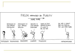
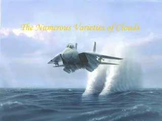
The Numerous Varieties of Clouds. Latin Root. Translation. Example. common cloud classifications. cumulus stratus cirrus nimbus. heap layer curl of hair rain. fair weather cumulus altostratus cirrus cumulonimbus. Cloud Types.

E N D
Latin Root Translation Example common cloud classifications cumulus stratuscirrusnimbus heap layercurl of hairrain fair weather cumulus altostratuscirruscumulonimbus Cloud Types Clouds are classified into a system that uses Latin words to describe the appearance of clouds as seen by an observer on the ground. The table below summarizes the four principal components of this classification system Further classification identifies clouds by height of cloud base. For example, cloud names containing the prefix "cirr-", as in cirrus clouds, are located at high levels while cloud names with the prefix "alto-", as in altostratus, are found at middle levels. This module introduces several cloud groups. The first three groups are identified based upon their
Cont… height above the ground. The fourth group consists of vertically developed clouds, while the final group consists of a collection of miscellaneous cloud types.
Low Etage SFC-6500 FT Low-level CloudsLow clouds are of mostly composed of water droplets since their bases generally lie below 6,500 feet (2,000 meters). However, when temperatures are cold enough, these clouds may also contain ice particles and snow.
Fair Weather Cumulus Clouds puffy cotton balls floating in the sky Fair weather cumulus have the appearance of floating cotton and have a lifetime of 5-40 minutes. Known for their flat bases and distinct outlines, fair weather cumulus exhibit only slight vertical growth, with the cloud tops designating the limit of the rising air. Given suitable conditions, however, harmless fair weather cumulus can later develop into towering cumulonimbus clouds associated with powerful thunderstorms.
dark, low-level clouds with precipitation Nimbostratus are dark, low-level clouds accompanied by light to moderately falling precipitation. Low clouds are primarily composed of water droplets since their bases generally lie below 6,500 feet (2,000 meters). However, when temperatures are cold enough, these clouds may also contain ice particles and snow. Nimbostratus Clouds
low, lumpy layer of clouds Stratocumulus clouds generally appear as a low, lumpy layer of clouds that is sometimes accompanied by weak intensity precipitation. Stratocumulus vary in color from dark gray to light gray and may appear as rounded masses, rolls, etc., with breaks of clear sky in between. Stratocumulus Clouds
Stratocumulus can be widely scattered, as depicted in this photo, but are usually concentrated closer together in clusters or layers and have very little vertical development. This photo of a stratocumulus layer from above was taken by Jay Shafer, a PSC meteorology graduate, from Mt. Washington. Jay also went down to a lower elevation and took another photo providing a closeup, side view of a stratocumulus cloud in this deck. These relatively flat clouds usually lack the sharp edges and "popcorn" appearance of most normal cumulus clouds
Stratus are usually the lowest of the low clouds. Stratus often appear as an overcast deck (as shown), but can be scattered. The individual cloud elements have very ill-defined edges compared to most low cumuloform clouds (e.g. cumulus and stratocumulus).
Fog can be considered as a low stratus cloud in contact with the ground. When the fog lifts, it usually becomes true stratus. This photo shows fog over the Pemigewasset River basin with clear skies elsewhere
ice crystals dominate. Under favorable atmospheric conditions, harmless fair weather cumulus clouds can quickly develop into large cumulonimbus clouds associated with powerful thunderstorms known as supercells. Cumulonimbus Clouds reaching high into the atmosphere Cumulonimbus clouds (Cb) are much larger and more vertically developed than fair weather cumulus. They can exist as individual towers or form a line of towers called a squall line. Fueled by vigorous convective updrafts (sometimes in excess 50 knots), the tops of cumulonimbus clouds can easily reach 39,000 feet (12,000 meters) or higher. Lower levels of cumulonimbus clouds consist mostly of water droplets while at higher elevations, where temperatures are well below 0 degrees Celsius,
Mid-Level Clouds The bases of mid-level clouds typically appear between 6,500 to 13,000 feet. Because of their lower altitudes, they are composed primarily of water droplets, however, they can also be composed of ice crystals when temperatures are cold enough Mid Etage 6500 –16500 FT
Altocumulus Clouds parallel bands or rounded masses Altocumulus may appear as parallel bands (top photograph) or rounded masses (bottom photograph). Typically a portion of an altocumulus cloud is shaded, a characteristic which makes them distinguishable from the high-level cirrocumulus. Altocumulus clouds usually form by convection in an unstable layer aloft, which may result from the gradual lifting of air in advance of a cold front. The presence of altocumulus clouds on a warm and humid summer morning is commonly followed by thunderstorms later in the day.
Altocumulus may appear as parallel bands or rounded masses. Typically a portion of an altocumulus cloud is shaded, a characteristic which makes them distinguishable from the high-level cirrocumulus. Altocumulus clouds usually form by convection in an unstable layer aloft, which may result from the gradual lifting of air in advance of a cold front. The presence of altocumulus clouds on a warm and humid summer morning is commonly followed by thunderstorms later in the day.
Altostratus have a more uniform and diffuse coverage where it is difficult to detect individual elements or features. In this picture, a few altocumulus clouds in the foreground precede a more uniform deck of altostratus.
High-Level Clouds High-level clouds form above 16,500 feet and since the temperatures are so cold at such high elevations, these clouds are primarily composed of ice crystals. High-level clouds are typically thin and white in appearance, but can appear in a magnificent array of colors when the sun is low on the horizon. High Etage 16500-45000 FT
thin and wispy The most common form of high-level clouds are thin and often wispy cirrus clouds. Typically found at heights greater than 20,000 feet (6,000 meters), cirrus clouds are composed of ice crystals that originate from the freezing of supercooled water droplets. Cirrus generally occur in fair weather and point in the direction of air movement at their elevation. Cirrus Clouds
Cirrocumulus are high clouds that have a distinct patchy and/or wavelike appearance, such as, in this patchwork cirrocumulus photo, composed of many individual cloud elements, or may be wavy.
Cirrostratus Clouds sheet-like and nearly transparent Cirrostratus are sheet-like, high-level clouds composed of ice crystals. Though cirrostratus can cover the entire sky and be up to several thousand feet thick, they are relatively transparent, as the sun or the moon can easily be seen through them. These high-level clouds typically form when a broad layer of air is lifted by large-scale convergence. Sometimes the only indication of their presence is given by an observed halo around the sun or moon. Halos result from the refraction of light by the cloud's ice crystals. Cirrostratus clouds, however, tend to thicken as a warm front approaches, signifying an increased production of ice crystals. As a result, the halo gradually disappears and the sun (or moon) becomes less visible
A contrail, also known as a condensation trail, is a cirrus-like trail of condensed water vapor often resembling the tail of a kite. Contrails are produced at high altitudes where extremely cold temperatures freeze water droplets in a matter of seconds before they can evaporate. Contrails form through the injection of water vapor into the atmosphere by exhaust fumes from a jet engine. If the surrounding air is cold enough, a state of saturation is attained and ice crystals develop, producing a contrail. CONTRAILS
Sometimes very ominous in appearance, mammatus clouds are harmless and do not mean that a tornado is about to form; a commonly held misconception. In fact, mammatus are usually seen after Mammatus Clouds sagging pouch-like structures Mammatus are pouch-like cloud structures and a rare example of clouds in sinking air. Photograph by: Manikin
Orographic Clouds forced by the earth's topography Orographic clouds are clouds that develop in response to the forced lifting of air by the earth's topography (mountains for example). Photograph by: Holle
Pileus (Latin for "skullcap") is a smooth cloud found attached to either a mountain top or growing cumulus tower. Photograph by: Manikin Pileus Clouds smooth capping clouds
Cap clouds form when air containing water vapor is uplifted on the windward slide of the slope and reaches saturation producing liquid water cloud droplets and a cloud which can "cap" the summit. The spectacular picture was provided by Michael Nahmias and shows the cap cloud shrouded summit of Mt. Ranier.
produced by Kelvin-Helmholtz instability Billow clouds are created from instability associated with air flows having marked vertical shear and weak thermal stratification. The common name for this instability is Kelvin-Helmholtz instability. These instabilities are often visualized as a row of horizontal eddies aligned within this layer of vertical shear. Billow Clouds
Credits Photos and Text Courtesy of: University of Illinois (Project WW2010) Ronald L. Holle Geoff Manikin Kevin Knupp Robert M. Rauber Plymouth State College Meteorology Department James D. Rufo Michael H. Nahmias Mrs. Lorraine Brown Mark J. Gibbas Jay Shafer Bill Schmitz University of Illinois Cloud Catalog NOAA Cloud Storm Spotter’s Guide