Identifying Landslides in Taiwan using Combined Remote Sensing and GIS Data
This study presents the methodology and results of identifying landslides in Taiwan using combined Remote Sensing (RS) and Geographic Information System (GIS) data. It outlines the impact of typhoons and torrential rainfall on landslide occurrences, highlights the importance of high-resolution satellite data, and discusses periodic monitoring for effective disaster management. Key findings include statistical evidence of landslides detected via high-resolution imaging from SPOT-5 and Formosat-2, and recommendations for enhancing monitoring and early warning systems.

Identifying Landslides in Taiwan using Combined Remote Sensing and GIS Data
E N D
Presentation Transcript
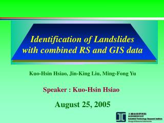
Identification of Landslides with combined RS and GIS data Kuo-Hsin Hsiao, Jin-King Liu, Ming-Fong Yu Speaker : Kuo-Hsin Hsiao August 25, 2005
Identification of Landslides with combined RS and GIS data List of Contents 1. Introduction 2. Landslide Detection 3. Results of landslide interpretation 4. Concluding Remarks
1. Introduction ◆ Geologic and terrain characteristics in TAIWAN ◆ Climate condition – typhoon, torrential rainfall ◆ R.S. data – spatial、temporal resolution resolution, data acquisition, time required for interpretation, combined information of GIS, etc. Lithology-conglomerates Highly fractured rock formations Variations of Geologic Conditions: A section across Taiwan
Requirement of A Monitoring and Early Warning System Both for Emergency Response and for Mitigation Policy Landslide Detection Using Satellite Images High Frequency Periodic Observation and Measurements : Month~Year Data : SPOT-5 or Formosat-2 . . Objectives of the study: Periodic landslide Monitoring for Sustainable Management using high resolution data (for detecting small landslides) Prevention of Illegal Land Use and Deterioration Disaster Damage Estimation Background Introduction Sun-Synchronous Orbit Altitude = 891 km; Inclination = 99.10 deg; Period = 14 Rev/day Orbit of FORMOSAT-2
Research Area: Shihmen Reservoir Introduction SPOT image flight path (CSRSR)
Purpose of the Reservoir General water supply Irrigation High-tech industry Watershed Area:764 KM2 Capacity: 2.5 x 10⁸ M3 Terrain Variation : 252M~3,500 M Average Rain Fall : 2,500 mm/yr Land-Use Type Coniferous Tree, Deciduous Tree Orchard, Rice, Village, Farming, Foresting Bare Soil, River, Mixed-Forest, Bamboo, Grass Land Mixed Coniferous-Deciduous Tree, Others. Shihmen Reservoir Introduction Land-Use Coverage
Shihmen Reservoir Introduction DEM slope Soil map forest type
Duration : Aug. 23 ~ Aug. 25, 2004 Maximum total accumulative rain fall -1,600 mm Maximum rain fall 146 mm / hr Disaster – Typhoon AERE Introduction CWB Contour of Total Accumulative Rain Fall 2004-08-24-09:23 2004-08-25-09:23
Satellite Radar Water Quality after Typhoon Introduction 2004/8/26 FORMOSAT-2 2004/8/26 FORMOSAT-2 High turbidity NSPO CWB NSPO Satellite IR Typhoon Road of AERE
2. Landslides Detection Data Acquisition Formosa-II 2005/04/04 Resolution:2m & 8m SPOT-5 2004/08/16 Resolution:10m SPOT5 2005/03/16 Resolution:2.5m & 10m
Disaster Estimation & Analysis Processes Landslides Detection Classification Day-2 Image Day-1 Image overlay NDVI/CVA NDVI/CVA Change Detection NO Landslide Coverage Change ? Stop YES DTM + Image (3D Visualization) Disaster Estimation On-Site Photography Disaster Areas Overlay Analysis
Various Types of Landcover and Landuses Landslides Detection (a)River-bank landslides (b)Slope landslides (c)Upstream landslides (d) snow on tops (e)Grass lands (f)Excavated lands (g)Cultivated lands (h)Mountain village (i)Plain villages (j) Cemetery (k)Roads (l)Rivers
Landslide interpreted from SPOT5 10m & 2.5m Results Spatial resolution : 10m Spatial resolution : 2.5m
Landslide interpreted from formosat2 8m & 2m Results Spatial resolution : 8m Spatial resolution : 2m
Statistical analysis Results
3D Visualization of Detected Landslides Results Landslide induced by typhoon AERE CSRSR Red regions denote the detected landslides of Formosat-2 test data. CSRSR CSRSR SPOT-5(2004/08/16) SPOT-5(2005/03/16) SPOT-5(2004/08/16) SPOT-5(2005/03/16) On-Site Photography On-Site Photography
Landslide induced by typhoon AERE Results CSRSR On-Site Photography SPOT-5(2004/08/16) SPOT-5(2005/03/16) CSRSR Helicopter Photography SPOT-5(2004/08/16) SPOT-5(2005/03/16)
Flight Simulation after NERE Typhoon Formosat-2 image SPOT image 2003/11/14 Before typhoon NERE 2004/8/31 (NSPO) After typhoon NERE
Comparison with Existing Landslides in GIS databasealso with Cadastral Informations
Requirements of A Monitoring and Early Warning System Bottleneck--Data Acquisition High frequency data acquisition of remote sensing. Near Real-time Dynamic Monitoring… Conclusions • Typhoon AERE • Statistics • 477 & 473 places, total areas of 693.33 & 723.74 hectares of landslides were detected using SPOT-5 and Formosat-2 fusion data • The reliability of landslide detection is high when comparing with on-site photography.
With Formosat-2, A Possibility of Near real-time disaster estimation Provide disaster information in a short time. Historical data collection is important. A comparison can be made by GIS database. Construction of GIS database infrastructure is critical for post-disaster analysis. Conclusions