Download
1 / 19
190 likes | 207 Vues
This study focuses on the use of mesoscale models and observational data to improve predictions of significant weather events in the Gulf of California during the warm season. It highlights the network of routine observations in northwestern Mexico and CICESE's contributions to the North American Monsoon Experiment (NAME) in 2004, including mesoscale model simulations and the study of oceanic processes on sea surface temperature evolution. The expected results include improved distribution of sea surface temperature, observed evolution of the marine boundary layer in significant events, and better initialization and assimilation of model fields at low levels.

E N D
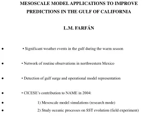
MESOSCALE MODEL APPLICATIONS TO IMPROVE PREDICTIONS IN THE GULF OF CALIFORNIA L.M. FARFÁN • • Significant weather events in the gulf during the warm season • • Network of routine observations in northwestern Mexico • • Detection of gulf surge and operational model representation • • CICESE’s contribution to NAME in 2004: • 1) Mesoscale model simulations (research mode) • 2) Study oceanic processes on SST evolution (field experiment)
NORA, 1997 JULIETTE, 2001 IGNACIO, 2003 MARTY, 2003
Surface station reports: 29 August – 01 September, 2002 •surface airways • synoptic sites • ships and bouys
Network of surface and upper-air stations 200 km Surface airways (12) Automatic sites (13) Upper-air soundings (2) 1,100 km
Upper-air and surface, automatic stations (EMAS) Comisión Nacional del Agua / Servicio Meteorológico Nacional
Eta model, vertical cross section of horizontal winds Sierra Madre Pacific Baja California gulf
3.3-km spatial resolution grid (94x88) La Paz (CNA/SMN) Desert Water City Forests Cd. Constitución (automatic) CIBNOR/SDSU La Paz (MMLP) San José (MMSD) Cabo San Lucas (automatic)
Proposed oceanographic cruises during NAME (Douglas, M. et al. 2003) • 1) Improved understanding of SST spatial and temporal distribution • 2) Observed evolution of marine boundary layer in significant events • 3) Better initialization and assimilation of model fields at low-levels
MESOSCALE MODEL APPLICATIONS TO IMPROVE PREDICTIONS IN THE GULF OF CALIFORNIA L.M. Farfán (farfan@cicese.mx) SUMMARY • • Continental MCSs and tropical cyclones are significant sources of events • • Surface and upper-air network provide data along coastal areas • • CICESE’s contribution to NAME: • a) mesoscale modeling studies for relevant case studies • b) study of the oceanic processes on SST evolution • • Expected results include: • 1) Improved distribution of SST in time and space • 2) Observed evolution of marine boundary layer in significant events • 3) Better initialization and assimilation of model fields at low-levels