

Abstract
E N D
Presentation Transcript
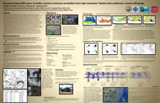
Reconstructing 2000 years of Indian summer monsoon variability from high-resolution Tibetan lake sediments, eastern HimalayaBroxton W. Bird1, Lonnie G. Thompson1, TandongYao21The Ohio State University, Byrd Polar Research Center, 1090 Carmack rd. Columbus Ohio, 43210, USA2Institute of Tibetan Plateau Research, Chinese Academy of Sciences, P.O. Box 2871, Beijing 100085, China Abstract This presentation outlines a joint United States and Chinese NSF funded research initiative to investigate Indian summer monsoon (ISM) dynamics during the last 2000 years using high-resolution lake sediment archives from the eastern Himalaya. Specifically, this work will examine the relationships between ISM dynamics during the Medieval Climate Anomaly (MCA, AD 900 to 1300), Little Ice Age (LIA, AD 1400 to 1800), and current warm period (CWP, the last 100 years) and 1) radiative forcing, 2) ocean-atmosphere variability, and 3) other records of the Indian and Asian monsoon. To address these questions, we will analyze the physical and geochemical characteristics of sediment cores collected from small alpine lakes (~0.1 km2) in the Nyainqentanglha Mountains of the southeastern Tibetan Plateau. This region is ideal for both ISM and Tibetan Plateau water resource investigations because it is located at the point where ISM moisture from the Bay of Bengal is transported into and westward across the Tibetan Plateau. As such, the hydrologic balances of lakes in this region should be highly sensitive to changes in ISM rainfall and record variations in its strength through time. Despite the Nyainqentanglha Mountain’s climatic significance, they are underrepresented in the current body of paleoclimate research. By developing records of ISM variability through time from this region, this research will provide new and valuable information about ISM variability that can be used to explore how and why this system changes through time. Here, we explore the current understanding of ISM variability, its significance, and future research directions. Significance Climatology Images provided by the NOAA/ESRL Physical Sciences Division, Boulder Colorado from their Web site at http://www.esrl.noaa.gov/psd/ 1998 El Niño SSTA 2010 El Niño Modoki SSTA 1997 +IOD Event Figure 2 (a) Vector winds associated with the ISM during June, July, and August. (b) Spatial distribution of ISM precipitation. Figure 3 Sea surface temperature anomalies (SSTA) during the (a) 1998 El Niño event, (b) the 2010 El Niño Modoki event, and (c) 1997 positive IOD event. Photographs illustrating some of the environmental and human systems that ISM supports. Upper left: farmers planting rice in the northwestern state of Punjab. Upper right: The Khumbu Glacier, Nepal. Lower left: Major rivers originating on the Tibetan Plateau. Indian Summer Monsoon The Boreal summer precipitation maximum that characterizes the ISM is associated with a northward position of Intertropical Convergence Zone (ITCZ) and reversal in seasonal wind direction. Although insolational heating of the Tibetan Plateau has been long held as an important driver of the onset of the ISM (e.g., Li and Yanai, 1996), new research suggests that the ISM is initiated and sustained largely by the delivery of warm moist air by the arrival of the ITCZ and its isolation from cool dry air from the Tibetan Plateau by the Himalaya Mountains (Boos and Kuang, 2010). Influences on the ISM ISMR is impacted by internal variability as well as large-scale ocean-atmosphere variability and global teleconnections. Influences include the El Niño-Southern Oscillation (ENSO), the El Niño Modoki, and the Indian Ocean Dipole (Krishnamurthy and Kirtman, 2009; Kumar et al., 2009). Reduced ISMR is associated with warm ENSO events, particularly the Modoki mode, and negative phases of the IOD. Warm ENSO phases are shown above (reduced ISMR) along with a negative phase of the IOD (increased ISRM). These modes dominate interannual ISMR variability. Decadal trends are less well understood because of the paucity of long-term instrumental records. A shift in the secular nature of the Indian summer monsoon occurred at the time of the AD 1976 Pacific and Indian ocean regime shift, however (Clark et al., 2000) , which suggests that decadal and longer-scale ocean atmosphere forcing contributes to ISM variability. • Research Objectives • Collect high-quality sediment cores from alpine lakes in the Nyainqentanglha Mountains. • Produce quantitative records of hydrologic variability using hydroclimate proxies. • Identify temporal patterns of mean state changes in regional ISMR variability for the last 2000 years. • Synthesize our results with other high-resolution paleoclimate records from Asia. • Research Questions • How has ISM intensity changed in the Nyainqentanglha Mountains during the last 2000 years? • Is there evidence for long-term reductions/intensifications of the ISM during the MCA, LIA, or CWP? • How does ISMR variability in the Nyainqentanglha Mountains compare with monsoon variability across Asia? • To what extent do radiative forcing and ocean-atmosphere processes contribute to long-term, high-frequency ISMR variability? Indian summer monsoon rainfall sustains water resources. Glaciers Regional groundwater Rivers Dry season water supplies Agriculture Municipal water supplies - Southern Tibetan Plateau is source of several large rivers (e.g., the Brahmaputra River). - Rainfall from the ISM contributes to Tibetan Plateau water supplies (Tian et al., 2003). - Some work suggests that ISMR is decreasing while intense intervals are increasing (Dash et al., 2009). Isotopes in Precipitation a. b. Figure 4 Annual relationship between δ18O and air temperature in recent precipitation events at four meteorological stations on the Tibetan Plateau (Tian et al., 2003). Approach Methodology This work will collect new lake sediment archives from small alpine lakes in the Nyainqentanglha Mountains. This region was selected because it is a center of ISM activity, but is underrepresented by instrumental and paleoclimate data. Target lakes have been identified in three regions that represent areas most affected by the ISM (Fig. 1 & 2). By reconstructing changes in the hydrologic regimes of these lakes, we hope to identify mean state changes in the strength of the ISM through time and their relationship with larger scale climate phenomenon We choose to utilize lake sediments for reconstructing ISMR because 1) lakes are geographically well-distributed across the Himalaya and Tibetan Plateau, 2) are sensitive to climate change at the time-scales with which this work is concerned, and 3) they often have sedimentation rates equal to, or greater than, 1 mm yr-1 in alpine settings, which justifies sampling sediment cores at annual, or near annual, resolution. • Age Control • 210Pb, 137Cs, 226Ra • 14C • Sedimentology • Total organic carbon • Total carbonate • Grain size • Bulk density • Magnetic susceptibility • Sediment geochemistry • Trace and major elements • - Ca, Fe, Mg, Si, Ti, Al • Stable carbonate isotopes • - δ18O, δ13C • Limnology • Modern lake hydrology • δ18O, δD • pH, DO, temperature, conductivity • Alkalinity Figure 5 Seasonal distribution of δ18O in recent precipitation at four meteorological stations on the Tibetan Plateau (Tian et al., 2003). Figure 6 (a) Correlation between monthly anomalies of temperature and δ18O based on IAEA station data. Significant correlations at p < 0.05 are indicated by white crosses. (b) as in (a) but for correlation between monthly anomalies of precipitation and δ18O (Vuille et al., 2005). Isotopes in precipitation (δ18O, δD) in regions affected by the ISM, or downstream from those regions, are influenced most significantly by the amount of precipitation that occurs during the monsoon season. Lakes in regions affected by the ISM that contain a sedimentary archive suitable for measuring δ18O trends may therefore be useful in reconstructing past hydrologic variability related to mean state changes in the ISM. Regional Records III. Ice Cores Speleothems (Thompson et al., 2000) (Thompson et al., 1989) 6 4 2 I. (Zhang et al., 2008) (Cai et al., 2010) (Cosford et al., 2009) Figure 1 Map of the Tibetan Plateau and surrounding region. Lake records are represented by circles (Table 1) and ice cores by triangles. The target region for this work is shaded in dark gray and numbered with roman numerals I-III. The thick dashed lines demarcate the region of Tibet influenced by the ISM with the Himalaya to the south and the TanggulaMtns. to the north (Tian et al. 2003). The direction of moisture influx to the Tibetan Plateau is shown with grey arrows. Field Plan Supported by US National Science Foundation and the Institute of Tibetan Plateau Research (Chinese Academy of Sciences) , an expedition to recover sediment cores from alpine lakes in the Nyainqentanglha Mountains will be conducted during May and June of 2011. This expedition will spend 1 to 2 weeks at each of the target sites to perform coring and watershed assessment. Initial sediment core analysis will be performed at the Institute of Tibetan Plateau Research. 5 4 6 3 LIA 2 1 MCA 7 II. (Tan et al., 2009) (Hu et al., 2008) (Dykoski et al., 2005) (Berkelhammer et al., 2010) (Thompson et al., 1997) 7 5 3 1 References Figure 7 Comparison of regional monsoon records from speleothems (1-7) and ice core records from the Tibetan Plateau. Also shown is a lake record of the South American summer monsoon from Pumacocha, an alpine lake in the Peruvian Andes. It is apparent from this comparison that late Holocene monsoon variability in Asia is complex. Speleothems from the Dandak cave in India and the Wanxiang cave in China, however, show some noteworthy similarities. This may suggest that western China and India experience similar spatiotemporal patters in monsoon variability. This work will help test this idea. Berkelhammer, M. et al. 2010. Persistent multidecadal power of the Indian Summer Monsoon. Earth and Planetary Science Letters, Vol. 290, Issues 1-2, pp. 166-172, 15 February 2010. Boos, W.R. and Kuang, Z. 2010. Dominant control of the South Asian monsoon by orographic insulation versus plateau heating. Nature, Vol. 463, p. 218-223. Cai, Y. et al. 2010. The variation of summer monsoon precipitation in central China since the last deglaciation. Earth and Planetary Science Letters, Vol. 291, pp. 21-31. Clark, C. O., et al. (2000), Indian Ocean and Indian summer rainfall: predictive relationships and their decadal variability, Journal of Climate, 13, 2503-2519 12 Cosford, J. et al. 2009. Climatic and local effects on stalagmite d13C values at Lianhua Cave, China. Palaeogeography, Palaeoclimatology, Palaeoecology, Vol. 280, pp. 235-244. Dykoski, C.A. et al. 2005. A high-resolution, absolute-dated Holocene and deglacial Asian monsoon record from Dongge Cave, China. Earth and Planetary Science Letters, Vol. 233, pp. 71– 86. Hu, C. et al. 2008. Quantification of Holocene Asian monsoon rainfall from spatially separated cave records. Earth and Planetary Science Letters, Vol. 266, pp. 221-232. Li, C. and Yanai, M. 1996. The onset and interannual variability of the Asian summer monsoon in relation to land-sea thermal contrast. Journal of Climate, Vol. 9, p. 358–375. Tan, L. et al. 2009. Summer monsoon precipitation variations in central China over the past 750 years derived from a high-resolution absolute-dated stalagmite. Palaeogeography, Palaeoclimatology, Palaeoecology, Vol. 280, Issues 3-4, pp. 432-439. Thompson, L.G., E. Mosley-Thompson, M.E. Davis, J.F. Bolzan, T. Yao, N. Gundestrup, X. Wu, L. Klein, and Z. Xie. 1989. 100,000 year climate record from Qinghai-Tibetan Plateau ice cores. Science, 246(4929), 474-477. Thompson, L.G., T. Yao, M.E. Davis, K.A. Henderson, E. Mosley-Thompson, P.N. Lin, J. Beer, H.-A. Synal, J. Cole-Dai, and J.F. Bolzan. 1997. Tropical climate instability: The last glacial cycle from a Qinghai-Tibetan ice core. Science, 276, 1821-25. Thompson, L.G., T. Yao, E. Mosley-Thompson, M.E. Davis, K.A. Henderson, and P.-N. Lin. 2000. A high-resolution millennial record of the South Asian Monsoon from Himalayan ice cores. Science, 289, 1916-1919. Tian, L. et al. 2003. Oxygen-18 concentrations in recent precipitation and ice cores on the Tibetan Plateau. Journal of Geophysical Research, Vol 108, No. D9, 4293. Vuille, M. et al. 2005. Stable isotopes in precipitation in the Asian monsoon region. Journal of Geophysical Research, Vol. 110, p. D23108. Zhang, P., et al. 2008. A Test of Climate, Sun, and Culture Relationships from an 1810-Year Chinese Cave Record. Science, Vol. 322, pp. 940-942. Dun Table 1List of lake-based paleoclimate studies from the Tibetan Plateau identified in 1 showing the length and resolution of the climate record. Gul II. I. Das III. Acknowledgements This research is funded by the National Science Foundation Grant # EAR-1023547. Support is also provided by the Chinese Academy of Science and the Institute of Tibetan Plateau Research.


