Download
1 / 13
130 likes | 164 Vues
Discover the largest natural lake in South America with historical significance and modern importance for oil drilling, fishing, and transportation. Learn about recent environmental challenges and ongoing efforts to protect this vital ecosystem.

E N D
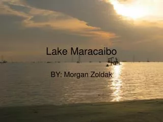
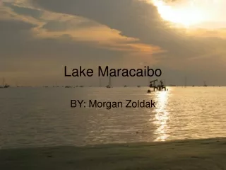
Lake Maracaibo BY: Morgan Zoldak
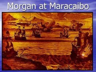
In 1499 Lake Maracaibo was discovered by Spanish Explorer, Alonso De Ojeda. Alonso was said to have been traveling with Christopher Columbus around this time. Who
Lake Maracaibo is the largest natural lake in South America covering an area of about 5,150 sq. miles. It is said to be one of the few ancient lakes as well as one of the oldest. What
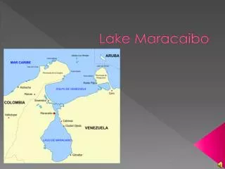
Lake Maracaibo is located in the extremely hot and humid Maracaibo Basin in Northwest Venezuela. It is connected to the Gulf of Venezuela by a 34 mile strait. Where
Of course there are many reasons why this lake is important and is still being used today. It is a natural beauty and attracts people from all over. It helps the economical situation in Venezuela and is a major food source. Why
In the past Lake Maracaibo has been used for travel, fishing, importing and exporting goods and also used for fresh water in the southern portion. Since 1918 the lake has been drilling for oil. Past
Today this lake is still used for oil drilling and produces much of the World’s oil supply. It’s estimated that the Maracaibo Basin holds about 25% of Venezuela’s population. Present
Today this lake is used for oil drilling and produces much of the World’s oil supply. Despite oil pollution and other various pollution it is used for fishing and growing crops such as sugar cane. It also acts as a major shipping route to the Maracaibo and Cabimas ports. How it Shapes Life Today
Lake Maracaibo is the 23rd largest lake in the world. The General Rafael Urdaneta bridge is also one of the largest bridges spanning 8.5 miles across the lake. It took about five years and $1,000,000 to make. Here is a picture of the bridge. More Facts
In Recent News… • A few weeks ago on July 27, 2010 Lake Maracaibo suffered a major oil spill. • It’s said that the oil sludge is almost 10 times denser than the spill in the Gulf of Mexico. • Chief of the gas company, Rafael Ramirez states that about 8,000 gallons of oil is being drained into the lake each day but, he says that the spill in the Gulf of Mexico is far worse and there won’t be much environmental damage. • His statement was proven 100% false as the lake is almost completely closed, unlike the Gulf, which won’t dilute the effects of the oil creating environmental damage that was originally unforeseen.
These are some things being done about the spill: fishermen and about 50 employees of the oil company are working together and cleaning up the spill and also the pipes that had been broken are being replaced. Here is a picture of the oil spill: the dark is where the oil is located. Recent News (cont.)
Bibliography • http://www.infoplease.com/ce6/world/A0831687.html#axzz0wyu6hHhe • http://www.rideforclimate.com/photos/main.php?g2_view=core.DownloadItem&g2_itemId=5968&g2_serialNumber=2 • http://www.freewebs.com/caribbeancelebs/AlonsoDeOjeda.jpg • http://www.encyclopedia.com/topic/Lake_Maracaibo.aspx • http://www.etravelphotos.com/photos.php?keyword=venezuela&page=3 • http://www.bing.com/images/search?q=lake+maraciabo+pictures&FORM=BIFD#focal=35a15cd70724942f0dcd94b1aa612d40&furl=http%3A%2F%2Fwww.randytrahan.com%2Focov%2Fimages%2FTiaJuana%2FTiaJuana04%2F28_Lake_Maracaibo_Eastern_Shore.jpg • http://geoinfo.nmt.edu/staff/scholle/graphics/stamps/venezprf/Venphoto_plane.jpg
Bibliography (cont.) • http://www.worldlakes.org/lakedetails.asp?lakeid=9069 • http://www.britannica.com/EBchecked/topic/363734/Lake-Maracaibo • http://www.absoluteastronomy.com/topics/Lake_Maracaibo • http://www.petroleumworld.com/sf10070401.htm • http://online.wsj.com/article/NA_WSJ_PUB:BT-CO-20100622-712103.html • http://www.venezuelareport.com/wp-content/uploads/2009/06/maracaibo-bridge.jpg • http://cyclops.marine.usf.edu/modis/level3/husf/maracaibo/2003/016/250m/pass/final/MODIS.2003016.154702.maracaibo.qkm.EV_250_RefSB_Band00.png • http://www.bing.com/images/search?q=+The+General+Rafael+Urdaneta+Bridge+&FORM=IGRE5#focal=4339c6bdae8a69e4eb02eb8dec7335e4&furl=http%3a%2f%2fstatic.flickr.com%2f37%2f83395541_3cb8818035.jpg • http://www.ehow.com/about_5348400_maracaibo-venezuela.html