Download

1 / 8
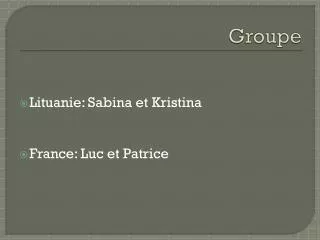
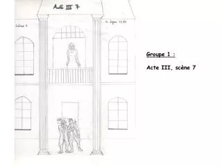
Groupe 1
80 likes | 228 Vues
Groupe 1. Menée par:. Lucaci Laur Cartes Roxana Prunean Radu Petric Alexandra. Position Geographique. Structure. Longitude Latitude Surface. D'une superficie de 551 500 km² la France s'étend sur 1 000 km du nord au sud et d'est en ouest.
Télécharger la présentation 
Groupe 1
An Image/Link below is provided (as is) to download presentation
Download Policy: Content on the Website is provided to you AS IS for your information and personal use and may not be sold / licensed / shared on other websites without getting consent from its author.
Content is provided to you AS IS for your information and personal use only.
Download presentation by click this link.
While downloading, if for some reason you are not able to download a presentation, the publisher may have deleted the file from their server.
During download, if you can't get a presentation, the file might be deleted by the publisher.
E N D
Presentation Transcript
Menée par: LucaciLaur Cartes Roxana PruneanRadu Petric Alexandra
Structure • Longitude • Latitude • Surface
D'une superficie de 551 500 km² la France s'étend sur 1 000 km du nord au sud et d'est en ouest.
C'est le troisième plus grand pays d' Europe , après la Russie et l' Ukraine.
La France métropolitaine a quatre façades maritimes sur : la mer du Nord , la Manche , l' océan Atlantique et la mer Méditerranée .


More Related