Download
1 / 44
440 likes | 575 Vues
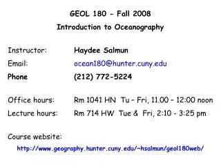
GEOL 180 - Fall 2008 Introduction to Oceanography Instructor: Haydee Salmun Email: ocean180@hunter.cuny.edu Phone (212) 772-5224 Office hours: Rm 1041 HN Tu – Fri , 11.00 – 12:00 noon Lecture hours: Rm 714 HW Tue & Fri, 2:10 - 3:25 pm Course website:

E N D
GEOL 180 - Fall 2008 Introduction to Oceanography Instructor: Haydee Salmun Email: ocean180@hunter.cuny.edu Phone (212) 772-5224 Office hours: Rm 1041 HN Tu – Fri, 11.00 – 12:00 noon Lecture hours: Rm 714 HW Tue & Fri, 2:10 - 3:25 pm Course website: http://www.geography.hunter.cuny.edu/~hsalmun/geol180web/
Course Description: This course will offer an introduction to the fascinating and complex subject of Oceanography. We will discuss physical, chemical, biological and geological aspects of the oceans. We will learn about the structure and motion of the atmosphere and how they influence ocean circulation. We will discuss waves, tides and coasts, and we will make discuss environmental issues connected with the world’s oceans as we discuss all these topics. In addition, although the focus of this course is not biological oceanography, whenever possible we will discuss primary productivity and the distribution of life within the oceans.
January 5, 2008 – Cortes Bank, CA – A sea mount feature of the ocean floor. The highest rides yet, claims 80ft waves....! Yes, we will ...!
Required Text:Oceanography – CUNY, Hunter College, 1th edition, Garrison, T. , 2007, Thomson. Grades: Grades are based on three midterms and a final. 3 midterms – 22% each final exam – 34% Grading is as follows: 90-100=A; 80-89=B; 70-79=C; 60-69=D; <60=F. Come to class, participate and if you encounter difficulties, bring them to the professor’s attention as soon as you find them, don’t wait till the end of the semester!
Keep in mind: One of your best friends in this course is the textbook. Makeup Exams: will NOT be given except in the most extreme cases. Academic Dishonesty: Hunter College regards acts of academic dishonesty (e.g., plagiarism, cheating on examinations, obtaining unfair advantage, and falsification of records and official documents as serious offenses against the values of intellectual honesty. The College is committed to enforcing the CUNY Policy on Academic Integrity and will pursue cases of academic dishonesty according to the Hunter College Academic Integrity Procedures.
Salmun, p.1: GEOL 180 – Fall 2008 – Tentative Lecture Schedule
Salmun, p.2: GEOL 180 – Fall 2008 – Tentative Lecture Schedule
Salmun, p.3: GEOL 180 – Fall 2008 – Tentative Lecture Schedule
Salmun, p.3: GEOL 180 – Fall 2008 – Tentative Lecture Schedule
Chapter 1 Knowing the Ocean World Oceanography: Definition and Subdisciplines The World’s Oceans – general characteristics Erastosthenes and the size and shape of Earth Latitude and Longitude Longitude and Time The History of Oceanography
Oceanography: is the study of the earth's oceans and their interlinked ecosystems , geological, chemicaland physical processes. • Geological oceanography: the study of geologic processes in the oceans (plate tectonics, coastal morphology) • Chemical oceanography: the study of the chemistry of the oceans • Meteorological oceanography: the study of the interaction between atmosphere and the oceans • Physical oceanography: the study of the physical attributes of the oceans (temperature-salinity structure, waves, tides, currents) • Biological oceanography: the study of the flora and fauna of the oceans
Chapter 1 - General description of the world’s oceans, Latitude and Longitude or how to find an ‘address’ on Earth, some history of scientific discovery. Chapter 2 - Earth and its origins, life and the oceans Geological oceanography: the study of geologic processes in the oceans (plate tectonics, coastal morphology) Inner structure of the Earth and how oceans and continents form – Chapter 3 – Ocean floor, continental margins and ocean basins – Chapter 4 – A look at what makes ocean features: sediments – Chapter 5. Chemical oceanography: the study of the chemistry of the oceans This is a lot about physics too, as it deals with the internal structure of the matter that makes the oceans: water – Chapter 6 – Then ocean water is not just pure water, it has salt and many other dissolved components – Chapter 7.
Meteorological oceanography: the study of the interaction between atmosphere and the oceans • Where there is ocean there is motion: the waters move because the air moves. Hence, where there is oceans there is an atmosphere, and they interact – Chapter 8. • Physical oceanography: the study of the physical attributes of the oceans (temperature-salinity structure, waves, tides, currents) • Finally we look into the motion of sea water in detail, first at the surface currents and how surface motion relates to motion deeper in the oceans – Chapter 9 – Motion of energy across the sea surface by waves: big waves, small waves, internal waves, huge-enormous waves – Chapter 10 – The longest of all oceans waves: the tides – Chapter 11. • Chapter 12 – Coasts & Estuaries is a lot about connections among all other chapters!
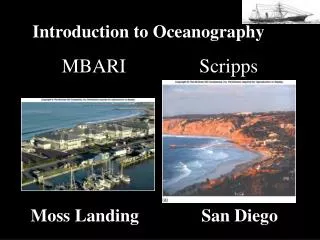
Three of the most prominent oceanographic institutions in the US: Lamont-Doherty Earth Observatory of Columbia University, NY Woods Hole Oceanographic Institute, Cape Code, MA (MIT) Scripps Institution of Oceanography, La Jolla CA (UC-San Diego)
Chapter 1 Oceanography: Definition and Subdisciplines The World’s Oceans – general characteristics Erastosthenes and the size and shape of Earth Latitude, Longitude & Longitude and Time The History of Oceanography
Summary of the relative amount of water in various locations on or near Earth’s surface. More than 97% of the water lies in the ocean. Of all water at Earth’s surface, ice on land contains about 1.7%, groundwater 0.8%, rivers and lakes 0.007%, and the atmosphere 0.001%. NOTE, as small as they may be, are unimportant!
Mid-Atlantic Ridge Ocean’s deepest spot Earth’s highest mountain Pacific Ocean Basin, Earth’s largest feature Fig. 1-2a, p. 3 The average depth of the ocean is 4 ½ times as great as average land elevation (about 840 m or ½ mile). Note the extent of the Pacific Ocean, Earth’s most prominent single feature.
Chapter 1 Oceanography: Definition and Subdisciplines The World’s Oceans – general characteristics Erastosthenes and the size and shape of Earth Latitude, Longitude & Longitude and Time The History of Oceanography
Understanding the Ocean Began with Voyaging for Trade and Exploration • Voyaging on water was important to many early civilizations. The Egyptians, Cretans, and Phoenicians were all skilled sailors. • Cartographers, or chart makers, recorded information about locations and landmarks and currents. • Today, charts are detailed graphic representations of water and water-related information. • The Library at Alexandria, in Egypt, was founded in the third century B.C. This library stored information on every area of human endeavor. • Eratosthenes of Cyrene was the second librarian at Alexandria. He was the first to calculate the circumference of Earth. He also invented a system of longitude and latitude. • The principles of celestial navigation were invented at the Library at Alexandria.
Parallel rays from sun Shadow of pole ~7° 1/50 circle Vertical pole at Alexandria 785 km (491 mi) Center of Earth 1/50 circle ~7° Vertical well at Syene Eratosthenes (200 B.C.) calculated what Pythagoras (~ 500 B.C.) already knew: size of Earth A diagram showing Eratosthenes’s technique for calculating the circumference of Earth. He used simple geometric reasoning based on the assumptions that Earth is spherical and that the sun is very far away. Using this method, he was able to discover the circumference of Earth to within about 8% of its true value.
Parallel Thule NORTHERN OCEAN EUROPE Borysthenes Danube Byzantium Rhodes Alexandria Ganges ASIA Tropic line Libya India Arabia Nile Meroe Meridian of the Alexandria Meridian of the Pillars of Hercules Meridian of the Indus Meridian of the Ganges ATLANTIC OCEAN The ‘world’ of Eratosthenes: first lines of latitude and longitude
Earth’s geometry & Earth’s Rotation One complete revolution in 1 day = 24 hours (360°) Average Earth’s Radius: ~ 6400 km Earth’s shape: Oblate Spheroid
Chapter 1 Oceanography: Definition and Subdisciplines The World’s Oceans – general characteristics Erastosthenes and the size and shape of Earth Latitude, Longitude & Longitude and Time The History of Oceanography
North Pole 60°N 30°N Latitude 0° Equator 30°S South Pole Latitude
North Pole Reference: Prime meridian Longitude 60°W 0° at Greenwich South Pole Determining Longitudes
Every 15° of longitude correspond to 1 hour The clock is set to noon when the Sun is at its zenith above the prime meridian Longitude and Time
North Pole 60°N 30°N A’ B’ 0° A 30°E B 60°W 0° 30°W 30°S South Pole NOTE: Lines of latitude are always the same distance apart (1° is always equal to 1°!) but the distance between two lines of longitude varies with latitude. This means that: 1. For example, the distance between the latitudes of the equator (0°) and of 30°N is the same as the distance between the latitudes of 30°N and 60°N. 2. At the latitudes of the equator (0°) and of 30°N there is 30° of longitude between points A and B and between the points A’ and B’ but the distance between A and B is different (larger) than the distance between A’ and B’.
Chapter 1 Oceanography: Definition and Subdisciplines The World’s Oceans – general characteristics Erastosthenes and the size and shape of Earth Latitude, Longitude& Longitude and Time The History of Oceanography
Southeast Asia Philippines Indonesia New Guinea Oceanography has quite a long history: The Polynesian colonization's are an example of knowledge of oceans and marine science used to colonize a vast number of islands. Ancestors of the Polynesians spread from Southeast Asia or Indonesia to New Guinea and the Philippines by about 20,000 years ago.
Southeast Asia Philippines Indonesia New Guinea The eight major Hawaii islands - Oahu, Maui, Kauai, the Big Island, Lanai, Molokai, Niihau, Kahoolawe, and over 100 small islets of Hawaii lie upon the northwest Pacific to southeast Pacific Ocean. Oceanography has quite a long history: The mid-Pacific islands have been colonized for about 2,500 years, but the explosive dispersion that led to the settlement of Hawaii occurred about A.D. 450-600.
Viking Raiders discover North America! • Coming from what is now Northern Europe, time period A. D. 850 to 1000, colonized Iceland then Greenland and then south from there along the coast. • Contributions from Chinese navigators: • They began exploring (around the 1400s) the Indian Ocean, Indonesia, Africa and the Atlantic. The Chinese invented: • The central rudder • Water-tight compartments • Sails on multiple masts
Then comes the “Age of Discovery”: Europeans explored the world by sea during the Renaissance Period (12th, 13th and 14th centuries). Henry the Navigator –Explorers under his patronage compiled detailed charts and explored the west coast of Africa. Christopher Columbus –Although he never saw the mainland of North America, his stories inspired other explorers to follow. Ferdinand Magellan – Although Magellan died en route, the small surviving portion of his crew circumnavigated the globe.
And then come the British – begins the use of science • James Cook, a commander in the British Royal Navy, is credited with leading voyages that greatly contributed to scientific oceanography. Some of the accomplishments of James Cook and his scientists include: • Verification of calculations of planetary orbits Charting of New Zealand and the Great Barrier Reef, Tonga and Easter Islands • Initiation of friendly relations with many native populations • Sampling marine life, land plants and animals • Recording data concerning the ocean floor and geological formations
First Scientific Expeditions were undertaken by Governments The United States Exploring Expedition launched in 1838 was a naval and scientific expedition. The HMS Beagle, on which Charles Darwin served as a naturalist, voyaged to South America and some Pacific Islands. HMS Challenger expedition (chart below) of 1872-1876 was the first oceanic expedition dedicated to scientific research.
Enter the United States: Challenger Expedition 1872-76 • 3.5 year voyage • 361 depth soundings • 1000’s of water & bottom samples, temp. readings • 20 years to analyze data • 50 volumes of reports, maps, etc. • Began descriptive oceanography
Advances in oceanic exploration in the 20th century Contemporary Oceanography makes use of modern Oceanography • Polar Exploration –explorers reached both the North and South poles in the twentieth century • The Meteor Expedition – the first expedition to use modern optical and electronic equipment for oceanographic investigation • The Atlantis – investigations by scientists on this research vessel confirmed the presence of the Mid-Atlantic Ridge. • The Trieste – a blimp-like bathyscaphe which descended into the Challenger Deep area of the Mariana Trench • Glomar Challenger –samples obtained by scientists on this drilling ship provided confirming evidence for seafloor spreading and plate tectonics.
20th Century Voyages Contributed to Oceanographic Knowledge Echo sounders sense the contour of the seafloor by beaming sound waves to the bottom and measuring the time required for the sound waves to bounce back to the ship. If the round-trip travel time and wave velocity are known, distance to the bottom can be calculated. This technique was first used on a large scale by the German research vessel Meteor in the 1920s.
Some specifics: • World War II (military applications!): Sonar Development for “submarine detection” and data collection for “bomb testing”. Around this time, Coastal Oceanography/ Engineering become formally a discipline. • The Glomar Challenger Deep Sea Drilling Program (1968) • had computers on board so Data Processing could begin at Sea and research adjusted as needed – great saving of time and effort! • NOAA (Nat. Oceanic & Atmospheric Admin., 1970), and with it National Ocean Survey (NOS), National Weather Service (NWS) National Marine Fisheries, Environmental Research Laboratories (ERL) and the Sea Grant College Program to foster academic studies of oceanography. • Hydrothermal Vents were observed late 1970’s
Improved Ocean Circulation due to the advent of satellites • Environmental Awareness 1980’s • Fisheries Degradation • Biological Productivity • GOOS “Global Ocean Observing Systems” • since 1991 • Increase understanding/ warning “El Nino” • MARA “Mid-Atlantic Regional Association • 2004 – 2005 Global Environmental Change
A final note on “Human Health and the Oceans (National Research Council, 1999) • In 1997, the NRC’s Governing Board approved a project proposed by the Ocean Studies Board (OSB), in cooperation with the Institute of Medicine’s Division of Health Science Policy entitled “The Ocean’s Role in Human Health.” • Topics addressed in this project: • Marine natural disasters and public health: Can we better model and predict marine natural disasters? Can we better anticipate effects on public health? • Climate and the incidence of infectious diseases: Are waterborne diseases detectable and predictable? How do changes in climate—both regional and global—impact disease vectors?
Hazards associated with toxic algal blooms: What causes toxic algae to bloom? Can their outbreak be predicted, mitigated, and prevented? Why has the incidence of these blooms been increasing? • The therapeutic potential of marine natural products: What are the implications of the discovery of life a thousand meters below the seafloor? Have we adequately examined marine biotechnology for medically important products? • Marine organisms as models for biomedical research: Are there marine species that could serve as useful medical models? Can marine species offer new understanding of human development or physiology? • National Research Council (NRC). 1999. From Monsoons to Microbes: Understanding the Ocean’s Role in Human Health. National AcademyPress, Washington, D.C.