Download
1 / 9
90 likes | 162 Vues
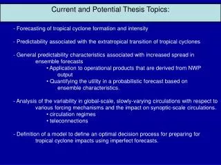
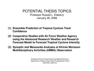
POTENTIAL THESIS TOPICS Professor Russell L. Elsberry January 26, 2006. Ensemble Prediction of Tropical Cyclone Track Confidence Cooperative Studies with Air Force Weather Agency using the Advanced Research Weather and Research Forecast Model to Forecast Tropical Cyclone Intensity

E N D
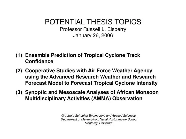
POTENTIAL THESIS TOPICSProfessor Russell L. ElsberryJanuary 26, 2006 • Ensemble Prediction of Tropical Cyclone Track Confidence • Cooperative Studies with Air Force Weather Agency using the Advanced Research Weather and Research Forecast Model to Forecast Tropical Cyclone Intensity • Synoptic and Mesoscale Analyses of African Monsoon Multidisciplinary Activities (AMMA) Observation Graduate School of Engineering and Applied Sciences Department of Meteorology, Naval Postgraduate SchoolMonterey, California
(1) Ensemble Prediction of Tropical Cyclone Track Confidence Background: The so-called “Poor man’s ensemble” that is a consensus of tropical cyclone track predictions from multiple centers has been effective in improving the track forecasts to 72 h. Whereas 10 such track predictions are available to 72 h, the spread among this sample of tracks gives an indication of the uncertainty of the track forecast. Because only four model tracks are available beyond 72 h, the consensus tracks are not as accurate and the sample is too small for estimating the confidence. Objective: Demonstrate that a pre-processed ensemble of tropical cyclone tracks will provide more accurate 4-day and 5-day forecasts and a measure of the confidence in that track forecast.
(1) Ensemble Prediction of Tropical Cyclone Track Confidence (continued) Approach: (1)Collect tracks from ensemble prediction systems: Joint Ensemble Forecast System (JEFS), which will be available this season; European Center Medium-range Weather Forecasts (ECMWF), which will have higher resolution and may have accompanying ocean surface waves. (2) Apply pre-processing technique to discard those ensemble tracks that begin so poorly as to not be representative of an actual track. (3) If required, also apply a post-processing technique to complete a representative spread of tracks at each forecast interval. (4) Compare spread of the ensemble track forecasts with the observed spread, and develop a measure of track forecast confidence for a given spread of the ensemble tracks.
(2) Cooperative Studies with Air Force Weather Agency using the Advanced Research Weather and Research Forecast Model to Forecast Tropical Cyclone Intensity Background: Western North Pacific tropical cyclone intensity forecasts are not adequate. The main tool is a statistical technique that has known deficiencies (rapid intensification and decay). Dynamical models with high horizontal resolution such as the ARW offer hope for skillful forecasts. Objective: Demonstrate that a better representation of the tropical cyclone in the ARW model initial conditions will result in skillful intensity forecasts.
(2) Cooperative Studies with Air Force Weather Agency using the Advanced Research Weather and Research Forecast Model to Forecast Tropical Cyclone Intensity (continued) • Approach: (1) Work with AFWA and Fleet Numerical Meteorology and Oceanography Command to incorporate the Geophysical Fluid Dynamics Laboratory-Navy version model initial conditions into the ARW. • Select a number of representative intensity forecasts to test the new ARW version. • Summarize ARW intensity (and track) forecasts relative to the Air Force MM5 and other guidance available to the Joint Typhoon Warning Center. • Analyze sources of errors and recommend needed upgrades to make a viable intensity forecast model for western North Pacific tropical cyclones.
(3) Synoptic and Mesoscale Analyses of African Monsoon Multidisciplinary Activities (AMMA) Observation Background: Africa is considered likely future area of military conflict, and yet surprisingly little is known about the weather systems over and downstream of West Africa. Best data set ever collected over Africa will be available later in 2006.
(3) Synoptic and Mesoscale Analyses of African Monsoon Multidisciplinary Activities (AMMA) Observation (continued) • Objectives: (1) Document the structure and evolution of the African Easterly Jet on synoptic and mesoscale space scales and its contribution to tropical wave accumulation. • Document the African Easterly Waves and their relation to the African Easterly Jet—Energetics due to barotropic instability or convective heat release. • Detect and document the existence and characteristics of the Northern Vortex and its relation to the African Easterly Jet and African Easterly Waves. • Document the existence and structure of the Saharan Aerosol Layer and its relation to tropical cyclone formation and intensification downstream.
(3) Synoptic and Mesoscale Analyses of African Monsoon Multidisciplinary Activities (AMMA) Observation (continued) Analysis/Data Sets: Available: NOGAPS, GFS, UKMO, (ECMWF 25 km?), Various satellite data sets Approach: (1) Extract AEJ in jet-following coordinate system and its path, east-west (or along-stream) variability as it relates to wave accumulation as a source of wavelength decrease while also amplifying (2) Using the detailed analyses, extract the fields relative to African Easterly Waves. Track these waves relative to AEJ and convective system. Calculate energetics due to these effects.
(3) Synoptic and Mesoscale Analyses of African Monsoon Multidisciplinary Activities (AMMA) Observation (continued) Approach (continued): (3) Use vortex tracker to detect the northern vortices. Track these waves relative to the AEJ (or the orography). Determine the environmental characteristics of these vortices, and document the satellite-derived convection characteristics relative to the vortices. (4) Use the CIMSS Saharan Aerosol Layer (SAL) data set and the Naval Research Laboratory Total Precipitable Water Values to document outbreaks of SAL from West Africa in relation to the AEJ, AEW, and northern vortices and their effect on tropical cyclone formation.