Download
1 / 3
30 likes | 177 Vues
City Planning is a Continuous process; responding to multifarious developments internal And external, with developing technology a City has new roles to play and urban development Needs new directions. For new directions of planning we require data, facts, information of Present and past so that our planners can plan for future needs on the basis of information, Data, facts available to them. Keeping in view the comparative data of past, present and Future a plan is prepared by planners. For arranging or collection of various data, facts and Information we need Services of a specialists, highly experienced and trained professional Called Surveyor who Should expertise in data collection and its evaluation. It is a fact that the Surveyor is very close to nature, problems of planning. Surveyor is very close to people and to Facts on ground . it is not important that he should be qualified only but he should be trained And experienced for type and nature of survey to be conducted and its evaluation, impact on City planning.

E N D
Modern Technique For Land Caluation For Master Plan Of A City City Planning is a Continuous process; responding to multifarious developments internal And external, with developing technology a City has new roles to play and urban development Needs new directions. For new directions of planning we require data, facts, information of Present and past so that our planners can plan for future needs on the basis of information, Data, facts available to them. Keeping in view the comparative data of past, present and Future a plan is prepared by planners. For arranging or collection of various data, facts and Information we need Services of a specialists, highly experienced and trained professional Called Surveyor who Should expertise in data collection and its evaluation. It is a fact that the Surveyor is very close to nature, problems of planning. Surveyor is very close to people and to Facts on ground . it is not important that he should be qualified only but he should be trained And experienced for type and nature of survey to be conducted and its evaluation, impact on City planning.
India faces tremendous pressure on her existing natural resources being the 2nd most Populous nation in the world. The growth of our population ias increasing with an alarming rate, hence every parcel of land should be utilized judiciously, to cater the needs and demands of the growing population. According to a recent report of the Govt. of India, the land availability is declining and will continue to decline if necessary steps are not taken by the planners, values scientists , social activists NGOS etc. to control population explosion and optimum utilization of land available. Since, the land is limited, we should concentrate and make our efforts for its optimal utilization for the benefit of human kind. Project success mainly depends upon (a) the site selection, (b) detailed survey of site And (C) topography of area and availability of resources. Therefore, we have to avail the Services of surveyor & valuer before conceiving any project /scheme, may be rural or urban Infrastructural development.
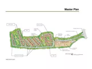
Land is a finite resource and is under tremendous pressure on account of growing Population. It has been put to various uses such as residential, industrial, agriculture, mining, Recreation etc. the value of a piece of land depends upon the surrounding and can be valuated On the basis of its location defined by economic and business activity and presence of Infrastructure. Remote sensing is one such technology which can be of immense use in land evaluation.The remote sensing data provides a Synoptic view of the earth S Surface with all natural as Well as Man made features. With the availability of high resolution satellite data it has now become possible to map individual dwellings at city/ ward level utilities/infrastructure mapping at city/ ward level can also be done using high resolution PAN data, which depicts road network,power and telecom lines, health and educational facilities etc. Hence remote sensing data can play a key role in evaluation of land by mapping infrastructure and other necessary details which are important in deciding the cost of a piece of land. As a simple example, a piece of land lying adjacent to a lake will have a higher value than a piece of land by the side of a drain. However, the value will also vary depending upon the purpose for which the land is proposed to be utilized. If one is looking a piece of land for commercial purpose, he should target the heart of the city in contrast to a person who is looking for an industrial set up,which requires a land outside the city limit. Remote sensing data provides a time and cost effective solution for land evaluation, which can be very useful for planners and decision makers involved in real estate and industrial sectors.