Download
1 / 17
170 likes | 338 Vues
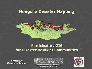
Mongolia Disaster Mapping. Participatory GIS for Disaster Resilient Communities. NorthWest Response Teams. Marc Lindenberg Center For Humanitarian Action. Northwest Response Teams. NGO Capacity Building GIS and Remote Sensing Response Teams Global Networking

E N D
Mongolia Disaster Mapping Participatory GIS for Disaster Resilient Communities NorthWest Response Teams Marc Lindenberg Center For Humanitarian Action
Northwest Response Teams • NGO Capacity Building • GIS and Remote Sensing Response Teams • Global Networking • Vulnerability Assessment • Disaster Mitigation • Sustainable Development University of Washington Marc Lindenberg Center Contact: Glenn Brooks GIS Manager Seattle Data Center Brooks.Glenn @ Comcast.net Cell: 1-206-790-8711
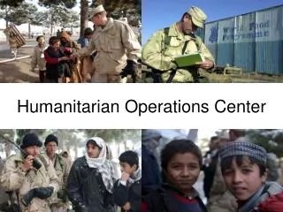
DISASTER ASSISTANCE • Mercy Corps Tsunami GIS Response: Sri Lanka, Aceh • City of New Orleans GIS Consultation • IWG-NGO Global Data Center Project • Gates Foundation African Public Health Assessment • Microfiance Risk Reduction Workshop-Latin America • $ 900,000 Software Donations • $ 1.5 Million Satellite Imagery Acquisition • VOLUNTEER MOBILIZATION • 140 PNW and International Volunteers • 23 Workgroups • 5,500 Volunteer Hours Marc Lindenberg Center North West Response Teams Current Programs
MLC-NWRT GIS Vision Statement Put Information Into Action to Support Humanitarian Relief and Development
Definition: • Participatory GIS • For Resilient Communities • Grass roots interaction, empowering local residents to interpret, map and communicate knowledge of land use, resources, and the environment, to mitigate vulnerability and improve community resilience.
Mongolia GIS Goals and Objectives • GIS Capacity Building for Disaster Planning, Mitigation, and Response • Civil Society ( Urban & Rural) Economic Resiliency Network • Remote Sensing/GIS for Rapid Assessment and Response ( Dzud) • National Geospatial Data Center Technology Transfer • Community Leadership and Program Decision Making • 5. Peer-to-Peer/Peer-to-Government Disaster Policy Dialog
GIS Framework3 Components Remote Sensing: GPS Data Collection GIS Analysis
Software • People A Geographic Information System What is GIS? • Geographic Information Informs Decision Making and Leadership
Integrating Layers . . . Social Factors Agriculture Engineering Transportation Data Layers Store Information In Databases
Very high 3 Scrub 17 Clay Polygon Spatial Databases and Tables A GIS stores program information in database tables that are linked together by geography.
Sectors Villages Programs Patterns Linkages Trends GIS is a Program Tool See the Whole Mongolia Programs
Phase I: Spatial Data Infrastructure Vulnerability Response Model
Build Common Operating Picture Mongolia National Vulnerability Analysis - drought - Northern Forest & Grasslands
Phase 2: Conduct Village LevelStakeholder Assessment Village Scale Map Based High Data Definition
Airlift Deliverable: Mongolia Stakeholder Action Plan Convoy Route Local Response
Mongolia Data Center • An Operational Network - • Information Gateway for • Capacity Building, Community Input, • Training, Data management • GIS builds Decision Making & Leadership Capacity • Support NGO Consortium • Relief and Development Programs • Local Data Collection Teams • become Knowledge Workers in • Development Programs.