Understanding Environmental Justice Through GIS Applications: A Case Study
60 likes | 172 Vues
This web application explores the concept of Environmental Justice utilizing Geographic Information Systems (GIS). It visualizes key datasets such as Superfund sites, census information on educational attainment, housing, and demographics. By symbolizing census data into three classes, users can understand the gradients of socioeconomic variables across the state. The application allows users to select specific census tracts to view the intersection of these areas with Superfund sites. Downloadable datasets and methodological challenges encountered during development are also discussed.

Understanding Environmental Justice Through GIS Applications: A Case Study
E N D
Presentation Transcript
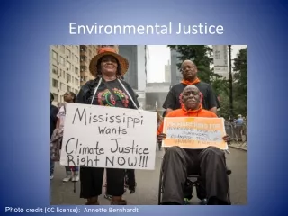
Environmental Justice on the web GIS web applications Jennings 12-18-12
Datasets Used • Superfund sites (DTSC) • Census datasets • % HS grads • Vacant housing units • % under age 5 • % Spanish speaking at home • Census tracts • Bing road
Methods • Symbolized census data into 3 classes to represent gradient across state • Plotted superfund sites on top • GP Model • Choose a census tract you’re interested in (select by attributes) • See the superfund sites in that tract (intersect)
Challenges • Lots • Geodatabase locked • SOC crashed • Switched comps • I clicked too many things • Model pointed to layer file instead of shapefile (so it showed up as not existing)