Download
1 / 14
140 likes | 308 Vues
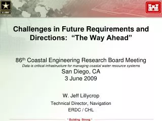
Challenges in Future Requirements and Directions: “The Way Ahead”. 86 th Coastal Engineering Research Board Meeting Data is critical infrastructure for managing coastal water resource systems San Diego, CA 3 June 2009. W. Jeff Lillycrop Technical Director , Navigation ERDC / CHL.

E N D
Challenges in Future Requirements and Directions: “The Way Ahead” 86th Coastal Engineering Research Board Meeting Data is critical infrastructure for managing coastal water resource systems San Diego, CA 3 June 2009 W. Jeff Lillycrop Technical Director, Navigation ERDC / CHL
Overview • Synthesize Presentations • Discuss Needs • Identify a conceptual framework • Identify Challenges
Needs / CWG • Standardized and accessible data storage (consistent into the future, adaptive, robust, discoverable, not program-specific) • Consistent national guidance and data collection standards with identified POC’s • Identify regional and time-scale issues and needs • Regional cooperation and knowledge of data collection efforts would encourage more data sharing and less data collection overlap • Potential identification of “Keepers of Data” (i.e. water level, wave, profile, etc.) to maintain consistency and access • Identify data needs to support multiple scenario, risk-based, and performance-based investigations • Identify data collection needs related to projects / people at risk (benefits/payoffs) • Move toward consistent base level funding of long-term data needs • Survey helps summarize current status. Additional steps needed to address: • What data already exists? What data do we need and why? What problems are we trying to solve?
Needs / OCM • A broad OCM community • A clear understanding of information required by ocean and coastal decision-makers and resource managers • A comprehensive, coordinated, long-term, sustainable OCM program providing the basic data and derived information products at appropriate scales and time intervals to support ecosystem-based approaches to resource management • One-stop data and product discovery • Map Once - use & fuse many times!
Data User Discover Wave buoy Acquire Data Collector Re-format Collection Quality control Quality control Integrate w/other data Format Analyze/Explore Distribute Create Product Archive Interpret Wave Forecast Make Decisions Needs / IOOS Data Discovery“Deep” web “User friendly” Acquire Collection Collection New Sensors Quality control Quality control Integrate w/other datacustomizable Standard Formats, including GIS Analyze/Explorestandard tools More Powerful Servers Integrated Productsanimated, customized EstablishedArchives InterpretScenario testing Better Decisions
Synopsis • Data is required to execute our missions • We have requirements for a wide range of data types – temporal, spatial, financial, real-time, legacy, biological, chemical, physical, environmental, economic… • Corps collects / produces a lot of data that is indispensable to us, our stakeholders, and the public • Corps relies on other agencies for much data: other Fed (USGS, NOAA, others), coastal States (TX, LA, MS, AL, FL, CA, OR, WA, all), NGO’s, and Universities • There are national & regional issues that require data partnerships to adequately address • Need a sustainable framework to discover, access, and use data
Data Access and Visualization • Hurricane Evacuation Zones Mapping Tool • Legislative Atlas • Historical Hurricane Tracks IMS • Hazard Assessment Tool • Data Handling Tools • Lidar Data Handler • Chart Reprojector • Electronic Navigational Chart Handler • Nautical Chart Viewer • Decision Support • Habitat Priority Planner • Nonpoint-Source Pollution and Erosion Comparison Tool • Impervious Surface Analysis Tool • CanVis Visual Simulation Tool • Multipurpose Marine Cadastre • Informational • Storm Mapping Tutorial • Storm Data Resource Guide Data – Tools - Training
IOOS Data Management and Communication Client Components Decision Support Forecast Models General Public Science Users System Monitoring … Utility Services Format Conversion DataIntegration … Visualization Catalog Registry Data Access Services Regular Grids Feature Collections Unstructured Grids … Pull Subscribe Alert Data Assembly Model Outputs … Industry Real-Time Archives Federal Regional Int’l Observing Systems XBT Buoys Fixed Stations HFR Satellite Drifters Ship Cruises AUV …
IOOS / USACE Navigation NOAA Condition Reports Navigation Applications Jetty Conditions Channel Performance Dredging & Inspection Regional Sed Budget TES Others Utility Services Google 3rd Party Viewers District Nav Web Site Data Picker Corps Map Viewer GOMA PHINS Navigation Gateway SI Tools OMBIL Data Access Services Alert Web Services Regular Grids Feature Collections Subscribe Unstructured Grids Pull Real-Time Waves Real-Time Tides District SDSFIE Corps Map database Local Sponsor Other Fed SI Sea Turtle database Model Inputs Data Mgmt. CEFMS Data Sources Hydro Surveys CE Tides Permit/environ NCMP Regional Mapping budget NOAA Tides AM FEMS SI USGS Stream gages Base Maps
IOOS / DMAC NOAA Condition Reports Navigation Applications Jetty Conditions Channel Performance Dredging & Inspection Regional Sed Budget TESS Temporal data standards (directional waves, current speed & direction, tide height, transmissivity, backscatter, turbidity, many others) Spatial data standards (SDSFIE, FGDC, ISO, many others) Modeling data standards (NetCDF, XMDF, DSS, OpenDAP, many others) Financial data standards (and other tabular data) Sensor data standards (wave gage, lidar, tide gage, multibeam, GPS, photo, radar, ADCP, flow meter, pumps, heave, sound velocity, many others) Others Utility Services Google 3rd Party Viewers Corps Map Viewer Web Services Data Picker GOMA PHILS SI Tools OMBIL Navigation Gateway IT Security Operational Reliability Data Quality Assurance Metadata Configuration Mgmt Data Access Services Alert Web Services Regular Grids Feature Collections Subscribe Unstructured Grids Pull CEFMS Real-Time Waves Real-Time Tides District SDS Corps Map database Local Sponsor Other Fed SI Sea Turtle database Model Inputs Data Mgmt. Data Sources Base Maps Hydro Surveys CE Tides Permit/environ NCMP Regional Mapping budget NOAA Tides AM FEMS SI USGS Stream gages
Navigation: Dredging & Inspection NOAA Condition Reports Navigation Applications Jetty Conditions Channel Performance Dredging & Inspection Regional Sed Budget TES Others Utility Services Web Services Data Picker Navigation Gateway SI Tools OMBIL Google 3rd Party Viewers GOMA PHILS Corps Map Viewer Data Access Services Alert Web Services Regular Grids Feature Collections Subscribe Unstructured Grids Pull Real-Time Tides Real-Time Waves District SDSFIE Corps Map database Local Sponsor CEFMS Other Fed SI DIS Model Inputs Data Mgmt. Data Sources Hydro Surveys CE Tides Permit/environ NCMP Regional Mapping budget NOAA Tides Waves SI USGS Stream gages Base Maps
Navigation: Channel Performance Decision Support Available Data Tools & Apps How do I… NOAA Condition Reports Navigation Applications Jetty Conditions Channel Performance Dredging & Inspection Regional Sed Budget TES Others Utility Services Google 3rd Party Viewers Web Services Data Picker Corps Map Viewer Navigation Gateway SI Tools OMBIL GOMA PHILS Data Access Services Web Services Regular Grids Feature Collections Alert Unstructured Grids Subscribe Pull Features District SDS Other Fed Real-Time Waves Real-Time Tides NDC Corps Map database Local Sponsor CEFMS Industry Data Mgmt. SI Data Sources Hydro Surveys USCG AIS Stream Gages NCMP Regional Mapping CMTS Data NOAA Tides Waves SI USGS Stream gages Base Maps
Challenges Goal (?): Leverage IOOS DMAC & Digital Coast concept for USACE Effort – requires a detailed design based on requirements Size of effort – requires Districts, Divisions, Labs, HQ Commitment – requires discipline & participation Process – complex, technical, does not currently exist Infrastructure – Corps-wide, does not currently exist