Download
1 / 31
320 likes | 508 Vues
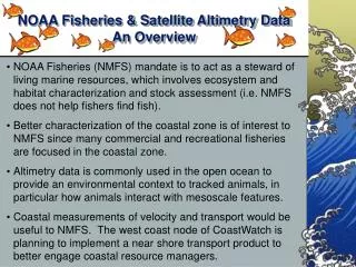
The Importance of satellite data to Fisheries management. Cara Wilson NOAA/NMFS/SWFSC Environmental Research Division (ERD) (formerly PFEL). 4th GOES-R User Conference, Broomfield, CO, May 2, 2006. Contributors. Jay Barlow NOAA/NMFS/SWFSC E.A. Becker UCSB

E N D
The Importance of satellite data to Fisheries management Cara WilsonNOAA/NMFS/SWFSC Environmental Research Division (ERD)(formerly PFEL) 4th GOES-R User Conference, Broomfield, CO, May 2, 2006
Contributors Jay Barlow NOAA/NMFS/SWFSC E.A. Becker UCSB Steven Berkeley UC Santa Cruz Bob Brownell NOAA/NMFS/SWFSC Rich Charter NOAA/NMFS/SWFSC Rich Cosgrove NOAA/NMFS/SWFSC Dave Foley NOAA CoastWatch, West Coast node Karen Forney NOAA/NMFS/SWFSC M.C. Ferguson NOAA/NMFS/SWFSC Trevor Platt Bedford Institute of Oceanography Xuemei Qiu NOAA/NMFS/SWFSC ERD Jessica Redfern NOAA/NMFS/SWFSC R.C. Smith UCSB Vera Trainer NOAA/NMFS/NWFSC Jay Zwally NASA/GSFC
Acknowledgments Special thanks to Stan Wilson and John Pereira (NESDIS) and NOAA’s Satellite Research & Operations (R&O) transition project
Outline • Overview of satellite data & fisheries • Impacts of the HES-CW to NOAA Fisheries • User requirements
Ultimate Ecosystem from presentation by Jack Dunnigan, former Ecosystem Goal Team Lead
Satellite data can NOTdirectly measure populations of fish, lobsters, whales, turtles, etc.
Satellite data measures oceanic parameters of habitat and ecosystems that influence marine resources
Ocean Features Important to Ecosystems • Ocean ‘fronts’, boundaries, ‘edges’ • River plumes • Coastal regions • Mesoscale circulation patterns: eddies, meanders, ‘loops’ • Convergence zones • Subsurface thermal structure: MLD, thermocline • Ocean surface winds • Ocean currents • Wave heights Most of these ocean features can not be adequately resolved without satellite data
Temporal Events Important to Ecosystems • Upwelling • Harmful Algae Blooms (HABs) • Oil Spills • Seasonal Transitions • El Niño events • Regime Shifts (i.e. PDO) • Global Climate Change Climate change can affect the timing and/or intensity of many of these processes Climate Data Records (CDRs) of satellite measurements need to be maintained!
What is the Importance of Ocean Color, and data from the HES-CW?
Ocean Color Data Satellite ocean color provides measurements of chlorophyll and primary productivity, which quantify the base of the marine food chain. No other biological component of the marine ecosystem is accessible to satellite remote sensing. Animation is not a continuous time sequence, but rather is a selection of relatively cloud-free scenes. Animation by NASA Goddard Scientific Visualization Studio http://svs.gsfc.nasa.gov
Large Marine Ecosystems Annual satellite-derived Primary Productivity and the outlines of the 64 defined LMEs Sherman et al., MEPS, 2005 NOAA/NMFS/NEFSC
Oceanic Food Web Fishing Marinemammals Tuna, billfish 4 3 2 1 Largesquids Misc.fish Small squids Small pelagics Mesopelagics Trophic Level Benthic fish Large zooplankton Benthic invertebrates Small zooplankton ≈ Satellite measured Chlorophyll Detritus Phytoplankton Modified from Pauly & Christensen [1993]
Timing of the Spring bloom and Haddock Survival (Melanogrammus aeglefinus) Late Early Test of the match-mismatch hypothesis Annual anomaly in the timing of the spring bloom based on SeaWiFS chlorophyll data Earlier bloom means more time in the ‘green’ zone From Platt et al., Nature, 2003 EarlyLate
Characterizing Habitat Loggerhead turtle tracks along the Transitional Zone Chlorophyll Front (TZCF) in the N. Pacific during Feb. ‘01 The TZCF is an important foraging ground for a number of commercial and protected species. Interannual variability in its location has been tied to the reproductive success of endangered monk seal pups. SSH Chlorophyll NOAA/NMFS/SWFSC PFEL Polovina et al., Fish. Ocean., 2004 NOAA/NMFS/PIFSC
Discovering Habitat? 35°N 30°N 25°N 20°N Large recurrent chlorophyll blooms discovered with satellite data in the middle of the oligotrophic Pacific gyre. The blooms occur within the target area of several fisheries, including albacore and swordfish, but their impact on higher trophic levels is not known. > 500 km in diameter Oct 2000 150°W 140°W 130°W 0.00 0.05 0.10 0.15 0.20 0.25 0.30 SeaWiFS Chlorophyll (mg/m3) Wilson, GRL, 2003 NOAA/NMFS/SWFSC
Calanus Calanus SST Color SST Right Whale Forecast = * Whale feeding areas = * Ship strikes are biggest source of mortality to highly endangered (<400 left) Right Whales. Ability to predict their location will help NOAA minimize ship traffic in those regions. Pershing and Monger, Cornell University, funded by NOAA’s Right Whale Grants Program www.geo.cornell.edu/whales
Harmful Algal Bloom (HAB) detection NOAA National Ocean Service Operational Monitoring and Forecasting of HABs in the Gulf of Mexico Courtesy of Rick Stumpf, NOS Orbimage - SeaWiFS
Harmful Algal Bloom (HAB) detection Distributed to Local/State/Federal Government Page 2 Page 1 Courtesy of Rick Stumpf, NOS
Cruise Support Domoic Acid levels (circles) measured during an ECOHAB survey, overlaid on top of satellite chlorophyll. Satellite chlorophyll data is crucial for monitoring development of harmful algal blooms (HABs). NOAA/NMFS/SWFSC PFEL From Vera Trainer NOAA/NMFS/NWFSC
Impacts & Benefits of HES-CW data to NMFS “The increased spatial and temporal resolution of data from the HES-CW on GOES-R will greatly improve our ability to characterize and monitor coastal regions for better management of ecosystems and fisheries.” “Environmental satellite data is essential to efficiently fulfill NMFS’s legislated mandates (i.e., the Magnuson-Stevens Act, the Marine Mammal Protection Act, and the Endangered Species Act) to monitor and manage living marine resources and their habitat” “The US commercial fishing industry contributes ~ $32 billion to the US gross national product, and recreational fishing contributes an additional $25 billion.” - excerpts from 4/20/06 memo from Bill Hogarth (NMFS AA) to Greg Withee (NESDIS AA) about the benefits of GOES-R HES-CW data to fisheries.
Better Resolution with GOES-R… A direct quote responding to the question of what benefits might be expected from the resolution of data from the GOES-R HES-CW: “Better resolution increases storage constraints, so while better resolution would be useful for select areas where intensive high research is underway, a global high res dataset would require a great deal more resources to manage… and I am not sure how useful this would be to marine researchers.” Meaning ?!?!…..
Better Resolution with GOES-R… Meaning – We are currently doing an inadequate job of supplying user-friendly means of: ACCESS, MANIPULATION, and DELIVERY of satellite data This must be improved before the launch of GOES-R!
Data Access Issues It can be difficult to access and manipulate the large depository of existing satellite data. Efforts are underway to address this: • New live access server (LAS) and browser at the west coast CoastWatch Node provide access to multiple satellite datasets, in a variety of formats, including IOOS-compatible OPeNDAP technology. • 4 NMFS scholarships given this year to attend a 2-week satellite course at Cornell University • A 3-day course for NMFS and NOS participants on accessing and using satellite data is being planned for Aug. 22-24 at OSU in Corvallis, OR. These activities made possible by funding by NOAA’s R&O project
SWFSC OceanWatch LAS at ERD http://oceanwatch.pfeg.noaa.gov Primary Productivity NOAA/NMFS/SWFSC PFEL
http://coastwatch.pfel.noaa.gov/coastwatch/CWBrowser.jsp New CoastWatch Browser
Satellite Data Training Course • 3-day course for NMFS and NOS participants who are interested in using satellite data • Aug 22-24, 2006 at OSU/CIOSS in Corvallis, OR • Funds available from NOAA’s Satellite Transition R&O (Research and Operations) project to cover participants travel costs For more information contact Cara Wilson cara.wilson@noaa.gov
What Resource Managers want • High Quality datasets • Temporal and spatial resolutions compatible with management activities and ecosystem dynamics • Long, consistent, time series • Flexible, easy access to data (OPenDAP, LAS, CWBrowser etc...) • Subsetting, and slicing capabilities • Multiple file formats • “One-stop shopping” for multiple datasets Identified by IOOS as DMAC standard