
Framework for Representing Spatio-Temporal Data in Urban Mobility Analysis
This study presents a conceptual framework aimed at effectively representing spatio-temporal data related to mobility in urban environments. Focusing on the transformation processes of information, we define key concepts that facilitate data instantiation from a variety of sources, addressing challenges such as database storage and data aggregation. By establishing a structured approach, our framework aims to normalize data from different sensors, thereby enhancing the visualization and analysis of individual and group movement patterns in urban spaces.

Framework for Representing Spatio-Temporal Data in Urban Mobility Analysis
E N D
Presentation Transcript
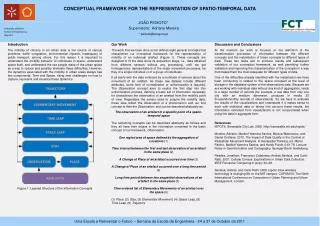
CONCEPTUAL FRAMEWORK FOR THE REPRESENTATION OF SPATIO-TEMPORAL DATA JOÃO PEIXOTO* Supervisors: Adriano Moreira * peixoto@kanguru.pt Discussion and Conclusions At the moment our work is focused on the definition of the transformation processes of information between the different concepts and the instantiation of these concepts to different types of data. These two tasks aim to produce results and subsequent validation of our conceptual framework, as well permitting further validation and improving the characterization of the concepts in a way that makes them the most adequate for different types of data. One of the difficulties already identified with the instantiation we have been conducting is related to the space occupied at the level of storage in the database system of the observations data. Because we are working with individual data without any kind of aggregation, leads to a large number of records (for example, a raw data from only one city with an medium dimension, produces in media 20 thousand/monthly records of observations). So we have to evaluate the results of the visualizations and understand if it makes sense to work with individual data or taking into account these results, the information extracted from visualizations is not compromised when using the data in aggregate form. References iSPOTS. Senseable City Lab. 2005. http://senseable.mit.edu/ispots/ Moreira, Adriano, Maribel Yasmina Santos, Monica Wachowicz, and Daniel Orellana. 2010. The Impact of Data Quality in the Context of Pedestrian Movement Analysis. In Geospatial Thinking, ed. Marco Painho, Maribel Yasmina Santos, and Hardy Pundt, 0:61-78. Lecture Notes in Geoinformation and Cartography. Springer Berlin Heidelberg. Reades, Jonathan, Francesco Calabrese, Andres Sevtsuk, and Carlo Ratti. 2007. Cellular Census: Explorations in Urban Data Collection. IEEE Pervasive Computing 6 (July): 30–38. Sevtsuk, Andres. and Carlo Ratti. 2005. Ispots: How wireless technology is changing life on the MIT campus. CUPUM 05: The Ninth International Conference on Computers in Urban Planning and Urban Management. London. Our Work The work that we have done so far defines eight general concepts that characterize our conceptual framework for the representation of mobility of an individual artefact (Figure 1). These concepts are designed to fit the data since its acquisition stage, i.e., data obtained from different sensors without any processing, until we get homogeneous representations of the major movement processes, be they of a single individual or of a group of individuals. It all starts with the data collected by a multitude of sensors about the movement of an artefact. As these raw dataset include different attributes, some form of normalization or uniformization is required. The Observation concept aims to realize the first step into this uniformization process, defining a basic set of information necessary for characterize the observation of an artefact from the mobility point of view. Regardless the sensor used to acquire the mobility data, these data reflect the observation of a phenomenon and our first concept is then the Observation, and can be described abstractly as: The observation of an artefact in a specific point of a spatio-temporal space The remaining concepts can be described abstractly as follows and they all have their origins in the information contained in the basic concept of our framework, Observation. One region/area of space defined by the aggregation of Locations (1) Time interval between the first and last observation of an artefact in the same place (2) A Change of Place of an artefact occurred over time (3) A Change of Place of an artefact occurred over a long time period (4) Long time period between two sequential observations of an artefact in the same place (5) Time-ordered list of Elementary Movements of an artefact over the space (6) (1) Place, (2) Stay, (3) Elementary Movement, (4) Space Leap, (5) Time Leap, (6) Trajectory Introduction The mobility of citizens in an urban area is the source of various problems: traffic congestion, environmental impacts, inadequacy of public transport, among others. For this reason it is important to understand the mobility behavior of individuals in space, understand space itself, and understand the use people make of the urban space as a way to reduce and possibly eliminate these difficulties. However, the dynamics associated with the mobility in urban areas always has two components: Time and Space, rising new challenges on how to capture, represent and visualize these dynamics. Figure 1: Layered Structure of the Information Concepts


