Download
1 / 26
260 likes | 469 Vues
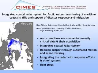
Integrated coastal radar system for Arctic waters: Monitoring of maritime coastal traffic and support of disaster response and mitigation. Hajo Eicken, Josh Jones, Hyunjin Choi Druckenmiller, Andy Mahoney Geophysical Institute, University of Alaska Fairbanks, hajo.eicken@gi.alaska.edu

E N D
Integrated coastal radar system for Arctic waters: Monitoring of maritime coastal traffic and support of disaster response and mitigation Hajo Eicken, Josh Jones, Hyunjin Choi Druckenmiller, Andy Mahoney Geophysical Institute, University of Alaska Fairbanks, hajo.eicken@gi.alaska.edu • Arctic maritime environmental security, critical data & their acquisition • Integrated coastal radar system • Decision-support through automated motion and event tracking • Integrating the radar with response efforts & other systems • Next steps NSIDC.org
Project status, 10 Jan 2011 • Algorithms for automated extraction of hazard information developed & validated • Paper to technical journal to be submitted in Jan 2011 • Programs for automated analysis and decision-support undergoing testing, completed by summer 2011 • Radar design study completed, components for complete system ordered, to be installed spring/summer 2011 • Review & framework for environmental security in ice-covered waters (strategy to tactics) • Paper to be submitted to MTS Special CIMES Issue • Dialog with USCG and other DHS-CoE continues (seminar series on Defining Risk in Offshore Resource Development, informal exchange)
The Arctic Ocean is opening up: Ice retreat, increased economic activity, growing maritime traffic • Environmental security: Response & mitigation of hazards & disasters in extreme environments (e.g., oil spill in ice) • Tracking & forecasting at relevant space & time scales: Address key gaps (sub-satellite scale) through integrated coastal observing system National Snow and Ice Data Center
Arctic maritime environmental security: Strategic vs. tactical/operational perspectives
Maritime environmental security in the US Arctic Map: A. Gaylord, Nunatech based on AK-DNR & BOEMRE & NSIDC data
Satellite repeat rates Coastal radar
Improving cold-regions maritime domain awareness through an integrated coastal observing system • Remote sensing* (km-scale): Coastal environments & infrastructure, ice hazards • Coastal radar (sub-km scale): Vessel & ice tracking, ice dynamics & potential disaster response • Aerial surveys, ice & sub-ice sensor systems* • Local knowledge*: Potentially important role for disaster response • Integration of data streams, GIS-based decision support systems * Leveraged through integration & assimilation of existing ocean observing system resources (AOOS.org) and partnering with Arctic Observing Network
Radar specifications and design Current system: • Furuno X-band FR7112, 10kW, 1.6m open array, 22m a.s.l. • Xenex 2000 A/D converter/controller (4-bit dynamic range) • Problems: Icing & wind drag (custom-built de-icer), range 10-20 km, low effective dynamic range
Radar specifications and design Current system: • Furuno X-band FR7112, 10kW, 1.6m open array, 22m a.s.l. • Xenex 2000 A/D converter/controller (4-bit dynamic range) • Problems: Icing & wind drag (custom-built de-icer), range 10-20 km, low effective dynamic range
Considerations for improved system Ordered system: • Furuno X-band FAR2127, 25kW, 2.4m open array, 22m a.s.l.; heavy-duty commercial de-icing unit • Digital data stream: Russell Technologies Signal Processor • Challenges: Furuno’s migration to all-digital systems; custom-install of de-icing system (delivery now at May 2011)
Decision-support: Automated detection of ice motion, hazard events & surface vessels Goals: • Analysis of radar image sequences to extract quantitative information about velocity fields and trajectories of individual features & ice pack • Automated detection of hazardous events (break-outs, ice shoves, etc.) • Automated delineation of stable/unstable zones Collaboration with University of Delaware, Dept. of Computer & Information Sciences Dr. Chandra Kambhamettu, Director – Video/Image Modeling & Synthesis Lab (chandra@udel.edu) Rohith MV, Ph.D. candidate (rohithmv@udel.edu)
Decision-support: Automated detection of ice motion, hazard events & surface vessels Challenges: • Complex occlusions • Low signal-to-noise ratio • Signal strength highly sensitive to position & orientation of reflectors • Inhomogeneous distribution of features • Non-rigid body motion
Motion Field: Feature tracking • Sparse motion fields: Feature tracking (Lagrangian velocity vectors) • Lucas-Kanade tracker (edge/point detection based on eigenvalues of time-shifted radar return signal) • Movement • of points • linearized • Least-sq. • solution
Motion Field: Feature tracking • Sparse motion fields: Feature tracking (Lagrangian velocity vectors) • Lucas-Kanade tracker (edge/point detection based on eigenvalues of time-shifted radar return signal) • Movement • of points • linearized • Least-sq. • solution
Motion Field: Feature tracking • Sparse motion fields: Feature tracking (Lagrangian velocity vectors) • Lucas-Kanade tracker (edge/point detection based on eigenvalues of time-shifted radar return signal) • Movement • of points • linearized • Least-sq. • solution
Motion Analysis: Stable Regions • Velocity potential field (hourly-daily mean) defines contours between stationary and moving ice • Contour refined from smoothness & potential constraints • Compares well with manual & SAR data, more accurate due to higher sampling rate
Motion Analysis: Break-out detection • Early, automated identification of break-outs (hazard mitigation) • Hidden Markov Model approach: Statistics of radar backscatter used to estimate state & trajectory of system (velocity & backscatter variations associated w/ break-out)
Motion Analysis: Break-out detection • Early, automated identification of break-outs (hazard mitigation) • Hidden Markov Model approach: Statistics of radar backscatter used to estimate state & trajectory of system (velocity & backscatter variations associated w/ break-out)
Motion Analysis: Break-out detection • Early, automated identification of break-outs (hazard mitigation) • Hidden Markov Model approach: Statistics of radar backscatter used to estimate state & trajectory of system (velocity & backscatter variations associated w/ break-out)
Motion Analysis: Detecting & Tracking Anomalous Motion • Automated tracking of individual ice floes • Detection of anomalous motion (non-linear acceleration/deceleration), e.g., grounding ice
Linkage to ice based wire-less sealevel & temperature sensors Integration with remote sensing data & local trail information Use as decision-support tool Integration with observatory components 2008 Barrow Ice Trails - Map produced by Matthew Druckenmiller and collaborators
Jacob Adams Crew Trail, 2008 2008 Barrow Ice Trails - Map produced by Matthew Druckenmiller Photo: Craig George
Safety on the ice: Iñupiaq knowledge, environmental observing systems & safety engineering • Local expertise: specific role of local, indigenous knowledge (LIK) in regulation and planning still being discussed • Value & primacy of LIK with respect to safety mostly undisputed • Example of Escape, Evacuation, Rescue (EER) Based on ISO 19906 - DRAFT
Integration into IR: Needs & next steps • Meet needs of USCG & response teams • Integration with remote power module & ocean radar • Integration with local expertise • Arctic maritime environmental security: Training & discourse w/ USCG, industry & stake-holders – Nx2020 Risk Seminar Series, further continuing education offerings? Based on Alaska Clean Seas, Tech. Manual & FEMA Handbook • Building capacity: Link with DHS Disasters, Coastal Infrastructure & Emergency Management (DIEM) Center at UNC